
A couple of weeks ago, reader Terry asked if I could suggest some pleasant walks in Redwood City, and noted that having new and interesting places to walk during the pandemic would be most welcome. Although I did walk through downtown (and up Woodside Road) this week and saw one or two things of interest, there wasn’t anything that wouldn’t keep. Thus, for this week’s post I thought I’d outline some of my favorite walks.
First, though, a couple of general thoughts on walking around town. For one, during this time of COVID-19 I always carry a mask with me, and don’t hesitate to put it on whenever I am approaching another person. I do that not only for safety (both theirs and mine), but also out of courtesy. In addition, I do what I can to give others a wide berth, even if it means walking out into the street if necessary (something I only do on quieter residential streets; I would never do this on El Camino Real, for instance). Of course, if I have to do that I keep a sharp eye out for traffic (including bikes!). I also will often alter my route somewhat to avoid others; I’m generally not in a hurry to get anywhere, so a small detour usually doesn’t matter much in my case. Lastly, sometimes I just have to stop and wait for others to pass on by, or to cross the street, or whatever. Again, I’m not in a hurry, so if I have to wait for a minute or two in order to maintain a safe distance, I’m OK with that.
As long time readers know, I am comfortable walking almost anywhere in our area. I will avoid walking underneath Highway 101 alongside Redwood Creek when I can see that people are living under there — as they are right now — and there are some areas where I am careful to keep my eyes and ears open. But I am a six-foot-tall, 190-pound white male; if you are not, you very understandably may find areas where you don’t feel comfortable. None of the walks I’ll talk about in a moment should be a problem for most of you, although note that a few go through wild, undeveloped areas of the city or county where you theoretically could run into dangerous animals (or somewhat dangerous environmental conditions, for that matter). I’ve never encountered any (I’ve run into deer, but they are generally quite skittish), but given that we are increasingly hearing about mountain lions entering some of our residential areas, they’re out there. Use your own judgement, and pay close attention to any posted warning signs.
Finally, in order to keep tabs on the various development projects in our area I often have to walk along very busy streets, including El Camino Real, Woodside Road, and Alameda de las Pulgas. They really aren’t the most pleasant places to walk, but sometimes you just need to use them in order to get somewhere. Certain intersections — where Woodside Road passes over El Camino Real, for instance — can be especially dangerous, but if you pay close attention to traffic and stay patient, you’ll find that you can navigate them safely. (Note that you cannot walk along Woodside Road over El Camino Real; jog over to Chestnut if you are following Woodside Road. You can walk along El Camino Real beneath Woodside, but be aware that cars making the transition from one street to the other are often moving quickly and may not be expecting to see pedestrians.) If you can, though, plan a route that avoids our busier streets.
Speaking of planning a route, I highly recommend bringing a smartphone. Even if you don’t care about tracking your route or recording your physical activity, the maps app can be particularly helpful, especially if you need to make a detour. I have most of the city firmly implanted in my brain, but even I still often rely on my mobile map when I’m navigating the twisting, turning streets of Emerald Lake Hills, say.
I’ve walked all of Redwood City’s defined neighborhoods, and I can highly recommend taking a stroll through any or all of them. Check out the official neighborhoods maps, and perhaps start with your own, or a nearby one that you are less familiar with. Some, such as Stambaugh-Heller or Centennial, are full of history. Others, such as Edgewood Park, have plenty of beautiful homes to look at. My write-ups on those neighborhoods may prove helpful if you want to get to know a given neighborhood. You don’t really need a particular route; I recommend studying the map for the neighborhood you are interested in and then planning out your own. But, along the way, if anything special catches your eye, don’t hesitate to make a detour: you never know what you might find!
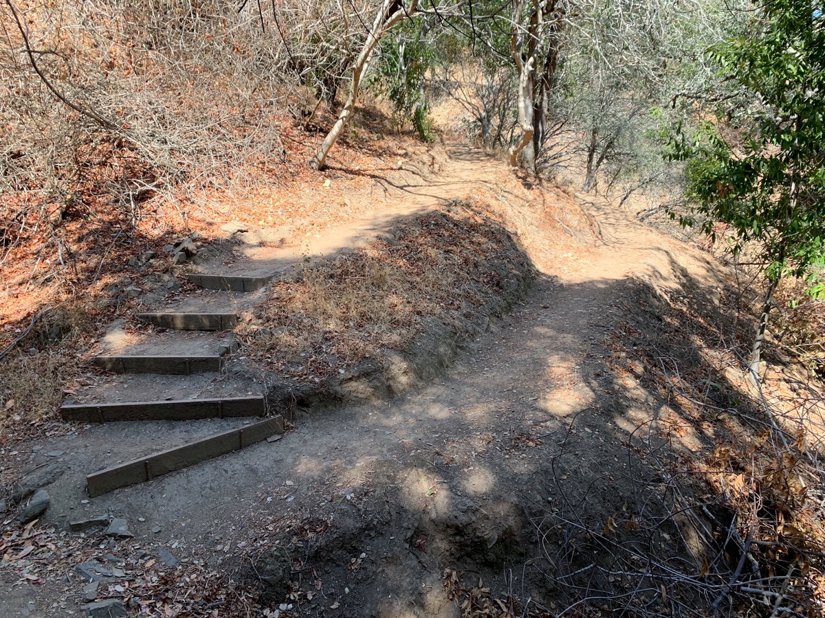
Some of my favorite walks have come about because I have a specific goal in mind, or a particular geographic feature I want to investigate. If you are up for some solid exercise, I can highly recommend walking up into Emerald Lake Hills. You know your own limits, but don’t feel bad taking a breather now and then — those hills can be steep! Walking to the Easter Cross is a fun goal, and the views from up there are spectacular:

Another fun and interesting place to walk to is Handley Rock Park (which is located on a street named Handley Trail). For either of these, note that because Emerald Lake Hills is an unincorporated part of San Mateo County, and is not in Redwood City proper, there are very few sidewalks. Stick to the smaller, quieter streets as much as possible, given that you’ll usually have to walk on the edge of the street itself.
While I’m up in the hills, I should mention some of our area’s best “wild” parks: Edgewood Park, Pulgas Ridge, Eaton Park, and the lower part of Stulsaft Park. I on occasion walk to the upper entrance to Edgewood Park, off Robertson Way, and then walk through the park to the lower, main entrance, from which I exit the park and walk home (partly along busy Edgewood Road, which doesn’t have sidewalks; be careful there). You can of course also just drive to the main park entrance off Edgewood Road, and then walk one of the park’s many loops. If Edgewood has become too familiar, or if it is just too crowded, allow me to recommend the lesser-known Pulgas Ridge Open Space Preserve, which can be found just across Edgewood Road from Edgewood Park. Pulgas Ridge has the added advantage of an off-leash dog area, although I generally stick to the trails (along which any dogs are required to be on a leash). For more about both Edgewood Park and Pulgas Ridge Open Space Preserve, do check out my post A Walk in the Woods, in which I discuss both in some depth.
I lived in Redwood City for many, many years before discovering the wonderful Eaton Park (which is not in Redwood City, but is very close by). Eaton Park is a very large (57 acre), wild park that lies within the boundaries of the City of San Carlos. You can enter it either from Eaton Avenue (just go to the western end) or from Brittan Avenue. I’ve never had too much trouble navigating the trails, although they are not as well marked as in Edgewood Park or Pulgas Ridge; I recommend entering the park from the Eaton Avenue end and photographing the map you will find there; you can then use that photograph as a guide when walking the trails. Again, I’ve written about my own experiences in this park (and in its next-door neighbor, Big Canyon Park); check out my post Hiking Redwood City if you want more.
In this same vein, but actually within the Redwood City boundaries, is the wonderful Stulsaft Park. There is a nice parking lot at the end of Mitchell Way (take Alameda de las Pulgas to Goodwin Avenue to Mitchell Way), and you can of course walk in from there. [Correction: that parking lot is no longer in use; park in the surrounding residential neighborhood instead.] Or, you can park along Farm Hill Boulevard at the park’s upper entrance, and walk past the playground to get to the road leading down into the wilder, more interesting (for me, anyway) part of this 42-acre park. The trails are quite nice through this park, and crisscross the lovely little Arroyo Ojo de Agua creek.
If you are comfortable with trails, but aren’t so excited about hills, I can highly recommend walking through Bair Island. Bair Island’s public parking lot is located off E. Bayshore Road: follow Whipple Avenue over Highway 101, and then stay on the road until you see the signs for the Don Edwards San Francisco Bay National Wildlife Refuge parking area. FYI, there are public restrooms and a drinking fountain here! After parking, walk out to and across the street, and then cross the small bridge (there is a gate — a door, really — across the bridge, but it opens easily enough). Head to the right if you want to take the shorter, 0.3 mile walk to the near observation deck, or head left to walk the 1.7 miles to the farther observation deck (which is located beneath the flight path for the San Carlos Airport, for those who like watching small planes). These two paths are wide, flat, and well-maintained; a wheelchair would have little trouble here. And if you enjoy watching birds and small wildlife, well, this is the place to be. Naturally, I’ve written about Bair Island on multiple occasions, but perhaps best in my post Island Life.
For a simpler walk in this same area, instead of crossing the bridge to Bair Island, simply follow the path to the right of the bridge entrance. This takes you into the Blu Harbor housing development, on a public pathway that follows the edge of Smith Slough. People are often out kayaking in this area, which can be fun to watch.
If these latter walks are your cup of tea, I can also recommend walking along the Redwood Shores Bay Trail, which follows Steinberger Slough. The near end of the trail can be found at the end of Spar Drive, which you get to from Redwood Shores Parkway (turn south at the Bridge Parkway intersection, then turn right on Spar Drive and follow it to the end). Personally, I prefer to head much farther out along Redwood Shores Parkway to Radio Road; follow the signs to and then slightly past Shore Dogs Park (a great off-leash dog park), and park in the small parking lot you find there. The far end of the Redwood Shores Bay Trail is located here, next to the Silicon Valley Clean Water plant (from which we get our recycled water, in case you weren’t aware). You can then walk along the trail back towards the west.
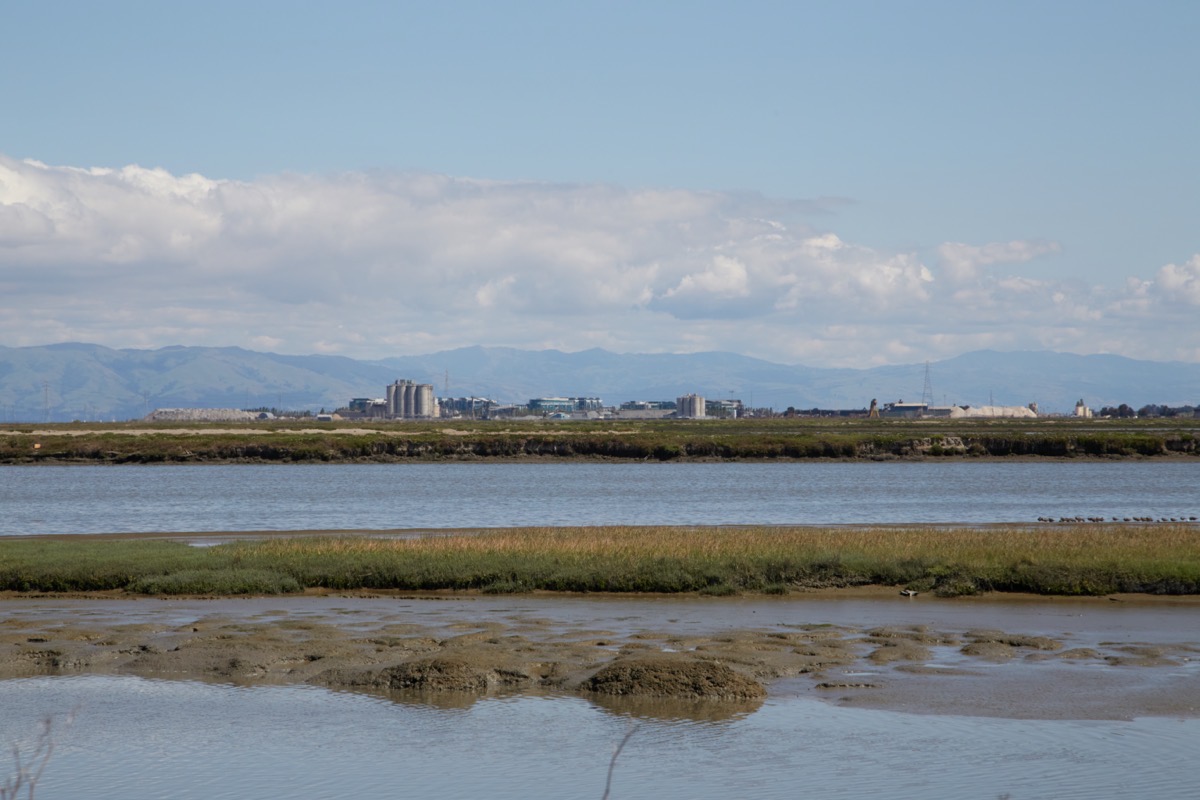
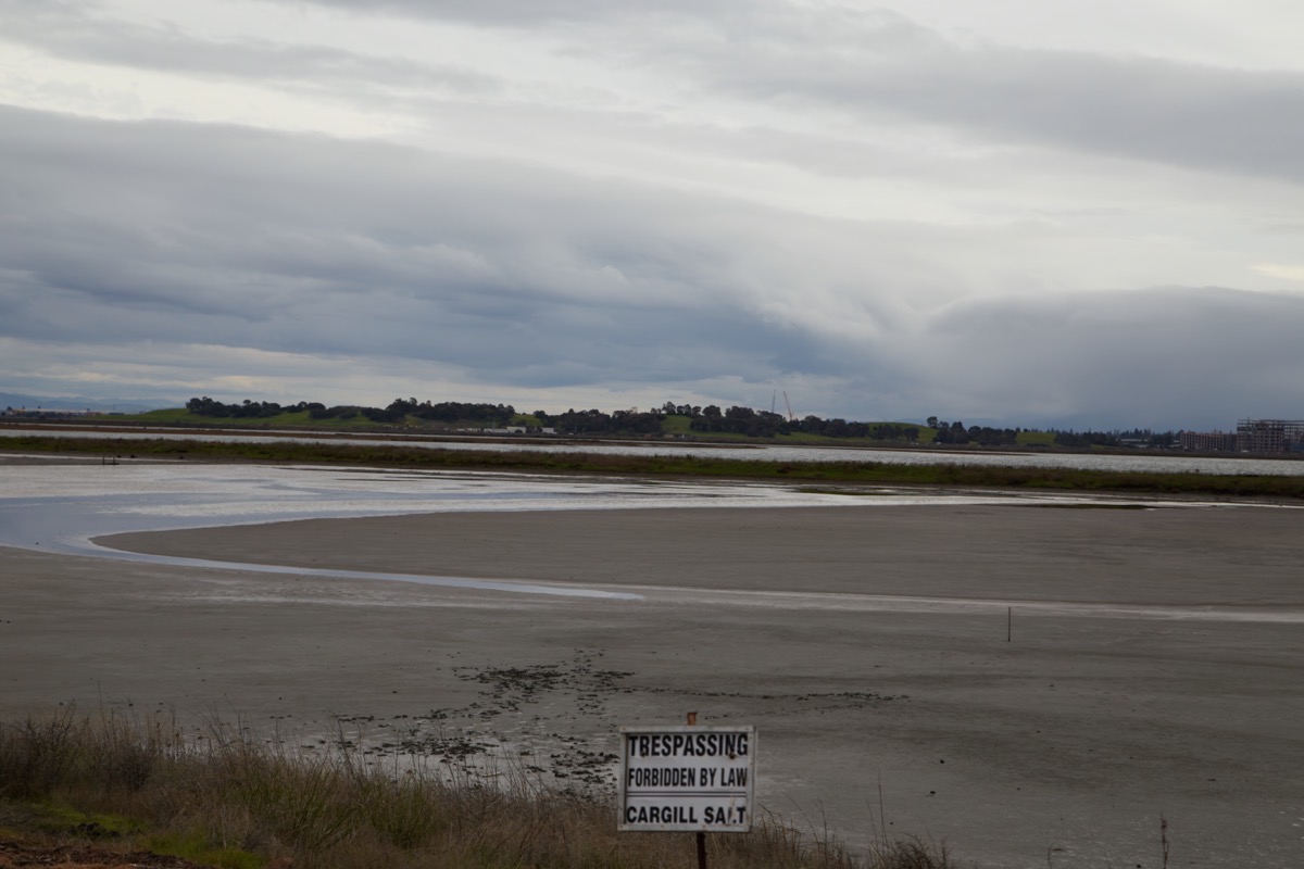
The above picture was taken from along the Redwood Shores Bay Trail, looking south at the Port of Redwood City. I’ve also found that the port itself is a great place to walk. I might suggest heading out Seaport Boulevard and turning in at Seaport Court. Here you’ll find plenty of public parking, next to the Port of Redwood City Marina. Do spend a little time exploring this part of the port, if you haven’t already done so. Then, walk back out to Seaport Boulevard, cross at the light, and turn left. There is a great sidewalk that follows the salt reclamation ponds all the way out to the Pacific Shores complex at the end. When you get there, follow the sidewalk (and street) to the right, and you’ll loop all the way around the development. You can, if you like, take a brief detour out to Westpoint harbor, or you can keep on a bit farther, where you’ll see signs (and parking, if you prefer to make this a shorter walk) for the San Francisco Bay Trail. There is a nice little looping segment of the trail here, from which you can see the waters of Westpoint Slough. Its a really beautiful spot, one worth exploring on foot.
The Pacific Shores business campus (most of which is owned by Google these days, I believe) is an interesting place to wander through. But we have another campus that I recommend walking through and around: the Stanford in Redwood City campus, which is located off Broadway in the Friendly Acres neighborhood. Stanford has done a terrific job with their landscaping, and has constructed a nice path through the middle of the campus (paralleling Broadway). I recommend taking Broadway down to Second Avenue, and parking on the street near the lovely little Andrew Spinas Park. There is a connector between the park and Stanford’s campus, or you can simply walk over to Bay Road (the park is located at Second and Bay) and enter that way. This is a great place for a leisurely stroll; the path is wide and paved, and there are benches and lovely plantings along the way. No restrooms, although there are some at Andrew Spinas Park, if you have need.

For something more challenging, my favorite is probably a walk I did back in 2017, when I followed Redwood Creek from its origin (well, as close as I could get to it) to where it joins Smith Slough. Because the creek runs underground in spots, and because it often runs behind homes where it can’t be seen by the average member of the public, I had to use maps and satellite photos to trace its route and devise a walking path that followed it as closely as I could. Naturally, I wrote about my walk; see my post Up a Creek, no Paddle Needed if you are interested. If you’ll like to trace my steps, be aware that even going just one way this is a pretty long walk, so you might want to have someone drop you off at the start (on Alameda de las Pulgas, just south of where Alameda and Fernside come together) and pick you up at the end. And I definitely recommend bringing a smartphone along on this particular walk; it’s easy to get turned around in some of the residential areas you’ll find yourself in…

If you take this walk and enjoy it, know that you can do something similar with Cordilleras Creek, although it is even harder to get a glimpse of in many spots. I have yet to write about that one, so I’ll leave that as an exercise to the interested reader.
Redwood City has many, many wonderful places where one can walk. Where you choose to go simply depends upon what kind of walk you want to take. We are blessed with a wonderful variety; you can walk in urban places or rural, and up and down hills or entirely on the “flats.” If you enjoy architecture, you can of course see plenty of that. And if you like history, there is much to see. Including, I should mention, along Redwood City’s downtown history tour. You’ve probably seen the signs downtown that talk about some of Redwood City’s historic buildings, but there is a loop that connects them; see my post Walking Back in Time for a description of that particular walk.
I’m sure I’m forgetting some great walks, but this should serve as a good start. If you have favorites of your own, submit a comment and let the rest of us know! And get out there, and walk!

Loved reading your post. I just signed up to follow your page. I’ve lived here since 1974 and have not explored so many of the places you wrote about. Thank you for sharing, makes me want to get out there.
Thanks for reading, and welcome to Walking Redwood City! By all means, do get out and walk around, if you can — there is a lot to see and do. Hopefully my posts will spur you on and give you some ideas for places to go.
Thanx. Ann Gustafson
Love reading your posts! Thank you for loving ‘my City’, sharing your stories and updates through your journeys!
I would like to mention since a few times you mention the County’s unincorporated surrounding areas having few to no sidewalks – please heed the law to walk on the side of the road facing traffic!! Better to see what is coming your way and many times better for traffic to see YOU!
Thanks again for writings 🙂
Merrily
Hello Greg,
There is no parking lot at the Goodwin entrance to Stulsaft Park. Parking is along residential streets.
Thank you, Kathy
Good to know. That entrance leads to a lot that sure seems as if it was once a parking lot, but of course I never drive there so that was just an assumption on my part. Thanks for the correction!
There is a “parking lot” inside the park which has been closed to public for a VERY long time!
Another great article Have you ever thought of making a book ?Walking Redwood City ?I look so forward to your post ,plus on the back page Your picture ?I always wondered if I walked by you ?LOL I know my friend Steve Penna knew you personally Called you a great guy Thanks again for your post I enjoy reading as I had to move out of RWC but hopefully can move back someday but until ❤️ then You keep me well informed of all the changes I know so any people say it’s not the same but it’s still home l
Thank you!
You are most welcome. Thanks for the idea! Hope it helps.