
Having focused on Redwood City for the last couple of weeks, this week I thought I’d head just a bit south and provide an update on a couple of projects along El Camino Real that lie just beyond the city border, in the unincorporated part of San Mateo County known as North Fair Oaks. I’ll then come back to Redwood City and talk briefly about one other area of interest: the site the city has apparently chosen for its RV “safe parking” area.
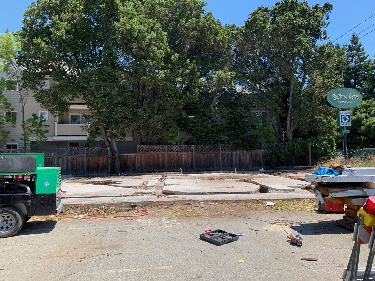
First off, let me take you all the way down El Camino Real through the North Fair Oaks section to just shy of the Atherton border, and talk about a building that a lot of people have been wondering about: the old Bonsai Japanese Cuisine restaurant. Just so you know, this parcel has an Atherton address, but that just indicates how the post office views the property. In reality, as you drive down El Camino Real, the Redwood City border ends at the edge of the Target shopping center parcel, and North Fair Oaks begins with the Dependable Lock & Hardware building — at least on the left side of the street. On the right side, you are still in Redwood City for a couple more blocks. But keeping to the left, North Fair Oaks runs all the way down to just past where the Bonsai Japanese Cuisine restaurant once stood. Bonsai Japanese Cuisine closed their El Camino Real location back in February of 2017, and moved to Ladera Country Shopper on Alpine Road (a year and a half later they sold the restaurant; under its new ownership it is called Loma Sushi). Just after Bonsai moved out, the city received an application for a building permit to add 371 square feet to the rear of the building and to convert the restaurant into a dental office.
Between late 2017 and April 2019, the building was slowly demolished. I say slowly because it really was done in fits and starts, as if the guys doing the work had other, full-time work and were doing this project as a side job. In any case, over about 18 months they stripped the building to the studs, poured a foundation slab for the addition to the rear of the building, and then ripped out some, but not all, of the studs themselves (possibly because they were in terrible shape). But that’s when the county stepped in:

As it turns out, the developer had gone too far, tearing out more of the original building than was permitted. Accordingly, the developer had to draw up new plans and go back to the county for updated permits. After going back and forth with the county, the developer was finally given the green light to proceed with the project. Together, all of this explains the long period of inactivity that so many of us who drive up and down El Camino Real witnessed and wondered about. Once the county gave the OK, though, the developer wasted little time in tearing down the rest of the structure, leaving only the building’s original slab, along with the slab that had been poured for the new addition.
The new plans apparently have some changes to the building’s floor plan, along with changes to the mechanical, electrical, and plumbing systems. Of course, that means very little given that I haven’t seen either the new or old plans. In any case, I’m guessing that the changes are not too significant, and that the result will be of a scale with the original Bonsai building (plus the added 371 square feet). I dropped by the site this week to see what’s up, and for a short time watched some guys cutting into the slabs, presumably to accommodate the changes to the building’s plumbing and electrical systems:
You almost have to wonder why they didn’t just tear up the old slab and simply pour a new one. Regardless, this project is essentially through the demolition phase (finally!) and should start the actual construction phase soon. As long as the contractor stays focused on the job, I would expect that it could be done as early as next year. Whether or not the result is still going to be a medical or dental office, well, we’ll have to see.
Heading back north, we next come to a project that is causing some minor traffic headaches on northbound El Camino Real right at the moment:

This is the site of the Sunrise Senior Living project. Sunrise is building a new facility here that will have 90 residential units to accommodate up to 127 residents. For orientation, the grayish building you can see through the trees in the center of the photo is Selby’s restaurant; between it and the project site is E. Selby Lane. Intruding into the photo from the left you can see a piece of a building; that’s our area’s Planned Parenthood clinic.
The 1.4-acre site was cobbled together out of six adjoining parcels. One of the parcels held the John Bentley’s restaurant, one held a single-story law office, and one, in the back along Markham Avenue, held a single-family house. The remaining parcels had been paved for surface parking. After the three buildings were torn down and the pavement had been ripped up, the contractors excavated the majority of the property for an underground parking garage, which is sized to accommodate 63 vehicles. Entrance to and exit from this garage will be from E. Selby Lane. The building’s main entrance will be alongside the driveway leading to the parking garage: the building’s address is currently being given as 1 E. Selby Lane. What we’ll see from El Camino Real is three stories of the building’s left side, plus, between the Sunrise building and the next-door Planned Parenthood clinic, a driveway leading to the senior center’s service entrance.
Currently the underground work has been largely completed, and the large ground-level slab that will serve as both the garage’s ceiling and the building’s base is being prepped for pouring:
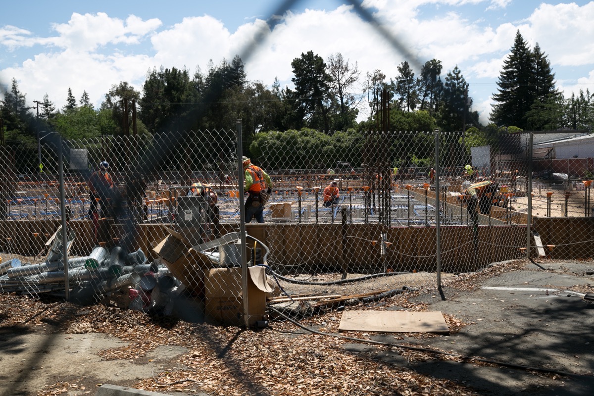
(I took the above photograph from the rear of the property, looking out towards El Camino Real.)
Along El Camino Real the building will be three stories high, but because it abuts onto a residential area in the rear, the rest of the building will be only two stories tall. Most of the building’s outdoor space will be in the rear as well: it will have a garden in the back where the house once stood, and a path that winds around towards the building’s main entrance. The building will have an open courtyard in the center, plus a small second-story deck containing a “rooftop garden” that will look out over that inner courtyard. Within the building there will be dining rooms on the first and second floors, along with various activity rooms, art spaces, a “theater,” and some other communal spaces. As for the rooms themselves, there will be something like 53 studios, 19 doubles (which consist of two bedrooms, a tiny “living room” type space, and a shared bathroom), and 18 semi-private units (which have two sleeping spaces largely separated by a shared bathroom, with no door between the sleeping spaces).
Assuming it remains true to the renderings, this should be an attractive building. Here is a rendering, taken from the plans submitted to the county along with the project proposal, that shows the building from the corner of El Camino Real and E. Selby Lane. Note the entrance to the parking garage, on the right side of the building (that street is E. Selby Lane; El Camino Real is the street leading off to the left):

Leaving Sunrise, allow me to move on to the next project. This one is only about two blocks farther along El Camino Real, towards Redwood City:
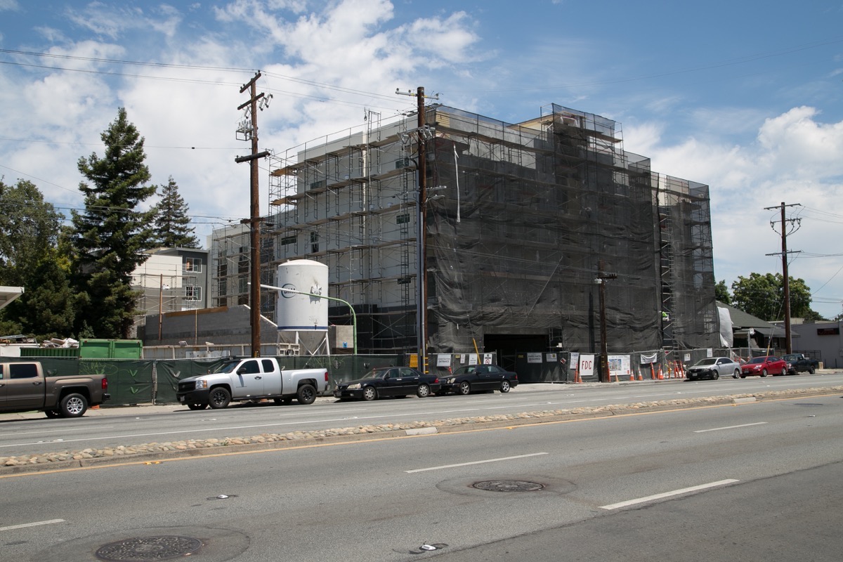
This particular building, located at 2821 El Camino Real, sits where Enterprise Rent-A-Car used to have one of their neighborhood rental centers. Next door (to the left, in the above picture) is where the Eco Green Auto Clean waterless carwash used to be (that property is being used by the building’s contractor as a staging site). The four-story building you see in the above photograph is slated to contain 67 apartments for low-income tenants on its upper three floors. The ground floor will consist of the building’s internal 53-space parking garage (which is all on the ground floor; this project didn’t excavate for a garage) and, in one corner, the building’s lobby.
This particular project is being brought to us by Alta Housing, the folks who until recently were known as Palo Alto Housing. Apparently they changed their name to echo the fact that they are expanding beyond their hometown, Palo Alto, beginning with this project. But speaking of names, this particular project finally has a name of its own: “Teto.”
Teto will be a low-income housing development. 32 of the building’s apartments will be Section 8 Project-Based Voucher units — and starting Monday they’ll be accepting applications for these. Of these 32 units, 27 will be studios and five will be one-bedroom units. An additional 27 of the building’s apartments will be reserved for “individuals or families who qualify for the US Department of Housing and Urban Development’s Veterans Affairs Supportive Housing Program (HUD-VASH).” Apparently, to apply for these latter units, one needs to talk to the Veterans Administration. More information on all of this, and a link to the application for the waiting list for the 32 Section 8 units, can be found here.
Returning to Redwood City, thanks to an article in The Daily Journal I learned that our City Council, who will be holding a virtual public meeting (on Zoom) next Monday at 6 p.m. to discuss Safe Parking, apparently plans to propose the use of a city-controlled parcel at the corner of Maple and Blomquist streets (just across from the Maple Street Correctional Center, and kitty-corner from the Redwood City Police Department headquarters) for overnight RV parking.

In its entirety the lot shown above is 4.7 acres in size, but a good portion of it — the portion closest to Redwood Creek — has been leased to Norcal Crew, a nonprofit “dedicated to the development of youth through the sport of rowing.” The end you see above, though, apparently has enough space to accommodate some 50 RVs, or about half the number of RVs that the city estimates are currently parked throughout the city.
This lot is flat and clear, having been most recently used as a staging site for the construction of the Maple Street Correctional Center. Location-wise, it isn’t as convenient as my preferred choice — the parking lot of our now-closed Kmart — but as I can attest the walk from this intersection to many of Redwood City’s shops and restaurants is doable. And of course the fact that the city has a lease on this land — and thus doesn’t have to negotiate with the owners of the Kmart building — certainly helps.
Because I’ve walked over to this part of the city many, many times, I can attest to the fact that for a part of the walk there are no sidewalks, and you need to utilize the Maple Street overpass to get over Highway 101, which isn’t properly designed for pedestrians. But with care one could walk from this site to Kaiser, to Applebee’s (which is probably the closest restaurant), or to Kohl’s Plaza, without too much trouble.
From the Daily Journal article it appears that the city has plans for a permit program that should keep things under control, and that would allow for some street parking elsewhere in the city — with time limits — for RVs as well. I’ll need to see the details of the program (which I presume we’ll get at least some of at Monday’s meeting) and I’ll need to give this some thought, but on the surface this program seems to make sense. I’ll certainly be very interested to see how it actually works out.

Pingback: Heading for the Goal | Walking Redwood City
I noticed the south end of the Kmart parking lot is a city dump now.