
Right off the bat, today’s blog post title doesn’t really have much to do with the content of the post. However, today is May 1, also known as “May Day.” During today’s situational update from Governor Newsom he pointed out that May Day is traditionally associated with freedom of expression, and stated that he was supportive of people’s right to protest — as long as it is done safely. I liked this as a title because it is not long after our shelter-in-place was extended for another month, and although I’ll put up with it, at times I do want to yell out “Mayday!” — as if there is anyone not experiencing our worldwide pandemic who could help!
Enough of that. This week I watched Monday’s City Council meeting, which had a couple of items of interest. The one that initially stood out, for me at least, was item 8.A, “Slow Streets Program.” Depending upon how much you get out and about, you may have already noticed that a select few streets in Redwood City have been closed to through traffic. For instance, here is Vera Avenue where it intersects with El Camino Real:

The idea is to drastically reduce, or “slow,” the amount of traffic on a smattering of city streets, which can then be used by walkers and runners who need more space than the sidewalks allow. With the requirement that we keep at least six feet from others, at times it can be challenging to maintain a safe distance while remaining on the sidewalk. I went out with a tape measure the other day and measured the sidewalk in front of my house: it is five feet wide. Thus, two people cannot pass each other on that sidewalk while maintaining six feet of distance. I often find myself veering out into the parking strip or the bike lane in order to allow others to pass, which, depending upon the level of traffic on the street at that time, can be somewhat dangerous. Although the vast majority of Redwood City’s streets are not being restricted by this Slow Streets program, the few that are will hopefully provide relief to people in surrounding areas.
Here is the complete list of streets that have been temporarily closed to through traffic:
- Flynn Avenue, from Middlefield Road to Spring Street
- Stambaugh Street, from Charter Street to Maple Street
- Allerton Street, from Winslow Street to Whipple Avenue
- Vera Avenue, from El Camino Real to Alameda de las Pulgas (note that Red Morton Park lies midway between the ends of this one)
- Ebener Street, from Geneva Avenue to Roosevelt Avenue
- Page Street, from Second Avenue to 17th Avenue
- Cypress Street/East Oakwood Boulevard, from Woodside Road to Oakwood Avenue
- C Street, from Stafford Street to Industrial Avenue
- Katherine Avenue, from Elwood Street to Nevada Avenue
All told, this works out to 5.1 miles of city streets that have been restricted.
Note that although we are allowed (encouraged, even) to walk and run along these streets, we still need to be careful: cars are restricted, but not disallowed altogether. People who live along the restricted sections of these streets are still allowed to come and go in their cars, and are still allowed to park on the street. For another, delivery vehicles and emergency vehicles still have access. Drivers should of course be mindful of the fact that they may be sharing the street with walkers and runners (and others), but those of us out on the streets without a car should stay vigilant as well.
This program is temporary and will be “decommissioned” once the shelter-in-place has been lifted (or, possibly, sooner). The city has the ability to quickly modify the streets in the program: streets can be removed, and others can be added.
As originally proposed, Bridge Parkway (in Redwood Shores) and Poplar Street were on the list, but those were dropped after the City Council heard public comment and held their own discussion. Bridge Parkway will at least get one minor change as part of this program, which is that the sidewalks on either side of the street will be made one-way. This is a great idea that will cut down greatly on the problem: if everyone on the sidewalk is going in the same direction as you are, it is much easier to keep a safe distance. It’s an idea that might have merit in other parts of the city, in fact.
I also found Item 7.A on the City Council meeting agenda to be interesting: it was titled “Fiscal Year 2020-21 and Five-Year Capital Improvement Program (CIP) study session.” Not the most arresting title, to be sure, but particularly with most sources of revenue shut down, I find myself extremely interested in seeing what the city chooses to spend its limited dollars on — and what it chooses not to spend them on. Ahead of the meeting I was guessing that the city might decide to hold off on fully implementing the Hopkins Avenue Traffic Calming project (it is currently in a pilot phase), and I was right. Turning the temporary curbing into concrete and fully building out the center islands was going to consume a minimum of $1.4 million of General Fund money. Although the City Council seems highly supportive of the project, once Jessica Manzi, our Senior Transportation Coordinator, let them know that the materials used for the pilot should be good for a couple of years, they were happy to simply extend the pilot into the indefinite future. Incidentally, the one part of the pilot that can’t survive as-is for too long are the boxed trees in some of the center islands: after a while, they’ll become root-bound. Fortunately, those trees are on loan from the City’s Parks & Recreation department and can be swapped out for different ones. The trees currently in the islands can then be planted somewhere else in the city, and won’t be wasted.
Another item on the Capital Improvement Program projects list is $400,000 for “Theater Way Street Closure.” Although Theatre Way is temporarily open to traffic, as a way to ease the process of delivery and pick-up from a couple of restaurants along that street, it will be closed again once we return to some semblance of normal (probably whenever the Century Theatre is allowed to reopen). For the last couple of years the street has been closed through the use of some orange plastic “Jersey barriers” (also known as “K-rails”) at the Winslow Street end. When deliveries need to be made along Theatre Way, someone has to physically move the barriers aside and then return them to their original position afterwards. Apparently, they don’t always get put back in place, and on occasion cars have driven onto the supposed-to-be closed portion of the street, endangering pedestrians.
Because the barriers aren’t always properly in place, and because they are difficult (and potentially injurious) to move, the city has plans to install a more formal barrier that can be opened and closed. I don’t know whether the plan is to install some sort of gate, or whether they’ll put in moveable bollards (those metal poles that stick up from the street), but whatever the plan is, the Council seemed reluctant to delay this particular project. However, $400,000 of General Fund money is a lot in these trying times, and so the Council agreed to not spend the money at the moment. Those plastic Jersey barriers will have to do until the city can either get its budget into better shape, or find some alternate source of funds.
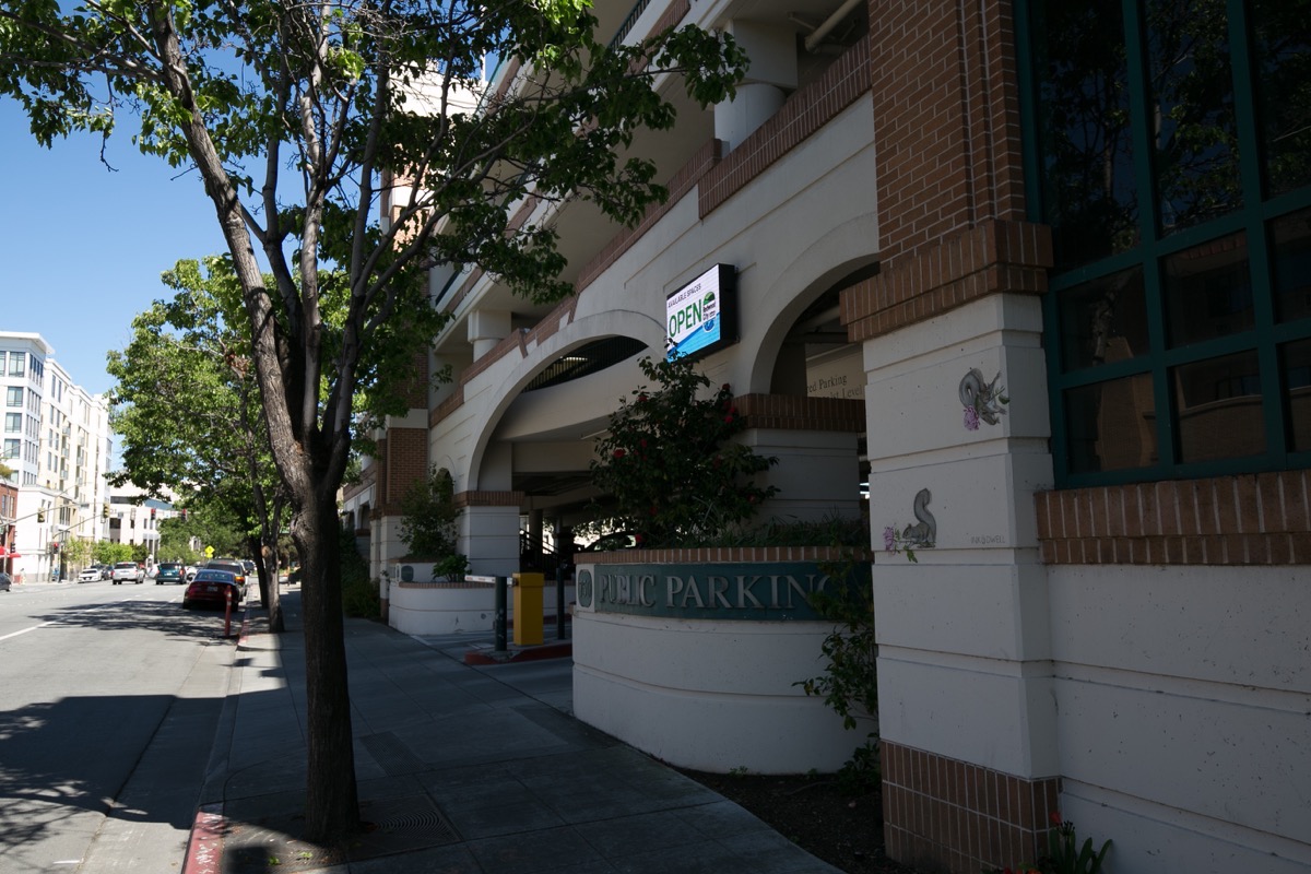
On a somewhat related note, I was poking around in some city documents and found confirmation of something that I thought I had noticed, which is that the system that lets you know how many spaces are available in the city’s parking garages (primarily, in the Jefferson Avenue garage beneath the theater block and the Marshall Street garage) is no longer functioning. I was wondering when we were going to get the promised electronic signs scattered around town that would direct motorists to available parking, and while poking around the city’s website I discovered that VIMOC, the company that created the system that counts cars going in and out of our garages, has “suspended all business operations.”

Not only that, I also learned that a different company, Streetline, creators of the “Parker” app that lets you find open parking spaces by using your smartphone, is also “ceasing their business operations.” Because of this, the Parker app is being decommissioned.
Fortunately, or unfortunately, thanks to COVID-19 there isn’t much demand for parking in downtown Redwood City right now. Thus, there is probably little impetus within the city to replace these defunct systems. But at some point people will return in large numbers to downtown Redwood City, and these helpful tools will once again be needed. The city has hopes to not only replace the now-idle systems, but to install something similar in the city’s surface lots. All of that occupancy data, plus data from a system that will track the availability of curbside parking spaces, is to be aggregated and then presented on a set of electronic signs that would direct motorists entering our downtown to available parking. The first phase of the project envisions five of these signs, located in the following places:
- at the corner of El Camino Real and Broadway
- on Veterans Boulevard, near Brewster Avenue
- on Veterans Boulevard, near Walnut Street
- on Broadway at Maple Street
- on Jefferson Avenue, before you go underneath the Caltrain tracks
This information would also be available through a smartphone app, of course.
Personally, I’ve been waiting for such a system for a couple of years now. Unfortunately, it appears that I’ll have to wait even longer.
While out walking this week I noticed two unrelated things worth mentioning. First, the 33-unit townhouse-style condominium project being built where Honda Redwood City once operated has condos for sale. KB Homes, the builder, is constructing this project in phases, and although 23 of the units have yet to be completed, the 10 units in the building fronting onto El Camino Real are done and are up for sale. I grabbed a flyer from the box in front of the building, and was interested to see that these condominiums start at $1.2 million. That is presumably for the smallest unit, which is a 1,150 square foot, 2 bedroom, 2 bathroom condo.
The project is apparently being called “Link 33,” and you can get all the interesting details (including floor plans and virtual walk-throughs) here. If you explore the plans you’ll see that the designs are somewhat unusual: while some of the units have a traditional design, in which the unit occupies all of the vertical space from the ground-level garage to the top of the roof, some of the units have their primary living spaces only on one floor (plus a ground-level garage). Thus, for instance, “Plan 2” has its entry and garage on the ground floor, and its living spaces on the third floor — to get between the two you have to walk up and down two floors worth of stairs. That second floor is taken up by someone else’s condo (a “Plan 1” unit, which has its two-car garage — in which the cars are parked nose-to-tail — and its laundry on the ground floor, and all of its living space on the second floor).
If you can live with the arrangement of the units, the buildings look reasonably attractive from the outside, and the virtual tour shows them off fairly well. Someday, perhaps, we’ll be able to have open houses again, and I’ll take a look for real.
The other thing I wanted to point out is the nearby Carnamic car dealership at the corner of El Camino Real and Whipple Avenue. Recently I’ve noticed that many of the dealership’s vehicles have vanished. Given our current economy I’m sure they haven’t been sold. I’m hoping that they aren’t going out of business altogether, but are simply adjusting to match market conditions — but from their website it appears that they may indeed be shutting down. In any case, although this looks (looked?) like a conventional dealership from the street, a quick search revealed that this is a dealership model for the modern age. What you do is select and purchase your vehicle online from their large inventory of, I believe, used cars. Carnamic then delivers the vehicle to your home or office from the dealership. If you prefer, you can arrange to stop by the dealership and pick up your car.
When they first opened Carnamic had a lot of high-end models, including cars from Mercedes, Jaguar, BMW, and the like. They also had a large number of SUVs and fancy-looking trucks. On my last visit, though, I counted a total of around 25 cars, all of them rather pedestrian:

Given the state of the automobile industry, this may be the death knell for an automobile dealership at this particular location in Redwood City. I hope not, but people have had trouble making a go of it here for years now, so I won’t be surprised if this property goes the way of Honda Redwood City, and is redeveloped as something entirely different.
Mayday!

Pingback: A Happy Medium | Walking Redwood City
Given the lot size, I really would love to see a Chili’s or similar family style restaurant at Alameda and Whipple.
Auto dealerships don’t belong on El Camino or in or near downtowns anyway … so I won’t be sad to see them go join the others in less bikeable/walkable/liveable, more auto-dependent industrial areas, such as near or along Hwy 101.
A definite must-do each day is for us to get out for the daily walk. And it helps to tweak the walk as much as possible to give it some diversity. We always ‘yield’ to people with leashed dogs and people pushing baby carriers or those with small children in tow. Others, however, is a game of ‘chicken’…OK, a little light humor here. Enjoy the walks everyone and explore !
Apparently Link 33 is not designed for people with disabilities if you have to climb stairs to get to your living unit. I thought all construction needed to be able to accommodate these folks.
Even though my limitations are not visible, my arthritis is such I would not be able to climb 2 flights of stairs.
Indeed, no elevators. But I don’t think they are required in developments like this
For Link 33, aren’t plans 1 and 2 odd? It is like they are puzzle pieces that fit together.
It certainly is different. I’ll be interested to see how well they sell.