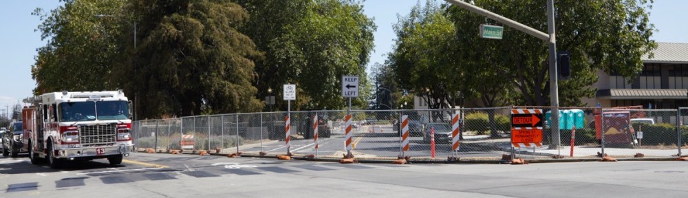
I kind of feel sorry for Redwood City’s Spring Street. It is already somewhat chopped up, and now it has well and truly lost an entire block: as I and the city previously warned, the section of Spring Street between Main and Walnut streets was permanently closed on Tuesday, September 1:
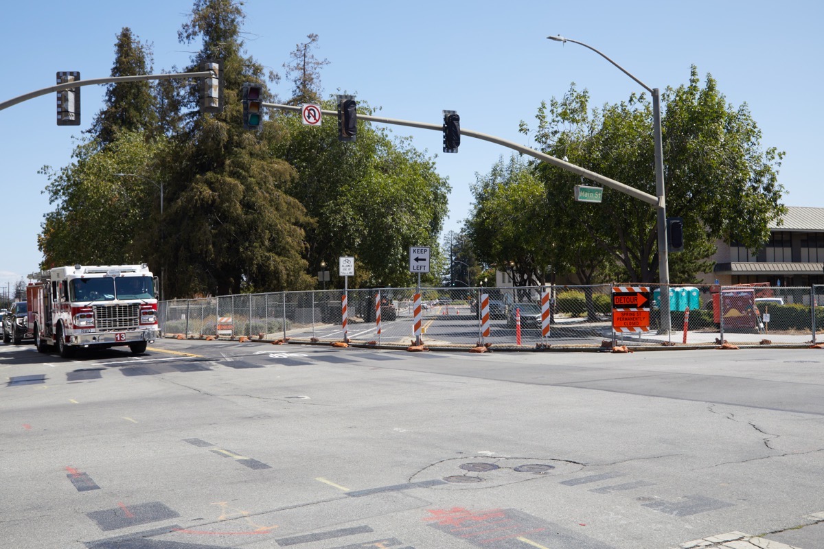
The above shows the former 5-way intersection at Main and Marshall. The construction fencing that previously surrounded the former Wells Fargo Bank building has been extended to not only encompass that one block section of Spring Street, but the triangular parklet that formerly was bounded by Spring, Marshall, and Walnut streets as well. That parklet, which seemed to be little used except by dog owners in nearby residences (especially those in the pet-friendly 196-unit Marston Apartments building, which is directly across Marshall Street from this parklet) is becoming a part of what will soon be a rectangular block upon which the seven-story 1900 Broadway office/retail building will be constructed.
Coming at the closed-off area from the other direction, the remaining one-block section of Spring Street branching off from Broadway comes to an abrupt end, giving motorists no choice but to turn right onto Walnut Street (Walnut Street between Broadway and Marshall is one-way, heading north, so you can’t go left):
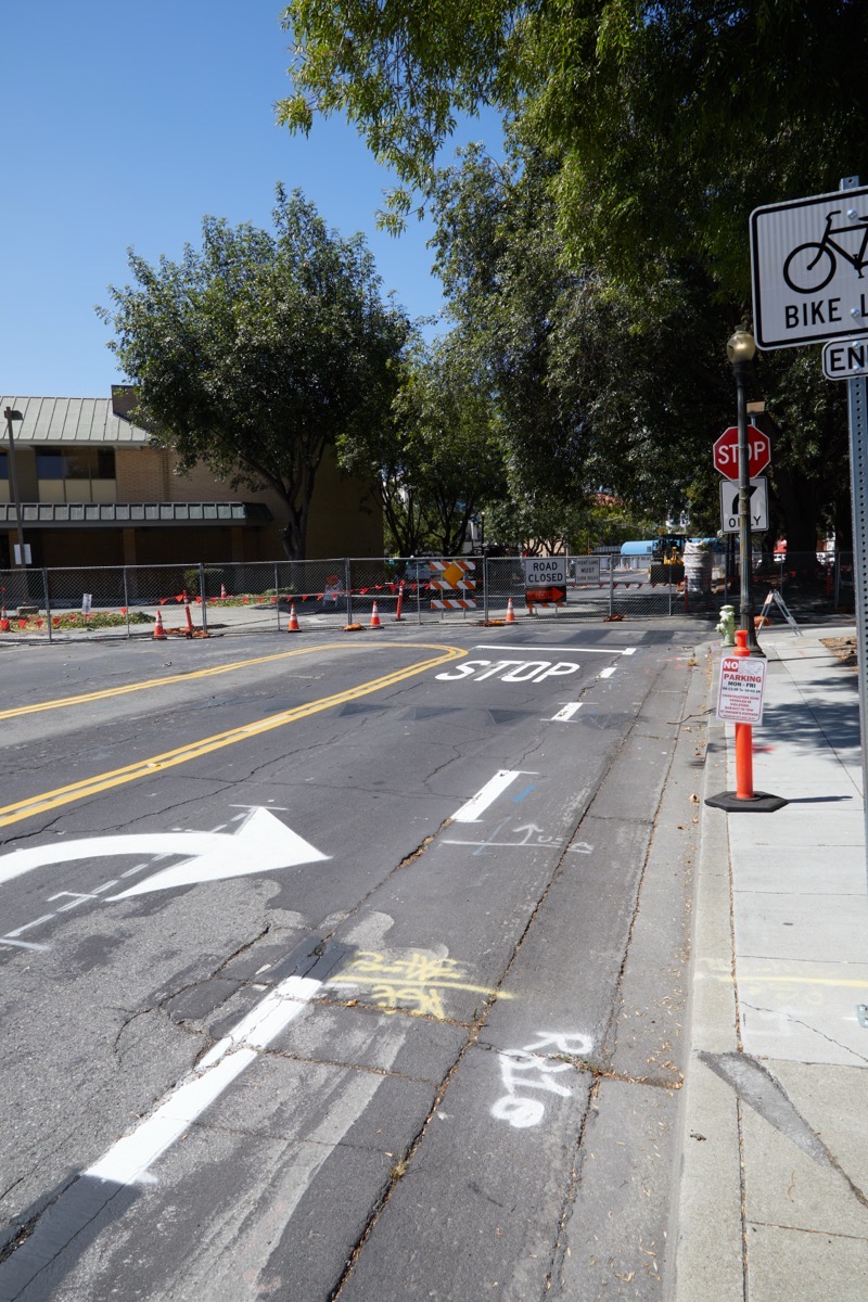
Spring Street here has gained both some right-turn only arrows, plus a stop sign. So far, though, the two lanes that run in the other direction remain, even though you can’t really use them at the moment: the short portion of Walnut that runs between Broadway and this intersection (coming in from the left and paralleling the Wells Fargo Bank building, which is visible in the above photo) is temporarily closed off, presumably for the duration of construction. Once construction is complete, however — in a couple of years from now — those lanes traveling southeast may once again make sense (and by then, Walnut Street should be a two-way street).
After you’ve turned right onto Walnut, you quickly come to Marshall Street:
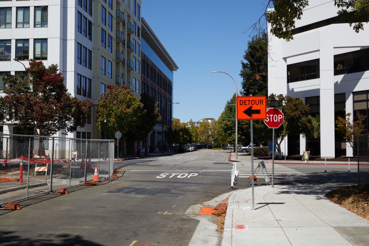
Note that although you’ll have to stop here, the drivers on Marshall Street do not. And now that the one-block section of Spring Street has been formally abandoned, more traffic will likely be driving straight through this intersection along Marshall, looking for the next best way to make the transition to Broadway (Maple or Chestnut being reasonable alternatives).
I’m not sure how quickly the parklet and the street will be demolished. But it might be soon. Parked along that section of Spring Street right now are a car and a couple of pickup trucks presumably owned by the contractors, plus a somewhat powerful-looking tractor:
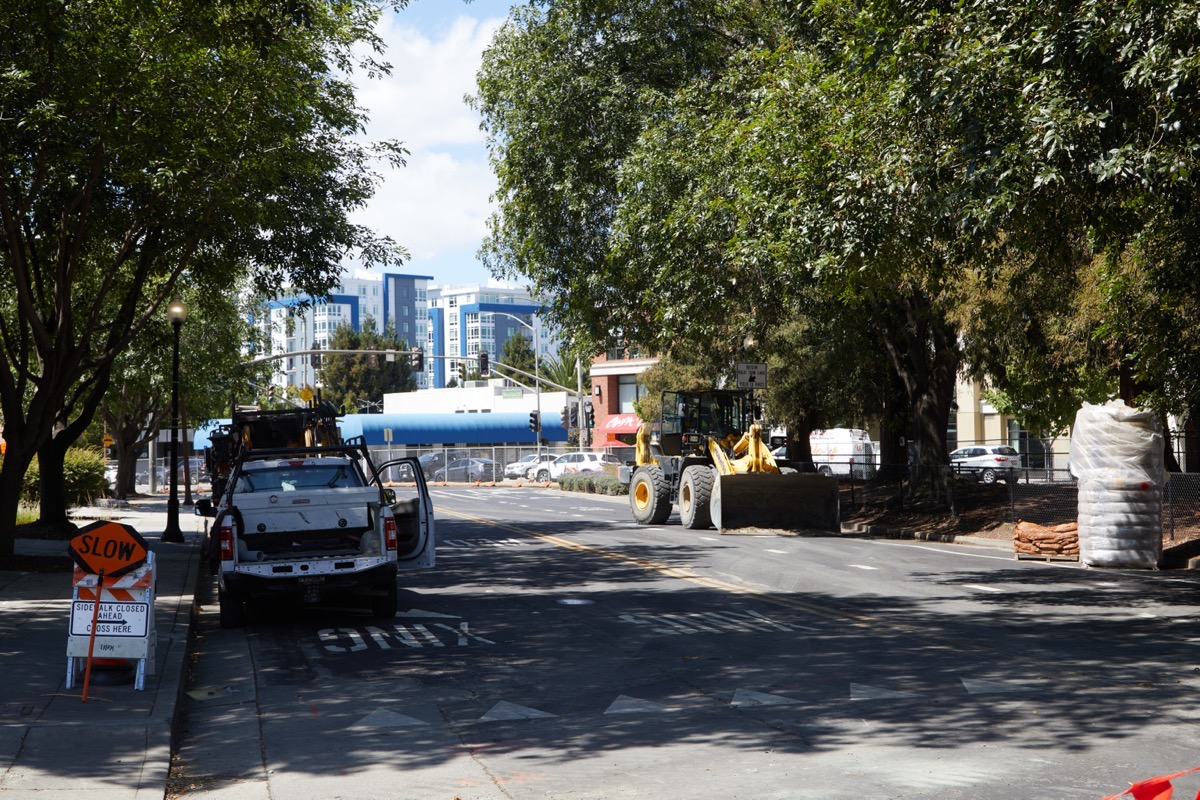
That tractor may be there to help with the utility relocation project, or it may be there for some other part of the project, or it may be there to begin demolishing the park and/or the street. Either way, we’ll know soon. Oh, and I’m sad to note that all of that lush greenery you see in the above photo is not long for this world; I believe that all of those trees will be coming out. Ultimately the developer will be planting new trees towards the end of the construction project, but of course those won’t be nearly as mature at the beginning. Fortunately, though, they will grow over time.
Other than the new fencing and the minor traffic tweaks, things were relatively quiet on the site when I went by to take the above photos. But watch for large equipment to appear on the site: I have to think that demolition of the old Wells Fargo Bank building is not far off.
I began by mentioning that Spring Street is somewhat chopped up, and I suppose I owe a bit of an explanation to those of you who aren’t familiar with its route. Until last Tuesday Spring Street ran from Marshall Street in downtown Redwood City all the way to just short of Marsh Road. But if you started at one end and tried to drive (or even walk) to the other, you’d encounter two discontinuities, one minor and one major. The minor discontinuity is very close to the end I’ve just been talking about, and is shown in this map (courtesy of Apple Maps):
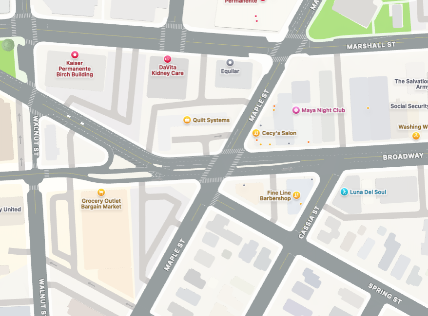
In this map, Spring Street angles diagonally from near the upper left corner down to the lower right corner. But as you can see in the map’s center, there is a gap in the street that, if you are coming from left to right, requires you to merge onto Broadway, then make a quick right onto Maple Street, and then make a very quick left back on to Spring Street. That maneuver is at least doable, although you have to quickly get into the right lane when you make the merge onto Broadway.
Continuing southeast, once back on Spring Street you’ll cross Chestnut Street before reaching Woodside Road. Here you find Spring Street’s major discontinuity:
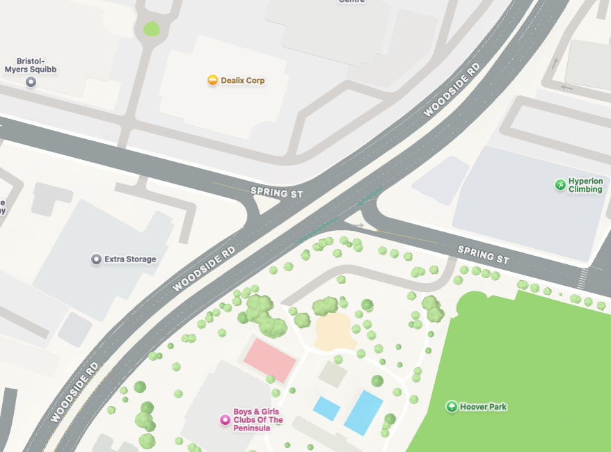
As this map shows, Spring Street does not cross Woodside Road. If you’ve gotten this far, you have no choice but to get onto Woodside Road going in entirely the wrong direction. Your only good option here is to head southwest (that is, turn right) on Woodside Road, turn left on Middlefield Road, turn left on Charter Street, and then turn right once you get back to Spring Street. (A better option, knowing the issue, is to turn left onto Chestnut Street before you ever get to Woodside Road, and then turn right on Bay Road. After you cross Woodside Road, you can turn right on Willow Street and travel the one block to Spring.)
On foot you don’t really have any better options; I cross Woodside Road at Bay Road a lot these days in order to get to Spring Street where it runs alongside Hoover Park, so as to check in on the progress of that particular park renovation (about which I have nothing to report this week; see last week’s post for my latest).
In other street news, the section of Broadway between Birch Street (basically, the entrance to Sequoia High School) and Duane Street is seeing lots of activity at the moment. There, not only are curb ramps being installed, the entire sidewalk on the north side of the street is being completely rebuilt (the sidewalk on the south side between Clinton and Duane streets is also being replaced). Plus, pedestrian-activated crosswalk lights are being installed at the intersection of Broadway and Clinton Street, on all four corners:
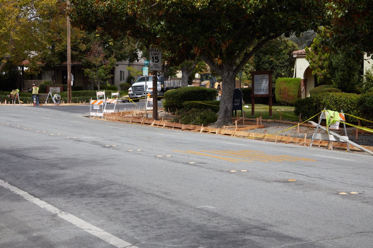
The work being done is quite extensive; replacing not only the curbs and gutters, but also in some places the entire sidewalk and the various driveway ramps:
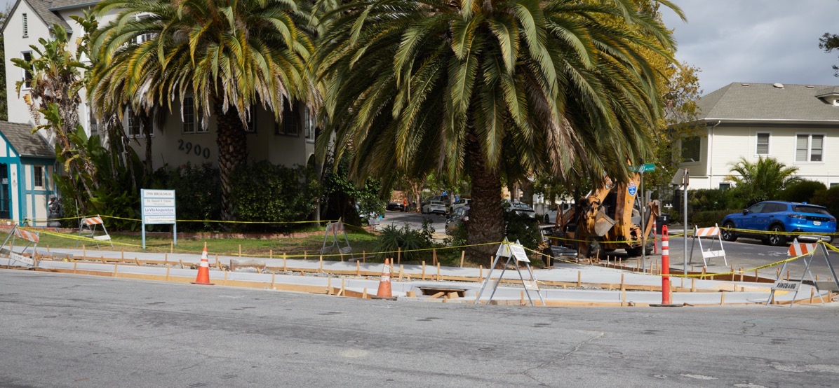
This is all being done as part of the Broadway Pavement Overlay & Curb Ramp Project, which is also affecting parts of Broadway downtown between Maple and Chestnut streets, and between Winslow and Marshall (close to the Caltrain tracks). The project should improve things for everyone: cars, bikes, and of course pedestrians.
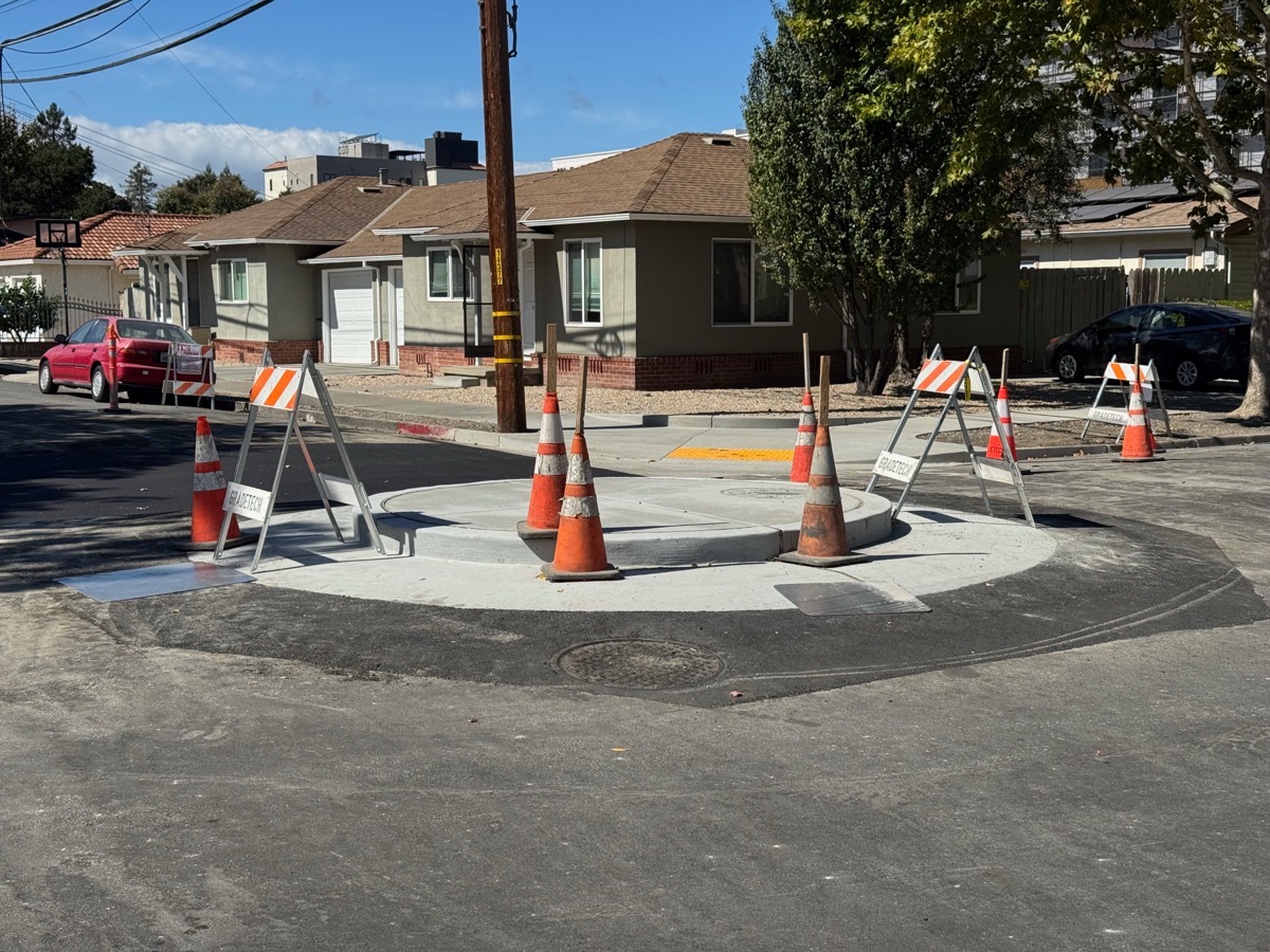
On a related note, the painted (only) roundabouts along Vera Avenue are becoming solid objects, so watch out:
Back on the subject of closures, a tip of my Tilley hat (if you see me out and about, I’m almost always wearing my Tilley) to reader Adrian, who let me know that CRU Wine Shop & Bar, in the Box building closest to Redwood City’s Caltrain station, has permanently closed:
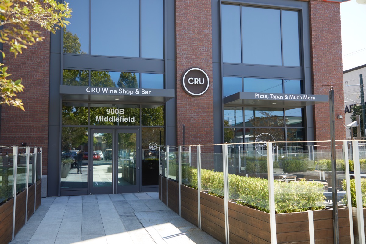
Cru will be missed, although perhaps by not nearly enough of us. Whatever the real reason for its closure, Adrian noted that “all their pre-packaged specialty Italian food items are now still available at Cru’s “parent” restaurant Donato’s on Middlefield across from the main library.”
Although not in Redwood City, the announced closure of Lutticken’s Deli and After 5 Restaurant on Alameda de las Pulgas (along with their two satellite locations) at the end of September presumably has a ripple effect in Redwood City: my understanding is that it was Bob Lutticken who back in 2020 signed a letter of intent to occupy the stand-alone restaurant building that was in the plan as part of the ELCO Yards project:
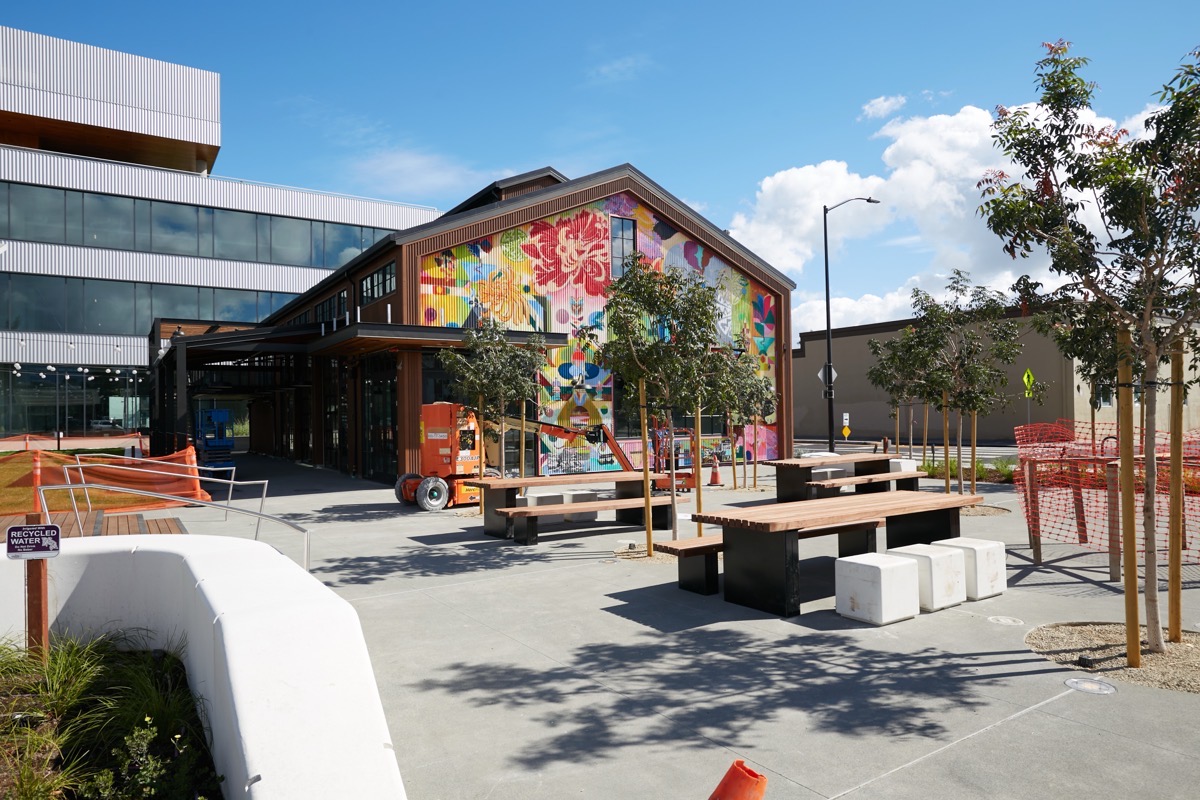
Back then I presume his plan was to create something akin to his former Main & Elm, which was torn down to make way for ELCO Yards. I’m only guessing, but the closure of Lutticken’s other restaurants cannot be good news for that little restaurant building. However, it’s a lovely space with a great outdoor area, and so I hope that if it doesn’t become a new Lutticken’s of some sort, that some other restaurateur will move in soon.
Finally, those of you who regularly drive around the city have undoubtedly noticed that we have a couple of gas stations that have been closed and fenced off for some time now. This week I made it a point to visit three of them to see what was up.
First, I checked in on the one that my wife and I tended to use most often: the Speedway Express gas station on El Camino Real at Brewster Avenue. I haven’t actually managed to witness any work in action, but work clearly was done: not only are the pumps gone, but so are the islands and the overhead shade structure:
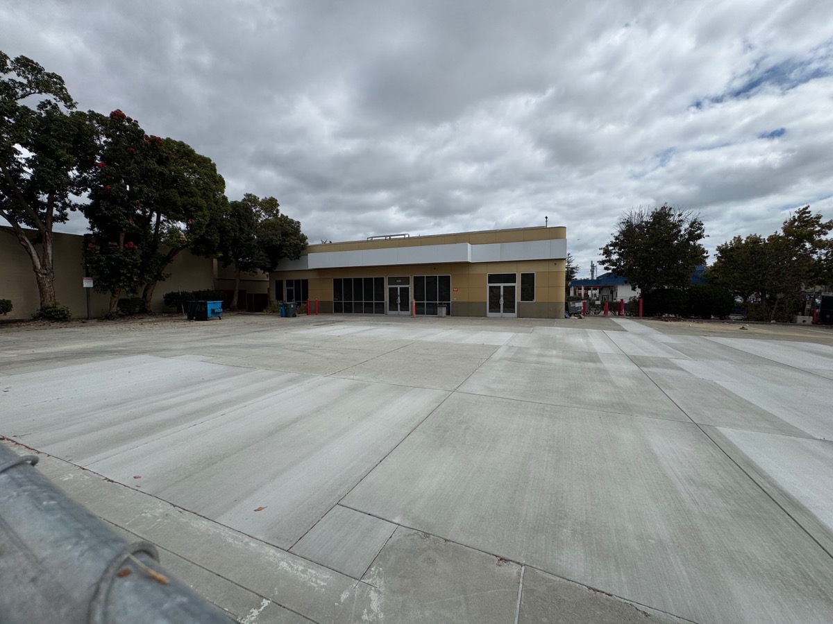
They’ve done such a clean job of paving over everything with new concrete that I have to think that this will no longer be a gas station. Instead, perhaps it’ll be a mini-mart or some other retail operation.
Next, I hit up the 76 station on Whipple Avenue between Winslow and Allerton streets. There, it seems clear that they are simply replacing the underground tanks (which I gather have to be replaced from time-to-time):
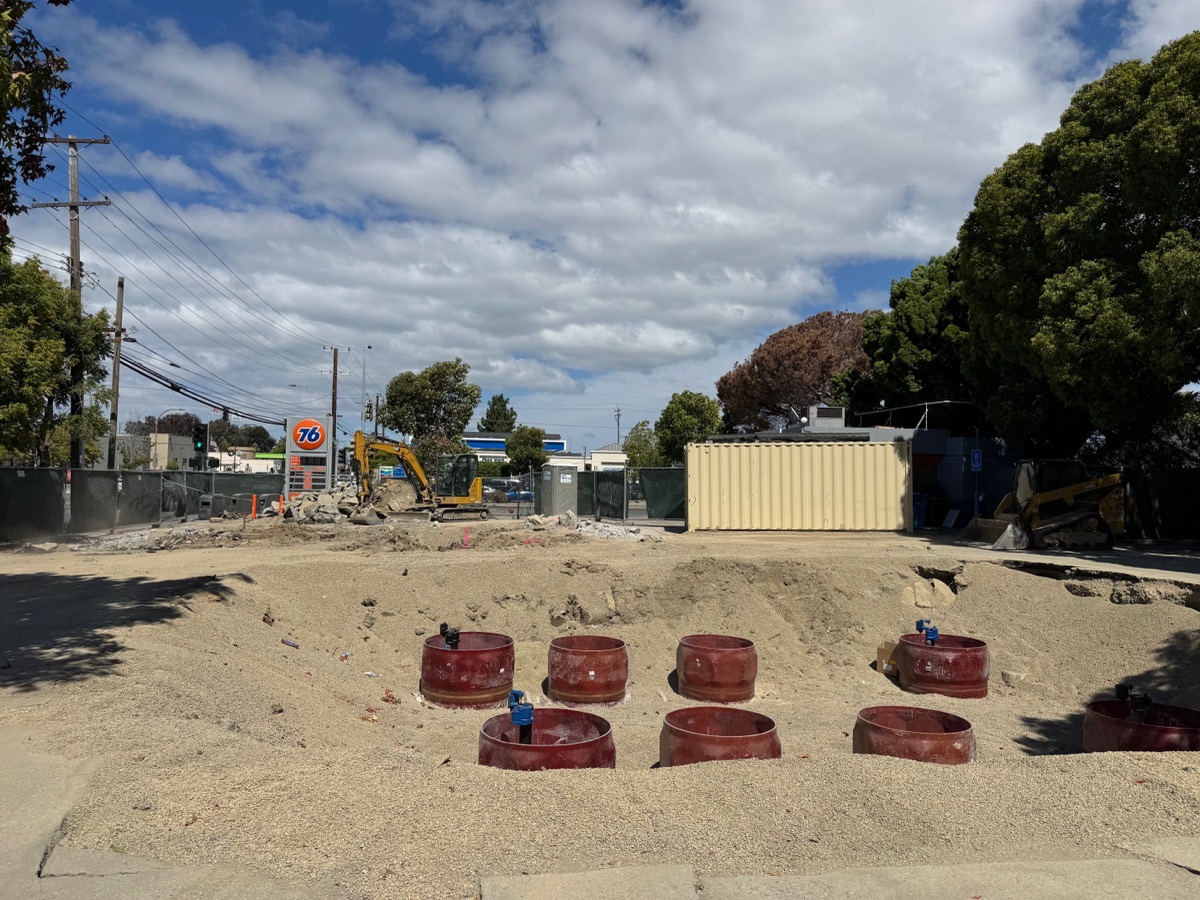
The station’s “Food Mart” remains open during the construction (accessible only from Winslow Street), but I can’t imagine too many people go there without being able to buy gas as well.
Lastly, I checked on the Marathon station on El Camino Real at Edgewood Road. That project seems inactive, although perhaps they are just waiting for the results of soil contamination tests or something (maybe they are just waiting for new tanks to arrive?). Either way, the pumps have been removed from the islands, but remain standing beneath the shade of the overhead structure. And nearby, where I presume the underground tanks are (or were), there is a large hole:
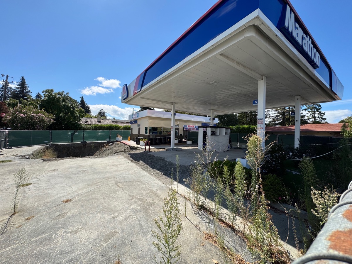
This station used to be a 76, but in the fall of 2022 it became a Marathon station. It operated as a Marathon for a couple of years, but has now been sitting idle (except for the smog station, which is still open for business) for several months now. As proof, check out the height of the weeds growing inside the fence:
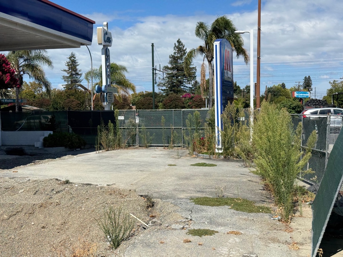
They’re even higher than the construction fencing itself! Not a good look…
Summer is coming to an end! Tonight, Friday, September 4, is the last Music on the Square concert for 2026. But that isn’t the end of the fun, of course. Fiestas Patrias is coming on September 13, and Oktoberfest will run from September 18-27 (get your tickets now!).


Just a shout out to my fellow WRWC super fans who read the comments. I learn so much from Greg and it’s wonderful to learn about San Carlos’ plans for the Carl’s Jr. and the backstory to the gas station situation from all of you!
The Carl’s Junior and parcel behind it will be re-developed for affordable housing. https://www.vmwp.com/city-of-san-carlos-unanimously-votes-to-invest-in-new-affordable-housing/
Thanks for this! I missed that San Carlos bought the property (and the one behind it) back in 2023. I’ll be watching for an actual project proposal.
Appreciate the write up! I am leaving RWC after nearly 16 years but I will still follow along thanks to your articles/emails. 🙂
We really like the smog check station at the Marathon. The guy is really nice and it is super easy. We drive from south Redwood City to go there.
I agree; I’ve used him a couple of times over the years.
I can shed some light on why so many gas stations have closed at the same time. A long time ago California passed a law that gas stations must replace their single lined tanks with double lined tanks. There had previously been one extension to the deadline (pushed to Jan. 1, 2026 in the end). Many gas station owners were hoping for another extension and were postponing the work. When it became clear this would not be the case, they were forced to begin work all at the same time. Presumably Speedway Express decided this was too expensive and decided to just become a mini-mart location instead.
I also have a question for you. Do you know what is happening with the Carl’s Jr just over the border in San Carlos on the corner of Eaton and El Camino? It’s been closed for some time and I haven’t been able to find any development updates for that parcel.
I don’t know what’s going on with Carl’s Jr; for a time it looked like something might be happening there, but it seems to have gone quiet. But that is based on just walking by and peeking over the fence; I’ll try to dig into it a bit since I’m curious, too.
Thanks for the background on the underground gas tank replacements. I noticed a number of stations around the city replacing theirs over the last couple of years, but these three really seem to have waited until the last second. Seems as if they gambled, and lost…