
As promised, I did indeed attend the ribbon cutting ceremony for the Highway 101 Pedestrian undercrossing. There were the expected dignitaries — the mayor, a handful of current and past City Council members, representatives from the developer and from Caltrans, and a number of current and past city staffers. In addition, I was delighted to see that a fair number of members of the public were there as well, many of whom arrived on bicycles (the undercrossing is designed for both pedestrians and cyclists).
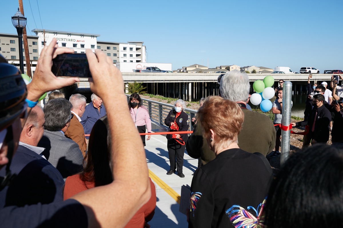
There were speeches, of course, but these were mercifully short. Mercifully not because I didn’t want to hear what they had to say, but because I, along with most of the crowd, couldn’t hear what they had to say: no one had thought to bring any kind of audio amplification equipment, and the noise from the freeway drowned out the speeches for all but the lucky few in the very front. I was relatively close, as the above picture shows, but still not close enough. Of the speakers, only Mark Muenzer, Redwood City’s Community Development and Transportation Director, recognized the need and spoke loud enough to be heard. However, the ceremony otherwise proceeded smoothly (and pretty much on time): it was scheduled to begin at 2 p.m., and by around 2:30 p.m. I was on my way home.
After the ceremony, I had plenty of time to walk the undercrossing, although acting on a hunch I had actually visited the site the day before the Wednesday ribbon cutting and discovered, as I thought I might, that the undercrossing was already open. Thus, on Tuesday I got to spend a lot of quality time examining the undercrossing without anyone else being around. That allowed me to take pictures like this one:
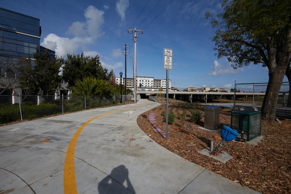
That is the approach to the undercrossing from the downtown side. Proceeding beneath the freeway, it looks like this:

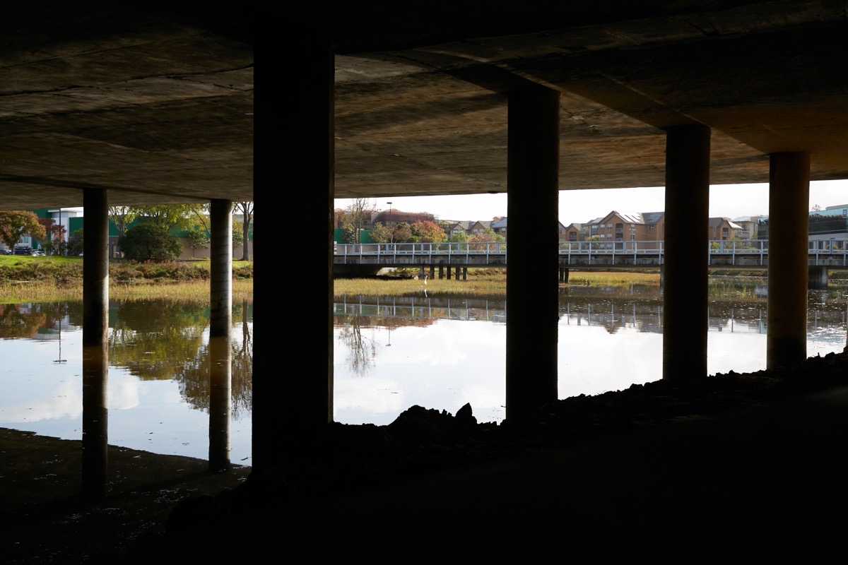
As you can see, there is plenty of headroom, even for those riding through on bicycles. In the above photo, Redwood Creek is on the right side. You can look through the metal railing and get some great views of the creek from beneath Highway 101:
Here is another view of the undercrossing, showing the side away from the creek:
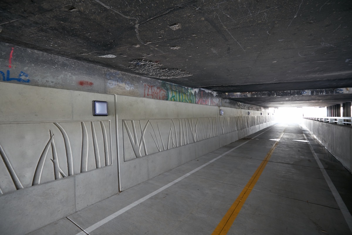
Note the nicely patterned concrete and, more importantly, the lights. I have yet to visit the site at night, but it should be pretty well lit. There are also streetlights along the path at either end of the undercrossing, as well as emergency call boxes in case there are any issues. Hopefully this is enough to make most people feel safe using the undercrossing at night.
One thing I was curious about was drainage. There are two good-sized drains in the pathway, one close to either end of the path where it runs beneath the freeway. Here is the one on the Bair Island neighborhood side of the undercrossing:
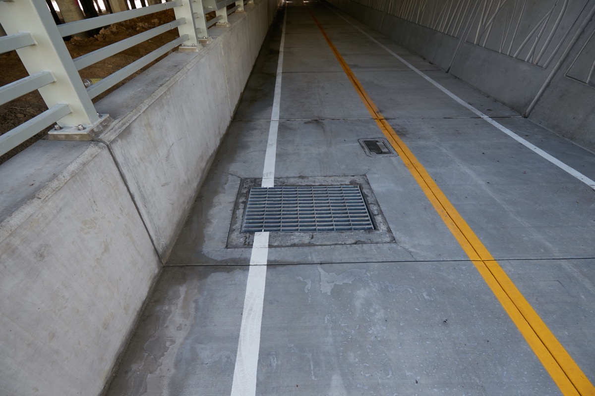
The drainage system leads into the adjacent Redwood Creek. It employs special one-way “flap gates” that allow water to drain from the undercrossing while preventing creek water from backing up into the undercrossing. Since the level of the creek can at times be higher than the lowest point of the undercrossing — when we are experiencing a king tide, for instance — this is a key feature of this particular project. And if there are problems — if it is raining heavily during a king tide, perhaps — chain-link gates at either end of the undercrossing can be manually closed to keep people out until the undercrossing is again safe for use.
Highway 101 is not the only thing that this pedestrian undercrossing makes its way beneath. Strapped to the side of the highway at this point, on the bay side of the freeway, is this large purple pipe:
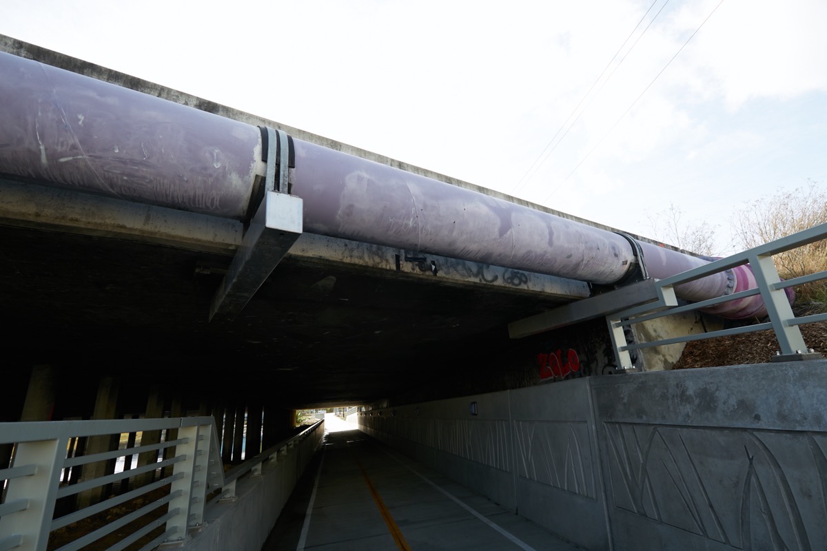
In case you don’t know, this is the main pipe supplying downtown Redwood City with recycled water. Redwood City’s sewage treatment plant, which is located out in Redwood Shores on Radio Road, produces water that is just one level below drinkable. Although we can’t use it for human consumption, it can be used for other things, such as flushing toilets and landscape watering (as long as the landscaping doesn’t contain edibles). That water is pumped from the treatment plant all the way out to the vicinity of the San Carlos Airport, where it eventually meets up and then runs alongside the freeway. After crossing over Redwood Creek, the pipe reaches the vicinity of Walnut Street (which dead-ends on the downtown side of the freeway, between Kohl’s and the Evernote headquarters building). There the recycled water pipe turns to run beneath Walnut Street towards downtown, where eventually it should get hooked up to many of downtown Redwood City’s large new developments — developments which have been dual-plumbed to be able to accommodate this recycled water, I should note. If I recall correctly, it is already serving the nearby Kaiser campus.
The Highway 101 Pedestrian underpass is a key part of the Redwood Creek Trail, segments of which are being built along with various new developments. One very small segment was constructed as part of the undercrossing: if you walk along the pathway towards downtown, you’ll see that the path continues for just a bit beyond Main Street:
As you can maybe see, though, this segment of the trail is quite short. It does have a nice bench, though, that I plan to use when I’m walking in the area: it should be a great place from which I can sit and watch the wildlife enjoying the creek. Regrettably, this segment dead-ends at a fence that circumscribes the property on which a neighboring building sits:
There is another segment of the Redwood Creek trail just beyond this particular parcel (that runs behind the Township Apartments, and is open to the public); in order to connect that other segment with the one shown in the above photographs, the owner of the office building shown above would have to grant permission for the trail to run right through their parking lot. Given that that would wipe out a substantial chunk of the property’s parking, I’m guessing that isn’t going to happen any time soon. Hopefully, though, some sort of accommodation can be worked out enabling those of us who would like to continue following the creek access to this parcel. For now, though, our only choice is to make a u-turn when you reach the fence, and then head back to Main Street. You can then follow the sidewalk along Main Street until you get to the Township building, at which point you can regain the proper trail, at least for the length of that one building. Soon, though, when the adjacent apartment project is completed, you’ll then be able to continue on, coming out into the parking lot behind the Supreme Crab and Carl’s Jr. restaurants.
Speaking of underpasses and parking, allow me a brief diversion. I was very excited to see that the city has finally erected at least two large electronic signs at key entrances to downtown, signs that indicate the amount of available parking at each of the most popular downtown parking areas. Here is the one on the Jefferson Avenue underpass (which passes beneath the Caltrain tracks by Sequoia Station):
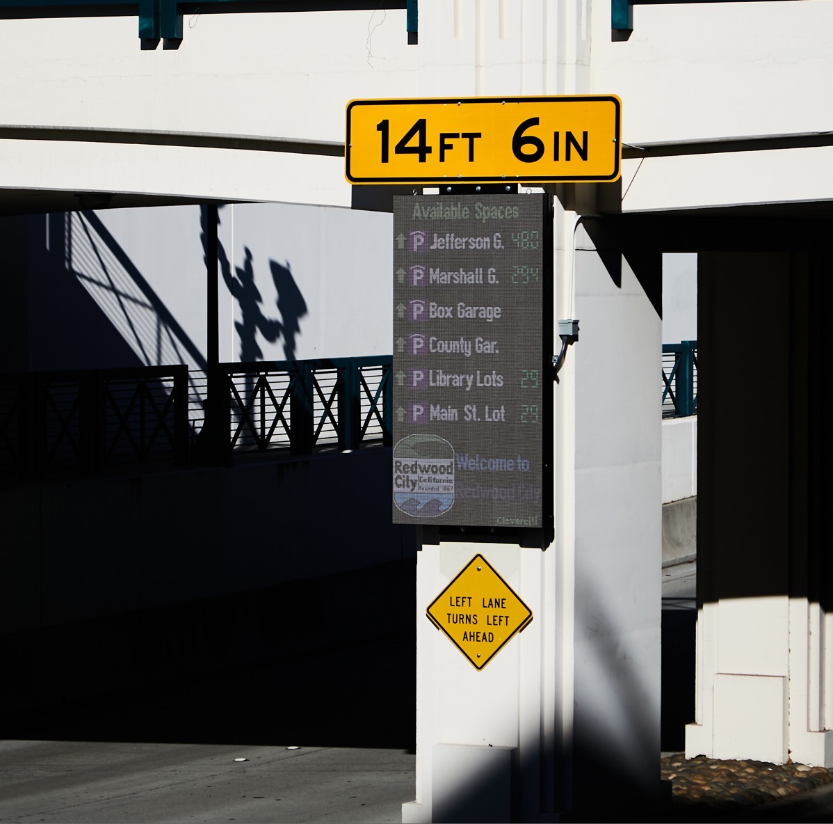
Currently these signs list the Jefferson garage (beneath the Century Theaters), the Marshall garage (in front of the main fire station, on Marshall Street), the “Box” garage (which, because it is not open to the public during working hours — which is when I took the above photo — does not indicate the number of available spaces), the County garage (ditto), the three parking lots surrounding the library (the circus is in town and occupying the largest of the three lots, leaving only 29 available spaces when I took the photo) and, finally, the Main Street parking lot (located behind City Hall and behind the downtown Post Office).
I know of at least one other of these signs, on Veterans Boulevard between Maple and Walnut Streets (only visible if you are heading west on Veterans Boulevard):
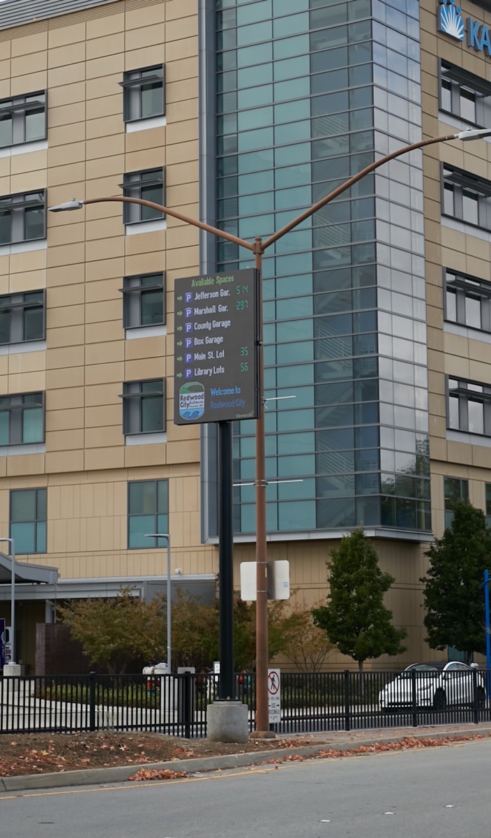
I expect that the city will install others, if they haven’t already. These go along with the small hockey-puck-shaped signs on light-poles in and around the various parking lots and garages, indicating the number of available spaces in just that one garage or lot (or aisle within a lot, as is the case with the Main Street parking lot).
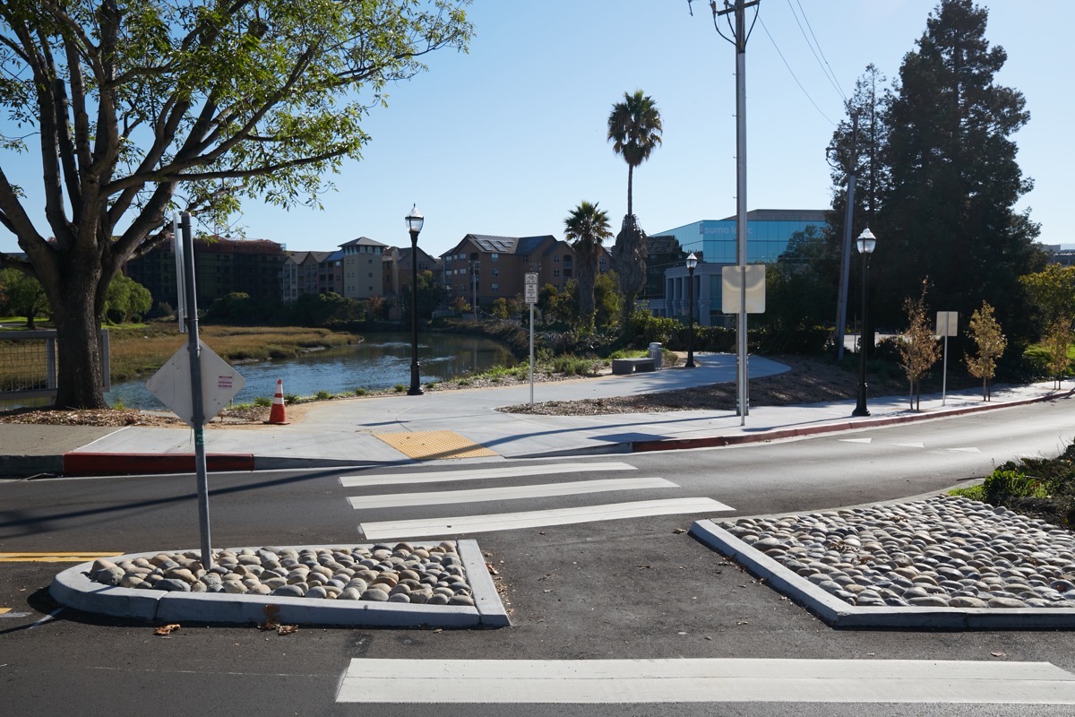
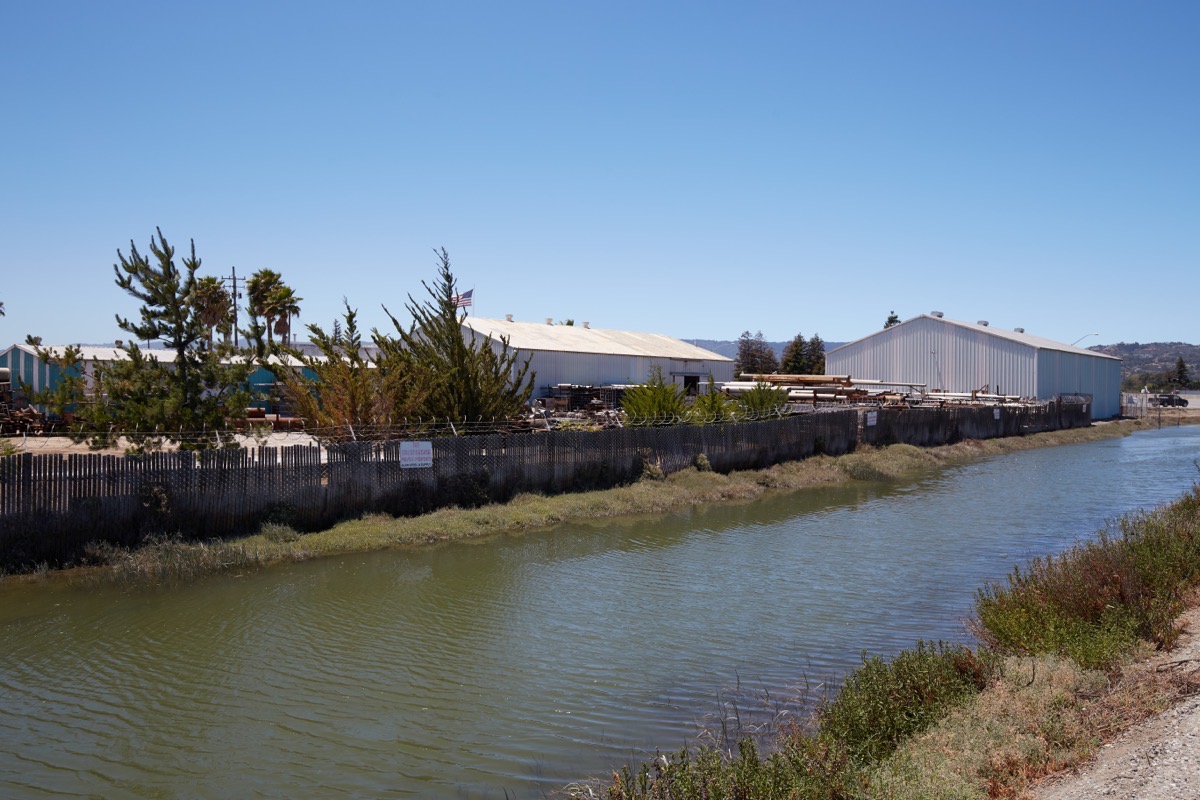
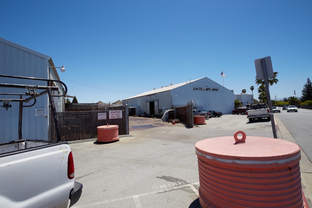
Ending my digression and returning to the Redwood Creek Trail (of which the path leading through the undercrossing is a part), on the east side of the freeway it intersects with the larger San Francisco Bay Trail, which will soon gain a vital new segment on the south side of Redwood Creek when the townhouse development over there — adjacent to Docktown Marina — is built. If you instead turn north, though, and follow the trail through Bair Island, once you’ve passed behind the old Century 12 Theaters building you’ll find yourself looking at the backside of Alan Steel & Supply Company:
As you may know, a developer has proposed a new use for this site: housing. The proposed 505 E. Bayshore Road project would put 56 townhouses (eight of which would be affordable at the Moderate income level) on this site. To the person walking the Bay Trail, that development might look something like this:
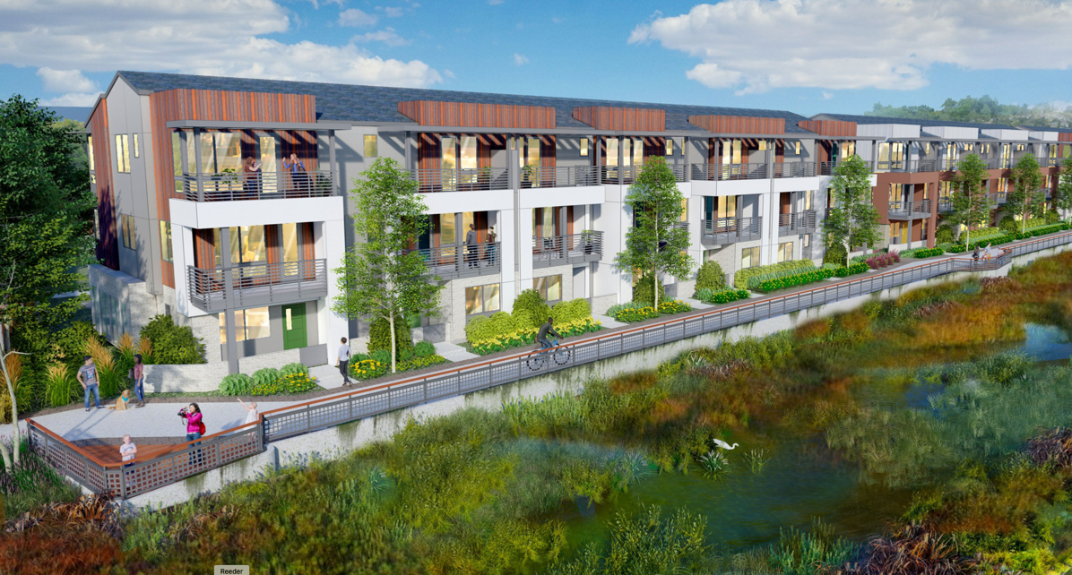
The above rendering shows not only the townhouses that face Bair Island, but also what the developer refers to as the “Shoreline Trail,” a new public pathway that would sit atop a seawall that hopefully will protect the townhouses from sea level rise. Behind the seawall, it appears that the whole site will be elevated somewhat, although precisely how much is hard to tell from the plans submitted thus far.
If our trail hiker could rise up into the air, the development would something like this:
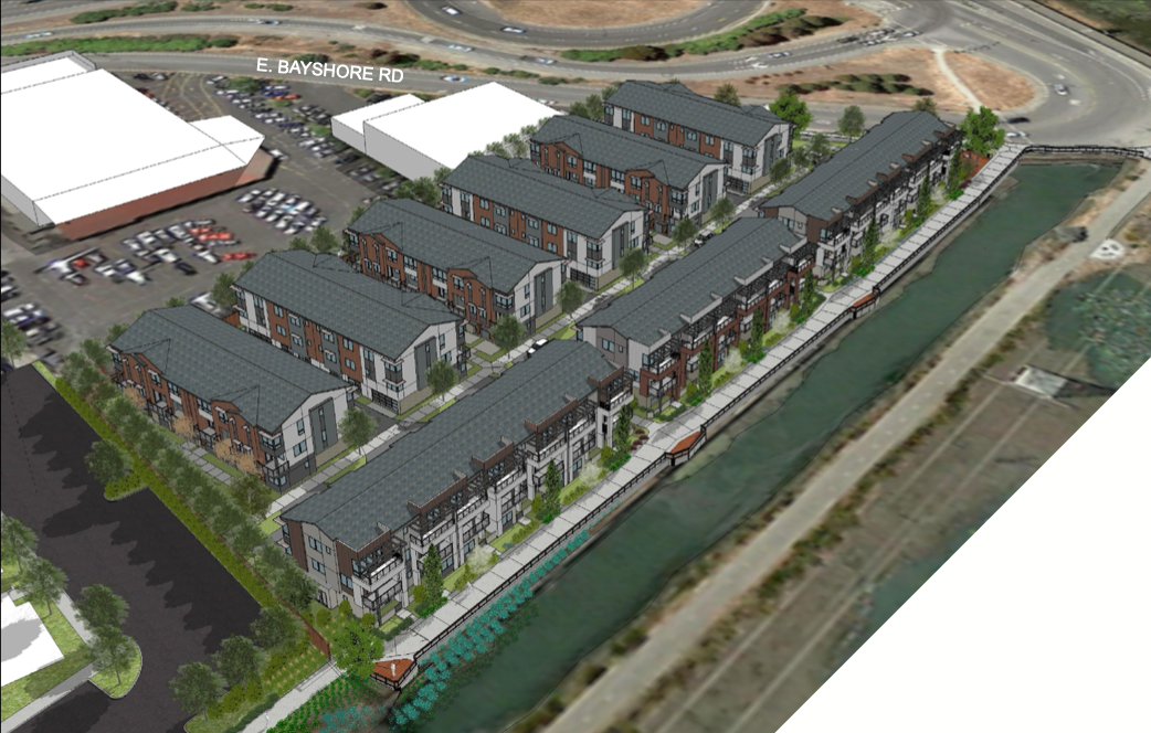
Those two minimally defined white buildings in this rendering are, by the way, the old Toyota 101 dealership; that dealership has mostly moved directly across the freeway, although some of their mechanics still seem to be repairing cars at this site. Anyway, note the three long buildings facing out onto Bair Island, and the six others that don’t have views that are nearly as nice. I’m guessing that the pricing of the various units will reflect those views, among other things. Those three long buildings contain 20 of the complex’s townhouses; the other six buildings contain six townhouses each, making the grand total of 56.
The townhouses would range from two-bedroom, 2.5-bathroom units up to ones with four bedrooms and 3.5 bathrooms. In terms of square feet, they’d range from about 1,200 square feet up to 1,700 square feet. Being townhouse style units, each would have a two-car garage on the ground floor (the smaller units park the two cars in tandem) with the public spaces (living room, dining room, kitchen) on the second floor and bedrooms generally on the top floor. Depending on the layout, some have one of the bedrooms on the second floor. And the larger units would have some usable space on the ground floor along with the garage. Generally this downstairs space is marked as an “office/den,” although the four-bedroom units designate that space as the fourth bedroom (there is also a full bathroom down there).
From E. Bayshore Road (which is just a continuation of Whipple Avenue after you make your way over the freeway), here is what the property looks like today:
If the development is built as proposed, here is what that same view would look like after it is completed:
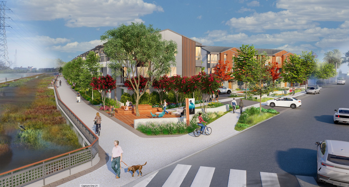
Note the shoreline trail between the development and Bair Island.
This project is slowly working its way through the approval process. It is currently in the works to be reviewed by the Architectural Advisory Committee, which will pass their recommendation on (to the Planning Commission, I presume). That committee often has input that is then reflected in the proposal before it moves to the next stage. Thus, the final proposal may or may not look just like the renderings I’ve shown here.
The Highway 101 Pedestrian Undercrossing is just the beginning of a network of trails that follow Redwood City’s waterways and lead onto adjacent cities to the north and south. Today there is already a lot worth exploring on the east side of the freeway, and now, with the new undercrossing, we can easily get there without using a car (note that there is often ample parking along Main Street close to the undercrossing, in case you want to drive to there and then walk the rest of the way). Cross the “Bridge to Nowhere” and explore the areas soon to be under development. Follow the concrete walkway that traces the north bank of Redwood Creek (between the creek and the One Marina townhomes) to view what is left of Docktown Marina, and to reach the delightful little playground at the end of the walkway that also marks the entrance to the large, and little-used, Peninsula Marina. Or turn left after exiting the undercrossing and then follow E. Bayshore Road out to the entrance to Bair Island, where you can either walk out to the island’s viewing platforms or you can simply proceed straight ahead along the public path into Blu Harbor. There is so much to see and do out there; take advantage of this new undercrossing and check it out for yourself!

Pingback: Wrapping Up | Walking Redwood City
@SamuelY: city staff is aware of the problem with the the toilet water having a hydrogen sulfide-like rotten egg smell in the brand new Kaiser clinic building. While not potable, recycled water is not supposed to smell. I reported it and received a staff response saying so, and that they were working to identify and correct the source of the smell. I noticed that Kaiser has since posted signs in the restrooms that essentially blame the city’s recycled water, as I presume they got tired of fielding complaints from staff & patients alike.
I can confirm that the new Kaiser Marshall Medical Office building is receiving recycled “purple pipe” non-drinkable water for its toilets, and it stinks! Yes, I mean literally it stinks; it smells like poopy toilet water. Employees and patients have complained that restrooms smell, but no matter more many times you flush the toilets, the smell doesn’t go away. They are working on better air fresheners to cover up this smell. We all agree that using recycled water for toilets is good for water conservation and good for the environment, but the water needs be specially treated to improve the smell before it leaves the treatment plant.
How long before it becomes a homeless encampment impeding passage?
Looking at the pictures of the 101 Undercrossing–No separation of bike and pedestrian lanes?! That’s an accident waiting to happen. Go to Palo Alto sometime and check out the Homer Avenue tunnel under the Caltrain tracks near downtown.