
I took advantage of the extraordinarily good weather we’ve been having lately to take a nice long walk this week. Over the seven-plus years I’ve been writing about Redwood City, I must have walked along nearly every street by now. I of course favor some streets more than others, though, either because there is more going on along those streets, or because they are useful ways to get to another part of the city. Broadway just has to be the street I’ve written the most about, for both of those reasons. And although it is somewhat shorter than Broadway, I’m guessing I’ve also written nearly as much about Main St.
Lately I’ve been doing a lot of research into the possible ways that Caltrain wants to upgrade their rail corridor through Redwood City (something I’ll write about next week) and in the process I spent some time investigating Redwood Junction, for reasons I’ll likely get into in that post. I decided to take a walk this week with the aim to explore Redwood Junction, which lies along Middlefield Road in North Fair Oaks, not far beyond the Redwood City border. In planning my walk, it occurred to me that over the years I may not have given Middlefield Rd. its due: given its length, and the way it cuts through the heart of the city, I probably haven’t written as much about Middlefield Rd. as it deserves. Thus, I expanded the purpose of this week’s walk to encompass the whole of Middlefield Rd., from its start at Veterans Blvd. in Redwood City, to where it crosses the southern border of North Fair Oaks and enters Atherton. And I’m glad I did! While you can get a good “slice of life” image of Redwood City by walking from one end of Broadway to the other, it turns out you can get an equally good, if not better, picture of what life is like in Redwood City by walking Middlefield Rd. Thus, for this week’s post, I’m taking you along on a somewhat lengthy photo journey through Redwood City and North Fair Oaks along Middlefield Rd.
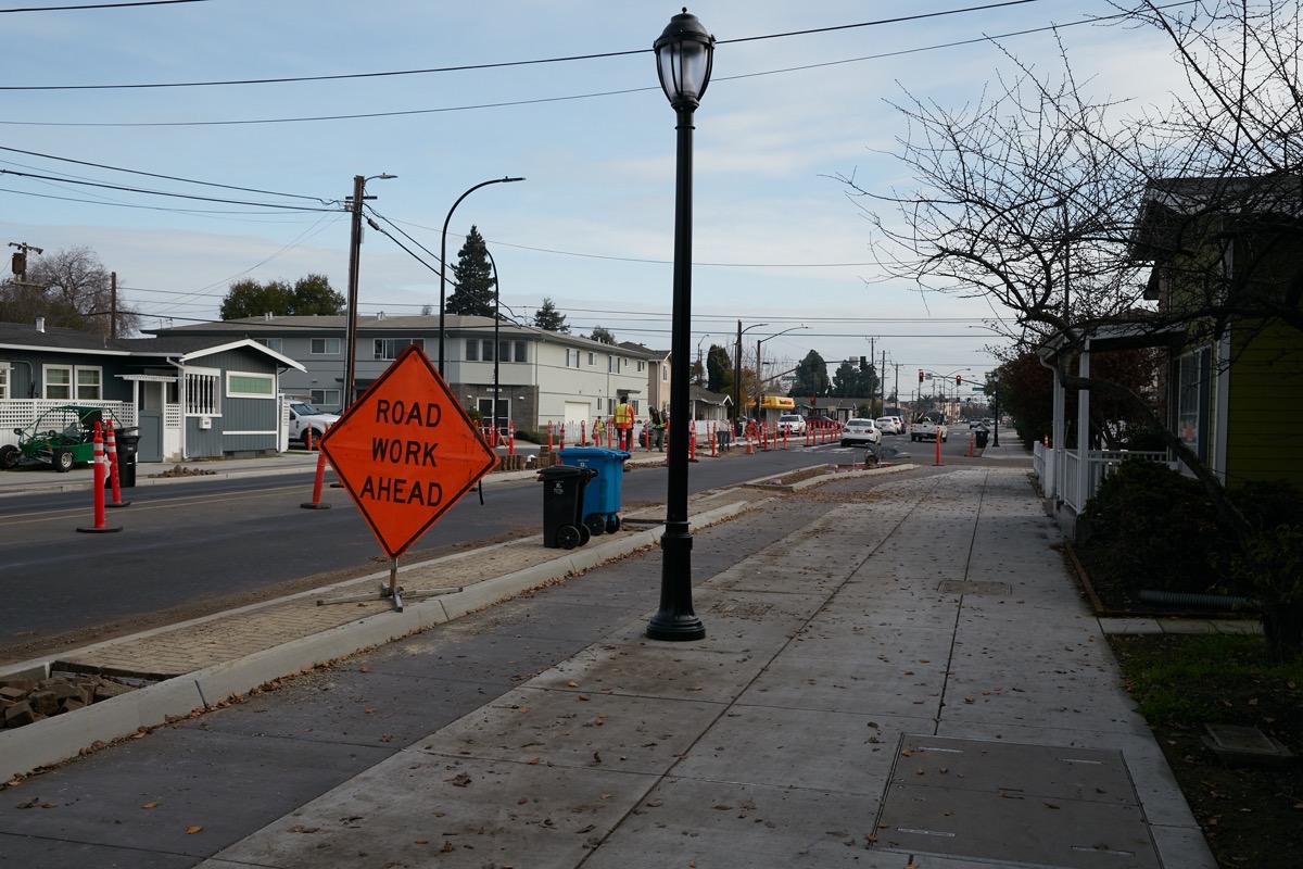
I began at the northern end, on Veterans Blvd., where Middlefield Rd. begins. Here:
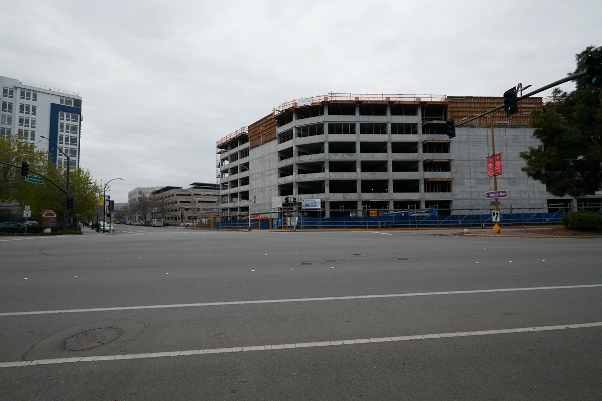
To take this photograph I stood on the sidewalk on Veterans Blvd., and aimed my camera down Middlefield Rd. On the left, you can just see a bit of the 10-story Indigo apartment building, and, in front of it, signage for a couple of restaurants and retail shops located just beyond the left edge of the frame. The primary subject of the photo, though, is the under-construction San Mateo County parking garage. As you can probably tell, this garage is going to be a whopper: this seven-story structure will have 1,022 parking stalls and will augment the existing 797-space county garage that you can just make out in the above photo; it is the next structure down Middlefield Rd. on the same side of the street. Together these two structures will provide close to 2,000 parking spaces for county employees, jurors, and people having business with the county.
From Veterans Blvd. down to Marshall St., all of the property on the right hand side of the street makes up County Center, where the seat of San Mateo County is located. There are a number of county buildings here, and more on the way. At the corner of Middlefield Rd. and Marshall St. the county has cleared away a number of smaller buildings to reveal a large lot upon which they will shortly be constructing a new county office building for some 600 employees:

(For orientation purposes, Middlefield Rd. runs along the left side of the picture, between this lot and the multi-story office building [601 Marshall St.] you can see in the above image.)
Currently the county is finalizing the building’s detailed design. They anticipate that the building will be completed sometime in the year 2023.

This next photo shows the intersection of Middlefield Rd. and Bradford St. The 601 Marshall building is visible on the right, but I wanted to focus on the two side-by-side houses — one or both of which are being used as law offices — at this corner. The right-hand one (up against the large office building) is on the city’s Historic Resources Inventory; it was built between 1891 and 1897 on this spot. It has a number of ornamental touches that are “hallmarks of the Queen Anne style,” and, fortunately, appears to have been well-maintained over the years (there even was some work going on as I walked by):
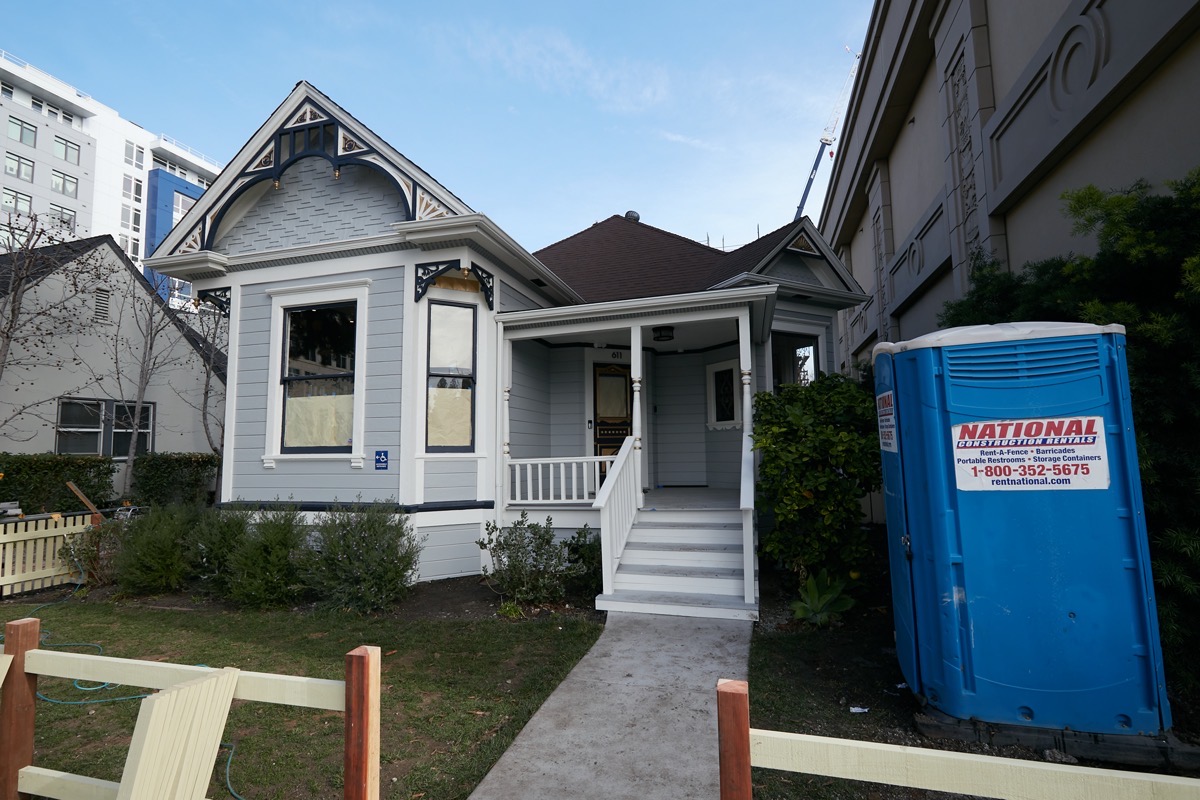
Although these two houses now look a bit out-of-place, being completely surrounded by modern multi-story buildings, a number of the surrounding buildings have some form of housing. For instance, there is the giant Indigo building, just across Bradford (the blue-and-white building visible in the above). Referring back to the earlier picture, the rather drab building just behind the houses on Bradford St. is an apartment building, while the building under construction next to it is the six-story Habitat for Humanity project going up at 612 Jefferson Ave.
So far, I’ve only come one long block along Middlefield Rd., and already I’ve seen restaurants, housing, the County Center complex, and now, a historic house and one of Redwood City’s newest office buildings. One more block brings me to Marshall St., and this:
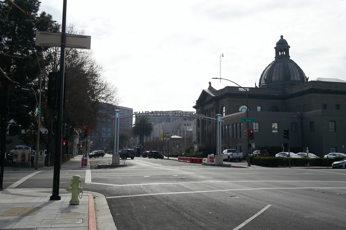
Here the view is dominated by back side of the historic courthouse, on the right, and some of the new high-rise buildings that make up today’s downtown Redwood City. Those buildings are framed by an archway that proclaims “Theatre District” (the words are easier to see at night, when the letters are illuminated). Proceeding beneath the arch, although the addresses along this street continue to list Middlefield Rd., the city prefers to call the next two blocks “Theatre Way.”
The next intersection — Middlefield Rd. and Broadway — makes the reason for the virtual name change clear. Here is what Middlefield Rd. looks like beyond that intersection:

On the left is Redwood City’s 20-screen Century Theatres multiplex. On the right is a building that here holds a number of retail and restaurant spaces, but, on its Broadway face, is where you’ll find Redwood City’s historic Fox Theatre:

Courthouse Square is just off the right edge of the above image; this is the large mostly open plaza in front of the historic county courthouse that Redwood City likes to think of as its “outdoor living room.” It serves as a theater of sorts on select summer nights, when the city erects a large outdoor screen and shows free movies for anyone who wants to come out and watch. Of course, Courthouse Square has a lot of other uses as well, including serving as a host location for art festivals, protests and rallies, and concerts.
Two things in particular caught my eye as I wandered down Theater Way. One, the former Brick Monkey 2 space appears to have been quickly snapped up: signs in the windows proclaim that “Madison Ave.” (presumably, a small independent retailer) will be opening there sometime in February. And a bit further down and across the street, I belatedly discovered that Marufuku Ramen had quietly opened up late last year. Currently Marufuku Ramen is open for pickup and delivery. With outdoor dining and gatherings largely prohibited, this block of Theatre Way has temporarily been reopened to cars, making pickup of phoned or online orders from any of the many restaurants along this block easy.
At the end of Theatre Way I came to the so-called “Box” buildings, which indeed serve as the headquarters for Box, Inc.

Middlefield Rd. appears to dead-end into these buildings, but, rather strangely, if you turn left you’ll find that you are still on Middlefield Rd. (turning right puts you on Winslow St.). I have no idea why some streets make 90-degree turns like this while still retaining their name. I tried to do some research on this, but had little luck. Once COVID is mostly behind us and I can get back into the Local History Room at the downtown public library, I hopefully will be able to come up with an answer. What I did learn, though, from looking at map of downtown Redwood CIty from 1897, is that back then Middlefield Rd. didn’t exist. The portion I had just walked along had been known as 2nd, and the bit I was about to turn left onto wasn’t even a street back then. As you continue along today’s Middlefield Rd. and get to Main St. you finally get to where there was a street back then, but it wasn’t called Middlefield; it was called Phelps.
Returning to the Box buildings for a moment, they were one of the first new buildings in downtown marking the city’s recent renaissance. Some people like the look, and some do not, but regardless, these two towers and their large internal parking garage serve as an important part of today’s downtown.
After turning left and walking to the end of the block, one then comes to another important intersection: Jefferson Ave. The four corners here hold the Box buildings, the Century Theatres building, Redwood City’s City Hall, and our lovely downtown library, which at one time was a firehouse:
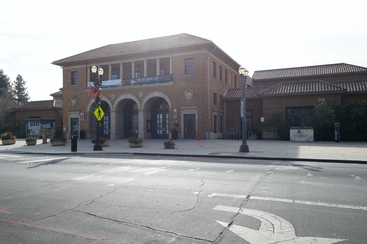
Personally, this is one of my favorite Redwood City buildings. I just love how they preserved the basic structure and look of the old firehouse, while extending and transforming the building into a truly wonderful library space.
The library property extends to the next intersection, where Middlefield Rd. meets Main St. Here we find the City Center Plaza building, which has housing above and retail and restaurant space below. Within this building are two of Redwood City’s more popular restaurants: Donato Enoteca, a high-end Italian restaurant, and Milagros, which serves Mexican dishes and drinks.

Until recently the block of Main St. adjacent to this building was closed to vehicles, and Milagros had set up a large outdoor seating area on the half of Main St. that was closest to their restaurant. No longer, unfortunately.
Resuming my walk, one more short block brought me to Maple St., where the old Foresters of America Hall still stands (that fraternal organization seems to exist no longer; today this building is being used as office space):

Directly across Middlefield Rd. from this great old building is Tacos El Grullense #1, apparently the first in a set of popular local taquerias.
Continuing on, Middlefield Rd. quickly turns residential. After passing Rise City Church, and the associated empty lot (across the street from the church) where that church recreates the town of Bethlehem during the Christmas season, for the next couple of blocks nearly all of the buildings are either apartments or single-family homes of a variety of ages and styles.

Soon I reached Chestnut St., though, and the area’s local public park: the delightful little Jardin de Niños:

Incidentally, there is a small fenced-off dirt lot immediately adjacent to this park along Middlefield Rd. At one time there was a run-down house on this lot, but the city purchased the property, cleared it, and made plans for an expansion of this little park. Before the expansion could get underway, however, the city decided to undertake it’s Middlefield Road Phase 1 Underground Utility District and Streetscape Project, and the empty lot proved too tempting as a place to stage materials and equipment for the project. Thus, until recently it had been used for that project, which is slowly nearing completion. Now, the lot once again stands empty; hopefully the city will soon extend Jardin de Niños park as it once intended.
The project to rebuild Middlefield Rd., incidentally, is coming along beautifully. The sidewalks have been greatly widened — something I can particularly appreciate — and the unsightly overhead wires should soon be a thing of the past. New landscaping will go in soon to join the old-style streetlamps the city has installed, making this portion of the street not only more functional, but much more beautiful:
The streetscape/utility project runs from Main St. to Woodside Rd., which is our next stop on this little tour. The intersection here was recently remodeled, which is key to making this walk work smoothly: prior to that remodel, pedestrians could not cross Woodside Rd. — also known as Highway 84 — at this intersection. Instead, one had to detour a block to the south, and navigate an overhead pedestrian crossing. Today, though, there are well-marked crosswalks with protective signaling that makes it easy to walk from this residential area to one of Redwood City’s most popular big-box stores: Costco.
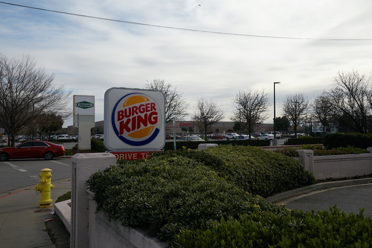
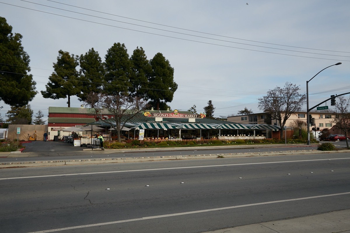
Costco isn’t the only popular retailer here, of course. Just next door is our large Outdoor Supply Hardware store. And across Middlefield Rd. from Costco is the wonderful Sigona’s Farmers Market, where you can get a wide variety of high-quality fresh fruits and vegetables, along with a number of other market goods:
Past Sigona’s, that side of Middlefield Rd. turns residential again, although not before we find another Tacos el Grullense taqueria. On the Costco side, the buildings remain commercial.
Things get interesting just past Costco, although you can’t tell just by looking. When you get to Flynn Ave., which is the signalized intersection just past Costco, you leave Redwood City and enter North Fair Oaks — depending upon which side of the street you are on, that is.

The above picture shows the first building you come to after Flynn Ave. Anastasia’s Coin Laundry, the primary business in this building, is in the city of Redwood City. The street in front of it, however, is not. It, and the sidewalk I’m standing on to take this photo, are actually in North Fair Oaks. Things continue this way for a couple of blocks, until you reach this building, at 2500 Middlefield Rd:
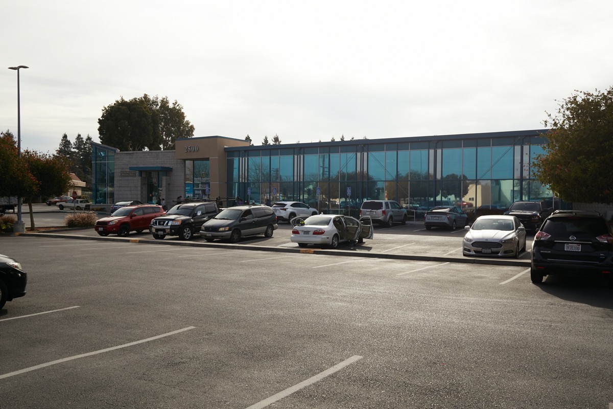
This building is home not only to the San Mateo County Human Service department, but also to the North Fair Oaks branch of our public library system. This building is in North Fair Oaks. But keep walking, and you come to this next one, which shares a parking lot with the one above:

As you approach this, the Fair Oaks Community Center, suddenly you are back in Redwood City once more. But only for the duration of this one building, plus one small additional retail space beyond. After that, you are back in North Fair Oaks again.
These oddities of the city’s boundaries are probably only of interest to the tax man, and to people like me who like to puzzle these things out. From here on out, though, we’re solidly in North Fair Oaks, with no more vestiges of Redwood City to be found.

Much of Middlefield Rd. from here all the way through North Fair Oaks looks a lot like the above, with small retail and commercial spaces lining both sides. I’ve found a few nice highlights, though. One is actually visible in the above photograph, although rather hard to see: Capelo’s Barbecue. Capelo’s is a great source for barbecued meats and sides. They have a food truck that makes the rounds of both San Mateo and Santa Clara counties (see their website for a schedule of locations) but I prefer to drop by the to-go counter at their commercial kitchen here and see what catches my fancy (they recommend preordering by phone or online to ensure availability).
Just about a block past Capelo’s, two sets of railroad tracks cross Middlefield Rd. This is the area known as Redwood Junction:

Redwood Junction itself is just a collection of single-story warehouse-style buildings where a variety of businesses have made a home. It is right next door to the rather impressive-looking Fair Oaks Health Center, which appears to be run by the county and provides a variety of community medical services:

Beyond the tracks, and on the other side of Middlefield Rd. from the health center, is Connoisseur Coffee Co., a popular small-batch coffee roastery. You can get a cup of coffee (or tea) here, and of course you can purchase an impressive variety of roasted coffee beans.
At Middlefield Rd. and Second Ave. you come to a small municipal parking lot which I wouldn’t normally mention except for the wonderful bit of public art painted on the wall of an adjacent building:

This beautiful mural is well worth a look.
I continued walking past Fifth and Sixth avenues, until I came to Semicircular Rd. Here, Middlefield Rd. again makes a left turn, although not as sharply as it did in downtown Redwood City. It turns because straight ahead is Garfield School, which is currently experiencing a great deal of construction.

As to what the school district is doing here, I’ll leave that for another post (this one is going on long enough as it is!). At this same intersection is a Chavez Supermarket; as you approach the intersection along Middlefield Rd. you come at the market from the back side, where they’ve painted some rather interesting signage to attract your attention:
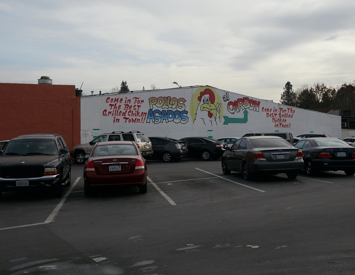
Apparently, they have the best grilled chicken in town…
Garfield School is within North Fair Oaks, but here we find ourselves getting close to the Atherton border, and the end of the journey. After turning left in front the school, I next found myself in front of St. Anthony’s Church. Only a few steps more brought me to the fabled spot “where the sidewalk ends”:

This, then, is the end of the journey. Up ahead is Atherton, and its dearth of sidewalks (you experience almost exactly the same thing when you reach the Atherton border while walking down El Camino Real). All I could do was turn around and head back home, although I didn’t retrace my steps. Instead, I followed Semicircular Rd. to Fifth Ave. to El Camino Real, which I then followed back to Redwood City.
Hopefully you’ve enjoyed this lengthy stroll down Middlefield Rd., from its beginning to and through North Fair Oaks. Middlefield Rd. continues on, of course, and eventually peters out in Sunnyvale. I found it an interesting journey, however, one that shows some of the best of Redwood City. It also shows a good part of North Fair Oaks, although there is much more to that unincorporated part of San Mateo County than what is just found along Middlefield Rd. The rest, unfortunately, I’ll have to save for another post.

“This, then, is the end of the journey. Up ahead is Atherton, and its dearth of sidewalks”
Growing up in North Fair Oaks. I’ve always wondered why it is incredibly difficult to walk from Woodside Road to Seaport Boulevard and to Atherton due to the lack of sidewalks.
Good write up!
Hi. This may be a long shot, but do you happen to know where the North Fair Oaks Community Church was? It’s listed on the recipe book I found (from 1961) as being in Redwood City.
I do not know. Likely it was actually in North Fair Oaks, which is an unincorporated part of San Mateo County. The US Postal Service calls some or all of North Fair Oaks “Redwood City”, but that is just for their own convenience, I believe. The Postal Service does the same for other nearby unincorporated areas, such as Emerald Lake Hills; the folks that live there also have Redwood City addresses even though they are not within the city limits and are not governed by Redwood City.
Great post Greg. Also really looking forward to the completion of the streetscaping project along Middlefield between downtown and Hwy 84. Will be fantastic for pedestrians.
I also have found it odd that there seem to be no sidewalks in Atherton. Not suggesting that sidewalks be installed on the residential streets in Atherton, but on the highly trafficked corridors which connect other towns on the Peninsula to each other, there should be sidewalks in my view. Likely something that would have to be taken up with Atherton City Council. I think it would make a lot sense to have more pedestrian/bike friendly passage on El Camino between Redwood City and Menlo Park which is finally coming into its own in terms of transit oriented development/communities.
Another beautiful mural is at the corner of Fair Oaks and Hampshire which I biked by recently. Would have never thought to look there, but there it was.
Don’t forget Martin’s Restaurant at 3143 Middlefield. Great food, takeout or dine in. Makes one of the best Cuban Sandwiches!
That’s a new one on me. Thanks for the tip!
Fly into the San Jose airport when I am in the Bay Area. If I have a rental car, every now and then, get off the 101 in Mountain View and take Middlefield Road into Redwood City. Recognize different things everytime I do this and always a good minnie adventure.
In ’71 the city was awarded an environmental justice grant to address the barrier for pedestrians to cross Woodside Road. I need help (1) understanding this document: http://www.redwoodcity.org/Home/ShowDocument?id=1452 and (2) whether the recommendations, from Fehr & Peers, make sense to you, to city staff & council, to the North Fair Oaks Community Council and to the county and whether they have been adopted or will be. When you get a chance!
Greg, I enjoyed your walk down Middlefield. We’ve been watching the progress and are pleased with what they’ve done. If only we could have underground utilities throughout the City. Sigh! I want to send you a rendering of what the corner of Middlefield and Marshall will look like once the San Mateo County Historical Association’s carriage house is built. I’ll try to attach it here but if you can’t open the attachment, email me and I’ll send it to you. Also, wouldn’t it be wonderful if we still had a Redevelopment Agency that could provide funds to the businesses between Costco and 5th Avenue to refurbish their store fronts?
/Users/dee/Desktop/image010.png
Being born in RWC, this was interesting to read. In fact I was born in a maternity hospital on Middlefield. Last I researched it I found it to be there as a private residence.
Interesting! Certainly the new(ish) health center looks great; presumably that is the place to have a baby these days…
My Uncle was born in a private residence/doctor’s office, just west of Middlefield Road, north of HWY84. When I was a kid, could locate this house. Now cannot find it. He was born in 1927. Do you have an address for this house? Thank you for this posting.
Thanks for this post — it’s one of my favorite north-south streets. I’m really pleased with the PG&E undergrounding project, the wider sidewalks and, I presume, the bike lane striping that’s to come. Thanks again! I look forward to your next post about North Fair Oaks! And we do like the barbecue chicken rice and beans from that Michoacan grocery across from the Garfield School — and the dark espresso blend beans from Connoisseur Coffee!
I really enjoy walking on those new sidewalks. A couple of weeks ago I passed by some guys who were installing those terrific new street lamps and I stopped and thanked them for all their good work. They were really pleased; I’m not sure they get a lot of compliments.
I’m interested to see how the county’s project to do something similar on their part of Middlefield road goes. Things will be a bit hard for the merchants during construction, but it should really improve both the look and the functionality of the street, which will hopefully help those merchants in the long term.
I think the answer for Middlefield is that Winslow didn’t always connect to it, so Middlefield just curved through there. When they were connected, it was probably straightened out to get something approximating a normal 90 degree intersection.
Sounds likely. I still plan to look at the maps someday and see if that’s correct. Then I can write yet another post about it…!
I did some digging on historicaerials.com and…
1948: Winslow kind of dead-ends at the tracks or maybe runs into Pennsylvania, if that ever existed on that side of things – whatever it is, it’s skinny and is right up against the tracks. Hamilton is interrupted by the creek (!) which hadn’t been buried yet, but has some kind of relatively narrow connection eastbound to today’s Middlefield. Middlefield just curves around what is today’s Arya Steakhouse.
1956: Looks about the same. Harder to tell – poorer image quality.
1958: Same connections, but the creek is gone there, replaced by a giant parking lot. Same for 1960, and 1968 (poor image quality).
1980: Winslow now has a sweeping curve that picks up the bottom of Hamilton and then continues straight-on into Middlefield. This winds up creating that little extra triangle of land in the northwest part of the intersection.
Everything after that is about the same as now in terms of streets. Obviously much changes with parking lots turning into buildings and so on.
Hope this helps! Love the writing. Please keep it up.
Once again, Totally friggin’ awesome!
Thanks!
My understanding concerning the streets running a bit strange was the creeks that were here the roads had to go where the solid ground was.
That makes sense as far as where the roads actually go, but doesn’t necessarily explain why Middlefield suddenly becomes Winslow.
Great post!
Regarding downtown, I don’t think building giant parking structures is a great use of land but oh well. You made me appreciate some of the stuff further down the street though.
I used to live in Los Angeles and there are all kinds of weird streets that curve in weird ways (National Blvd near culver city) or even disappear and then re-appear miles away (San Vicente Blvd). It is super confusing but also one of those things that makes you feel like a local if you know how it works 😉
Thanks. FYI, I grew up in that very part of Los Angeles. I know those streets well (especially San Vicente).