
This week, I bring you an overview of Redwood City’s Farm Hill neighborhood. Redwood City has seventeen neighborhood associations, and I’m slowly working my way through each one, for each writing a post in which I attempt to capture that neighborhood’s essential character. This post is number fifteen out of seventeen; to see the others, go here.
I often begin these posts with a verbal description of the neighborhood’s extent. But the boundaries of the Farm Hill neighborhood almost defy description. Thus, I’ll simply begin with a map of the neighborhood, taken from the neighborhood association’s web page:
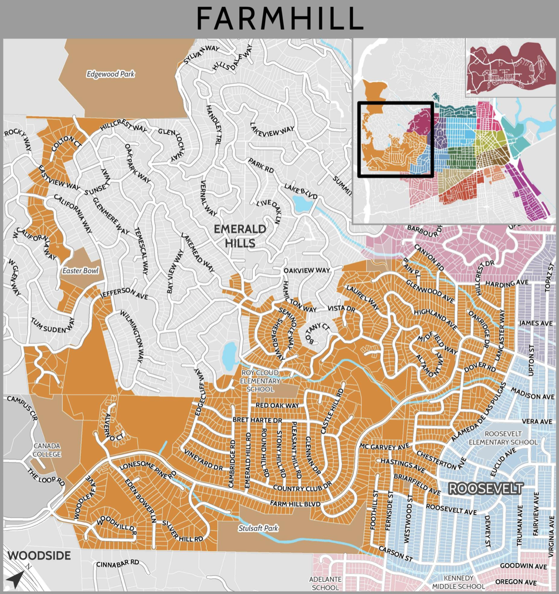
As you can see, the neighborhood’s shape is an odd one. If you look closely you’ll see that most of the neighborhood’s borders don’t even follow roads. Much of the eastern edge follows Alameda de las Pulgas, but as for the rest, well, just look at it! Even the neighborhood’s shape cannot be easily described, unlike some of the others which can be described as roughly square, rectangular, or triangular. I should note that the above map shows the neighborhood’s name as “Farmhill” but it is indeed two words, “Farm Hill.” Farm Hill Boulevard slices through the neighborhood and echoes a good part of its shape: that likely is where the neighborhood’s name came from.
The Farm Hill neighborhood is almost entirely residential, although it contains a couple of important parks, one public elementary school, and even a small chunk of Canãda College. It also has what appears to be one of the more active neighborhood associations, with bi-monthly meetings held at the large Peninsula Covenant Church (which lies within the neighborhood); see the association’s web page for more information.
In area the Farm Hill neighborhood is probably the second largest among the seventeen. I haven’t tried to measure them, but from the larger map showing all of Redwood City’s seventeen neighborhoods, it appears that Redwood Shores is the largest, followed by Farm Hill.
The Farm Hill neighborhood is the city’s most westerly, and lies along the city’s border with Woodside. The neighborhood also touches on quite a few other Redwood City neighborhoods: Canyon, Eagle Hill, Roosevelt, and Woodside Plaza. It also, as you can see, borders Emerald Hills, which is not part of Redwood City but instead is an unincorporated part of San Mateo County.
From the name of the neighborhood you might get the impression that this neighborhood has, or is in, the hills, and you would be correct. The Farm Hill neighborhood is located entirely in the hills on the western edge of the city, and encompasses the city’s highest point: the knoll upon which the Easter Cross sits.
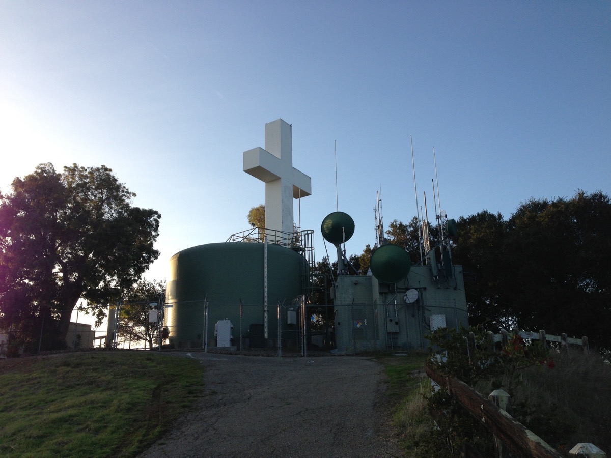
The Easter Cross and the Easter Bowl (a large natural amphitheater just below the cross, now largely overgrown) was once where numerous Easter morning sunrise services were held. The tiny parcel (just 891 square feet) upon which the cross sits is private property, but nearby, on city-owned land, are a number of cell towers and a water tank (there is a second, larger tank just below the one you see in the photograph, down closer to California Way). These tanks may account for the neighborhood’s somewhat strange shape: there are several water tanks scattered throughout the neighborhood, all serving as a critical part of the water delivery system throughout the city, and the city may have extended itself to encompass the land needed for those tanks. By placing them in the hills, well above most of the homes and businesses that they serve, gravity can be used to help provide a reliable source of water pressure. Filled during low-use periods from the Hetch Hetchy system, these tanks provide water for daily use but can also serve as a short-term water source in the case of an emergency. (Curious about where Redwood City’s other water tanks are located? See my post from 2015, Tanks a Lot.)
The Farm Hill neighborhood is in the process of getting yet another water tank, this one off the intersection of California Way and Tum Suden Way. Crews are in the early stages of the project, preparing the ground for the installation of a new 750,000 gallon tank along with the associated pipes and pumps.
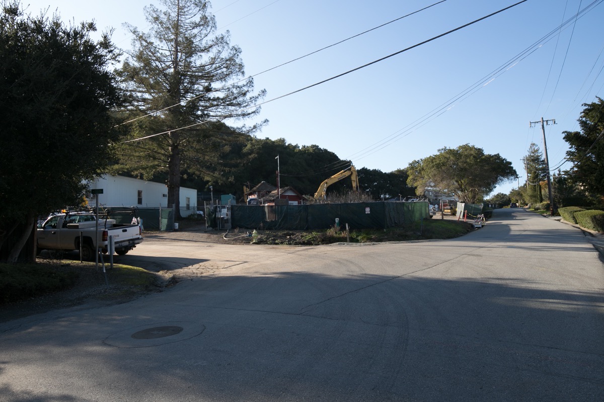
The above picture was taken roughly from the intersection of Jefferson Avenue and California Way. The road where the white pickup truck is parked is Tum Suden Way — which, incidentally, is a gravel road; something of a rarity within Redwood City’s borders. The green-covered hill above the construction site is where the Easter Bowl is located, and the cross is at the top of that hill, beyond the range of this picture. The Easter Bowl property is currently owned by the City of Redwood City, and is ostensibly managed by the Parks and Rec Department. However, other than a few signs and a path it is completely wild. That path is steep: it runs from the bottom to the top, just below where the Easter Cross stands. Although I didn’t walk up it this week, I’ve been on it before and I assume it is still traversable.
Before I leave this part of the neighborhood I should mention that this being the highest point within the city, the views from up there are incredible. Here is a picture I took a few years ago, taken from the closest I could get to the cross itself:

It is certainly well worth the trip.
As you can see from the neighborhood map, the Easter Bowl and Cross are located near to, but not at the top of, the neighborhood. The top of the neighborhood (its westernmost point, in fact) encompasses a large chunk of Edgewood Park. Curiously, not all of that park lies within Redwood City. About half is within the city limits, and about half — mostly, the half closest to Highway 280 — is on county land. As well, the park entrance off Edgewood Road along with the parking area, along with the Bill and Jean Lane Education Center, are just outside the city limits. But once you leave your car and being hiking, you quickly find yourself invisibly crossing into Redwood City.
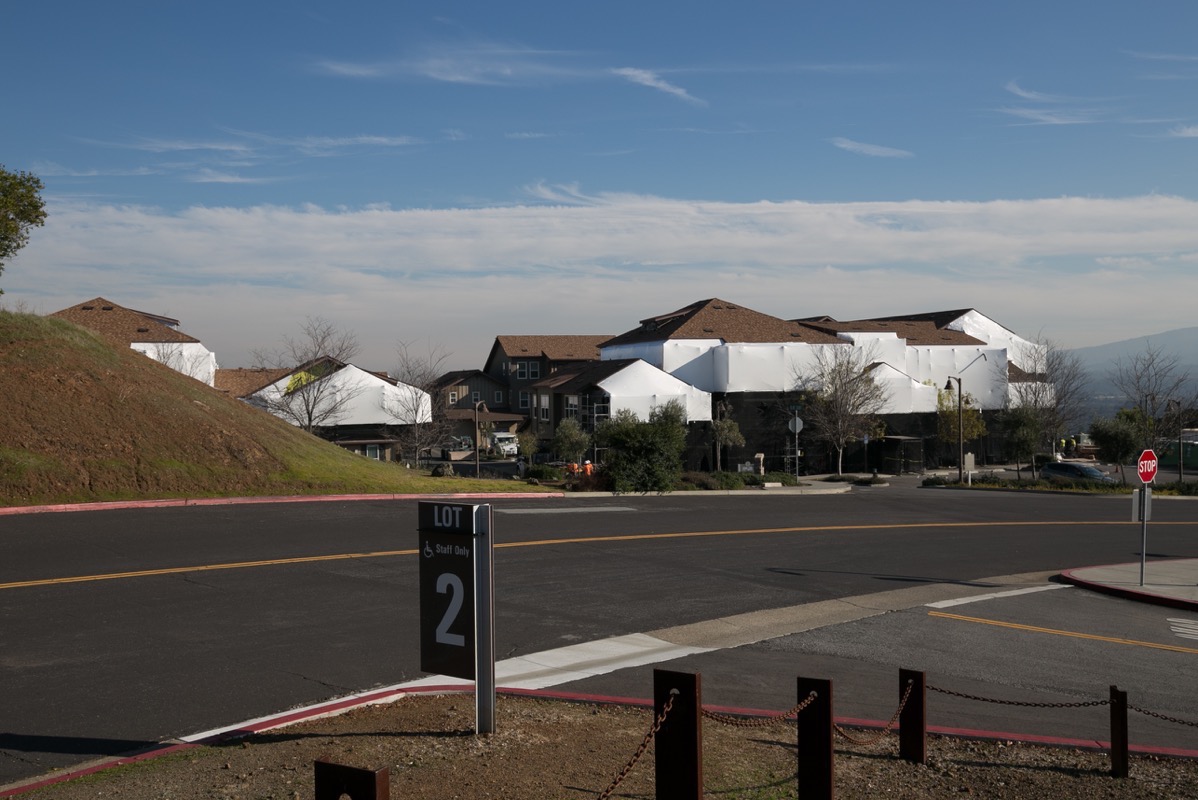
Moving down to the southern end of the neighborhood (in the lower left corner of the neighborhood map) you can see that a small chunk of Canãda College lies within the city limits, within the Farm Hill neighborhood. The bulk of the college is actually located within the city of Woodside, but one parking lot, the tennis courts, and the relatively new (it opened in August of 2010) 60-unit Canãda Vista apartment complex, which is fairly affordable and reserved exclusively for San Mateo Community College District faculty and staff, is on Redwood City land. That housing project is currently undergoing some sort of refurbishment, incidentally. It was slated to receive a new roof back in 2017, but either that project is taking a lot longer than planned, or something else is going on. Here is a current photo of the development, showing the extent of the current activity (which looks like a lot more than just a new set of roofs):
There is a lot more construction going on at Canãda College right now, but given that the rest of the campus lies outside the Farm Hill neighborhood, I’ll save that for another time.
Heading down Farm Hill Boulevard, you come to the excellent, and mostly wild, Stulsaft Park:
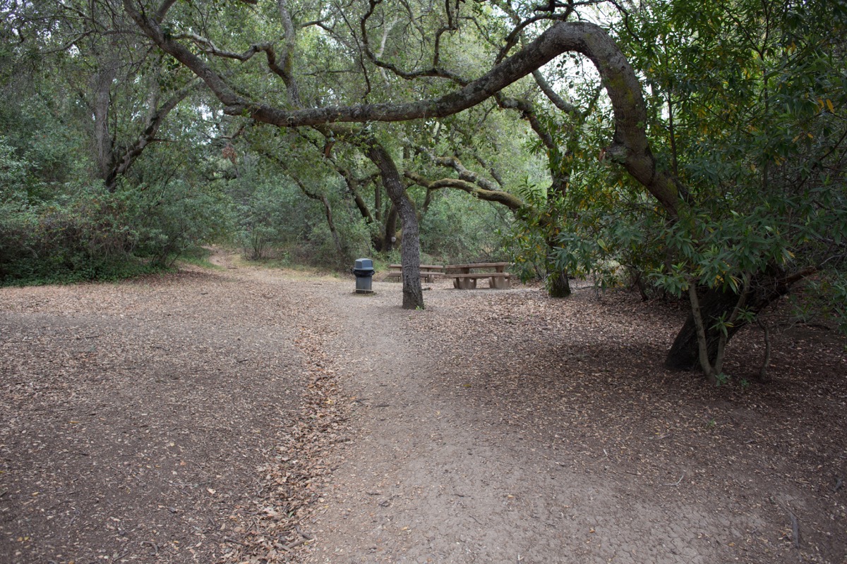
This is an excellent place to walk, especially if you like to get back to nature. There is a formal playground and “tot lot” at the park’s main entrance off Farm Hill Boulevard, along with restrooms and picnic tables. Head beyond the playground, however, and you quickly get into the wilder portion of this 42-acre park. Paths through this part of the park eventually lead you to two other park exits in the Farm Hill neighborhood (one on Silver Hills Rd., at the southwestern end of the park, and one on Parkdale Way, at the northeastern end of the park) and one into the Woodside Plaza neighborhood.
Running through the length of the park is one of the three waterways that traverse the Farm Hill neighborhood. All eventually feed into Redwood Creek and thus flow out to the bay, but this, the largest of the three waterways, is the only one with a proper name: Arroyo Ojo de Agua. (The other two waterways are the Jefferson Branch of Redwood Creek, which begins at Upper Emerald Lake, and the Emerald Branch of Redwood Creek, which originates at Lower Emerald Lake.) I spent some time tracing this particular waterway, from its origins up in Emerald Hills through a nice-sized canyon just off Farm Hill Boulevard, through the residential area to the south and east of Farm Hill Boulevard, and finally to and through Stulsaft Park. Here is a picture of the creek just before it crosses Farm Hill Boulevard:
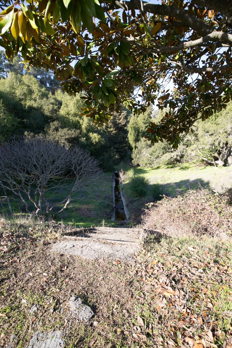
You’ll find this on the north side of Farm Hill Boulevard, in middle of the large undeveloped section across (and a bit further up) from Lonesome Pine Road. At the top of that canyon, incidentally, is the large property most people know as the Mount Alverno Convent — but since 2003 or so has been a Shinnyo-en USA Buddhist Temple. That it is where that tall tower you can easily see from a large part of the surrounding area is located:
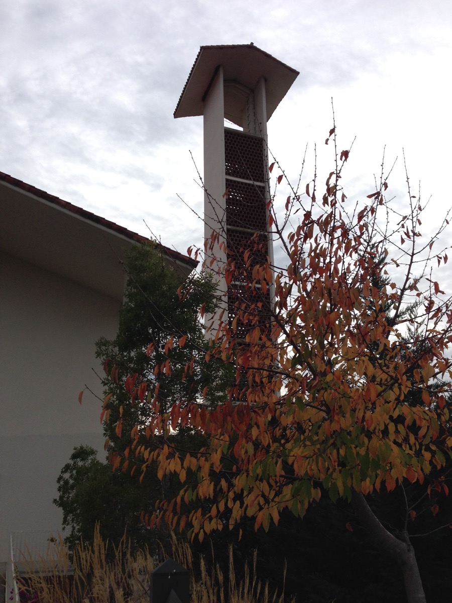
As best as I can tell, the public is welcome to walk through the temple grounds. As you might imagine, it is a very peaceful place to walk…
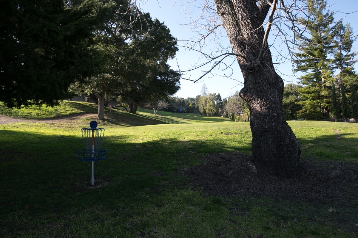
Very close by the temple is another unique feature of the Farm Hills neighborhood, the Elk’s Lodge and Golf Course. Entrance to the lodge buildings and the nine-hole golf course — which is open to the public — are off Wilmington Way. I’ve played this Emerald Hills Golf Course many times, and although it is an enjoyable place to play, be aware that its location in the hills means that many of your shots are going to be heading up or down some rather steep hills, making for some rather interesting challenges. Indeed, this course bills itself as the “toughest 9 hole course in Northern California.” Then again, it claims that “hole 6 has the most Holes-in-One in Northern California,” (I’ve never gotten a hole-in-one, although I have recorded two strokes on this hole) so it might also be a good way to boost your ego!
Unlike Stulsaft and Edgewood parks, the Emerald Hills Golf Course, although open to the public, is on private land. But the Farm Hill neighborhood has other parks (they may have the most of any Redwood City neighborhood, come to think of it). A large portion of Garrett Park also lies within the Farm Hill neighborhood, off Glenwood Avenue. The Emerald Branch of Redwood Creek flows through Garrett Park, although the portion of the park where it flows is in the Canyon neighborhood. However, after crossing a couple of private parcels it passes under Bain Place and enters the Farm Hill neighborhood (see the neighborhood map for the route it takes).
It wasn’t until I started researching the Farm Hill neighborhood that I became aware of the existence of the cute little Westwood Park. I wasn’t sure how I could have missed this one, until I actually paid it a visit. I’ve walked through the area a handful of times, and have walked within a block of the park, but unless you were specifically aiming for it, it is very easy to miss. This little quarter-acre park is located at the corner of Westwood Street and Briarfield Avenue, neither of which is a major street. For orientation, though, it is only two short blocks from the intersection of Alameda de las Pulgas and Roosevelt Avenue. The park consists entirely of a playground (with an enclosed “tot lot”) and a partially sloped grass area, along with a picnic bench or two. It has no restrooms, no BBQs, and no sports fields.
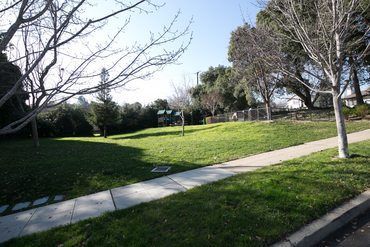
It does have one little “secret” that I’m sure the kids love: look carefully at the line of tall bushes along the back of the park, towards the left side of the above picture. There is a hole in those bushes just large enough for a person to walk through. Pass through it, and you find yourself here:
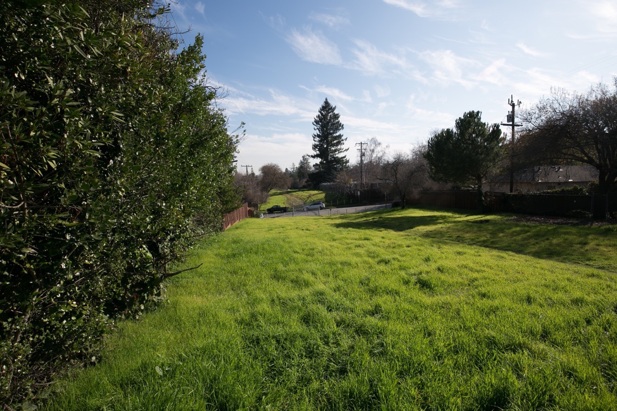
This is the Hetch Hetchy right-of-way, beneath which the pipes that supply water to San Francisco and much of the peninsula (including Redwood City) run. These huge pipes bring our water all the way from the Hetch Hetchy valley, in the northwestern park of Yosemite National Park; their path cuts a wide swath through Redwood City. Much of their path is fenced and off-limits to we citizens, but for some reason this section is open to the public. The hole through the bushes that connects the park to the right-of-way appears to be an official one, although the way the bushes have grown into the opening makes it feel a bit like a secret passage to a hidden place. I’m sure the kids love it; I know I would have, when I was younger.
I mentioned that the Farm Hill neighborhood has one public school: Roy Cloud Elementary School. Roy Cloud is a highly regarded part of the Redwood City School District, serving students in grades K-8. The school’s main entrance can be found on Red Oak Way, although the school can also be accessed from Jefferson Avenue, just down from Emerald Hill Road.
The Farm Hill neighborhood is also home to Peninsula Covenant Church, or as it is better known, “PCC.” PCC has a church, of course, and a preschool. It is also home to what they’ve dubbed the Peninsula Community Center, a membership-based center for tennis, swimming, fitness, and a variety of youth activities. Many Redwood City residents are members of the Community Center, and use its facilities to stay in shape.
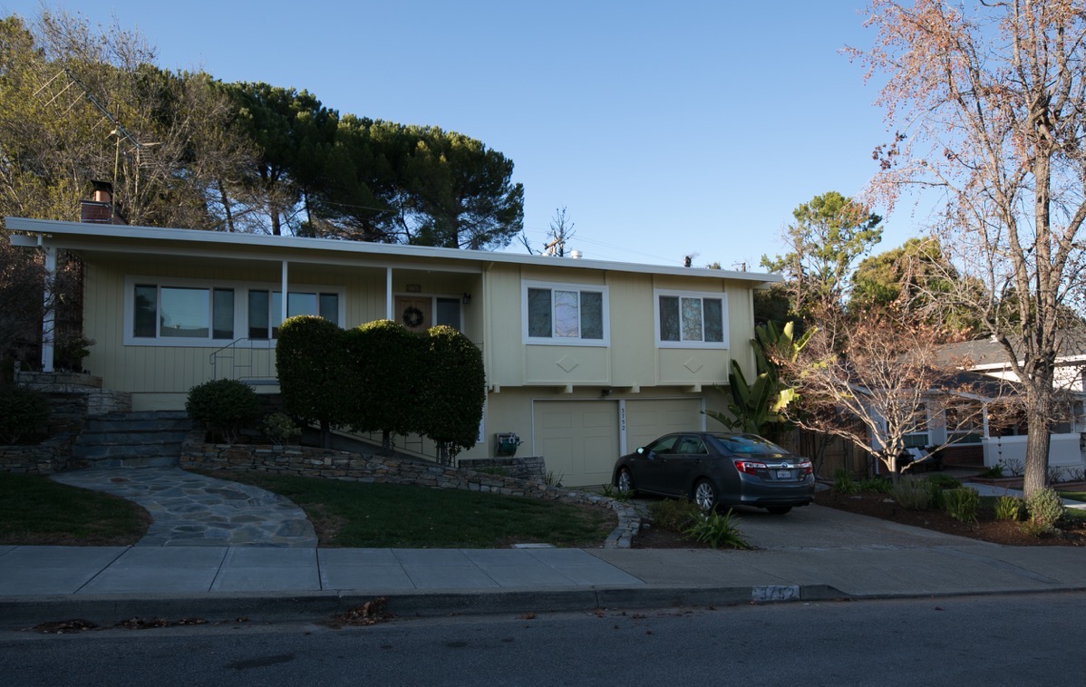
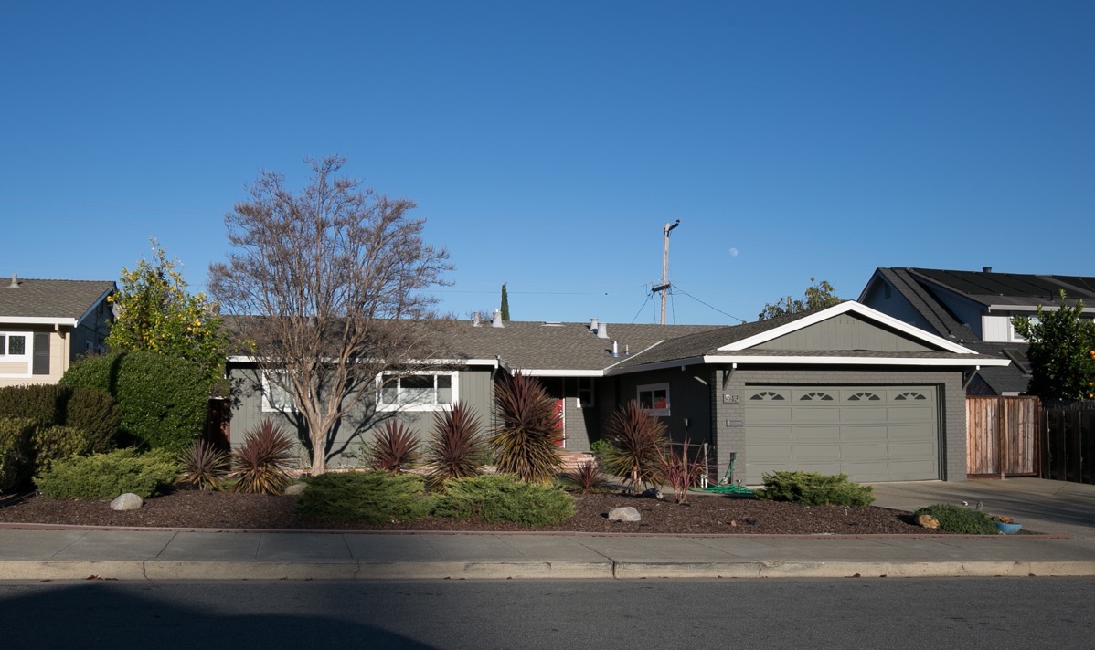
I’ve talked about nearly all of the aspects of the Farm Hill neighborhood; all except what makes up the lion’s share of the neighborhood, which are its residences. The Farm Hill neighborhood is filled primarily with single-family homes, although it contains a number of multi-family developments as well (apartments and condominiums). The homes all appear to be of a similar age, indicating that this part of Redwood City was largely developed within a tight timeframe. Because much of the neighborhood is draped along the hills on the western edge of Redwood City, you find numerous homes that accommodate the sloping land, such as this one:
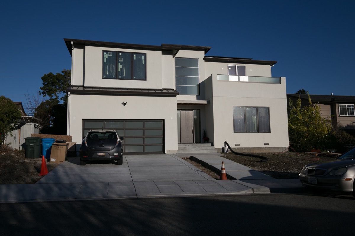
This wouldn’t be part of Redwood City without a fair number of remodels and new home builds, however, and there certainly are those:
Size-wise the houses seem to fall within a relatively narrow range. Although surely there are a couple, none of the houses I saw were particularly small, and none seemed excessively large. Here, for instance, is one of the smaller ones I saw — and it probably isn’t all that small:
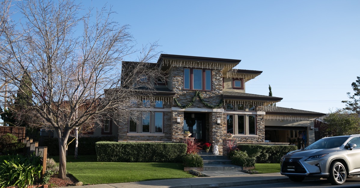
And here is one of the larger ones. A nice house, to be sure, but not what I’d call an estate:
I should note that there are some very large houses up by the Easter Cross, but when you do the research you discover that most of those are actually not in the Farm Hill neighborhood but instead are on unincorporated land. There is this nice-sized one, though, on Tum Suden Way very close to where that new water tank is being installed:
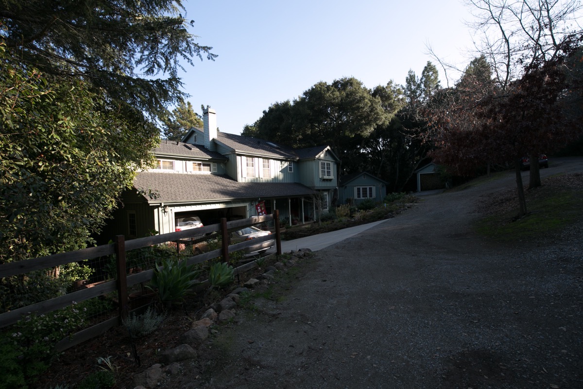
It does appear to be on city land.
So that’s the Farm Hill neighborhood. A great place to live if you enjoy hills (there are of course some wonderful views from many of the houses up there). Plenty of parks, and lots of wildlife. And a number of key elements to both the system that supplies water to our homes and businesses and to the system of natural waterways that made Redwood City what it is today. Walking in the Farm Hill neighborhood is not for the faint of heart: in many places the hills are steep, and to get to parts of it you have to walk through Emerald Hills, which, being unincorporated, has few to no sidewalks (the portions within the Farm Hills neighborhood — and thus the city — largely have sidewalks). Thus, you often have to carefully walk on the side of somewhat narrow streets with blind corners; be sure to be on constant alert for cars. The views are rewarding, though, and you get some great exercise walking up there. So do pay the neighborhood a visit: it is a unique but key part of the whole that makes up our Redwood City.

I grew up on Pleasant Hill Road. Farm Hills was a huge housing development that was created in the early 1950’s. We moved in in 1956 and the home was brand new as were almost all the houses surrounding us. We have photos of visiting the house as it was being built and many of the families that moved in at the same time as my family became quite close as most stayed in their original home for more than 20 years. Lots of kids in the neighborhood and many neighborhood gatherings and several life long friendships established. It was a great place to grow up. I stumbled upon this blog when I was looking to see if Mount Alverno still existed. Enjoyed your description of the old neighborhood very much. Thanks for posting.
I grew up on Hamilton Way. Loved the neighborhood in Emerald Hills. Thank you for bringing back great childhood memories.
There used to be an Entrance/Exit to Stulsaft Park on Brandy Rock Way. It was an alley that ran between two residences. It was absorbed like 30 years ago by a property owner I guess with the city’s blessing. They probably got tired of the noise and graffiti. So they removed it. There also used to be an ally one door up from 3738 Farmhill blvd that ran between Farm Hill and Country Club which was also removed. It gave good access to that neighbor hood but the city let it be absorbed into the adjacent property. Grew up and had no idea about some of the points of interest you have described. Takes me back…Such a shame all those houses are mostly $1,000,000 or more….
I remembered both of those alleys! Our 1st house was on brandy rock way and our 2nd house was on country club. Wow! I used these alleys all of the time when growing up!
Hi Tim, I was bummed when I heard about our alley, it was fun growing up next door to you guys.
Mark L.
In the 1920’s my Dad used to hike into these hills with his parents for picnics. Have just a couple of photo of this. Always wondered if logs over the creek in Stulstaf Park – Sleepy Hollow, were the inspiration for log dancing in Dirty Dancing……
Where are there logs over the creek in Stulsaft?
Probably from the pipes over the creek in several places!!
But I miss the bridge in the lower part of the park!
🙂
@Merrily, I know about the single steel sewer pipe that passes over the creek a few times … but it didn’t occur to me that anyone would confuse it with “logs” (plural).
As for the site of the missing bridge (just upstream of the stepping stones), I recall many months ago chatting up a RWC public works employee who was there to take measurements for a new bridge. Not sure what’s taking so long, but I expect we’ll see a new bridge installed one of these days …
@Adrian – tongue in cheek about “logs”!
Thanks for the info about bridge 🙂
You mention one reason for Emerald Hills having few to no sidewalks is because it is unincorporated. Do you know the history behind why it’s unincorporated, and what are the ramifications of that decision?
> Do you know the history behind why it’s unincorporated, and what are the ramifications of that decision?
I know some of the ramifications, but not entirely why it remains unincorporated (other than that is presumably the choice of the people who live there). I plan to do some research, though, and once I’ve finished the last two Neighborhood posts I’m going to do one on Emerald Hills as well; I’ll cover what I find out there.
Thanks for all the interesting info! I’d love to hear why a handful of the county islands exist around town. I live in the Selby tract and have always wondered why it didn’t get incorporated by one of the surrounding towns. Santa Clara county has a program that encourages unincorporated areas to become incorporated. This doesn’t appear to be the case with San Mateo county.
I’m curious about that, too, and will look into it.
I may be mistaken but I thought 2 of the entrances to Stulsaft Park were in Farm Hill ( off Farm Hill, the other on Foothill) 3rd entrance on Granger near Goodwin, which is in Woodside Plaza! You mentioned one into /from Roosevelt neighborhood, where is that one?
Thanks for weekly write-ups!! I always find them interesting!
No, you aren’t mistaken in that there are indeed two ways in and out of the park from the Farm Hill neighborhood; I neglected to mention the one off Silver Hill Rd. But I was mistaken, just barely, about the Roosevelt neighborhood one; I didn’t look quite closely enough at my map. It turns out that the Farm Hill neighborhood sneaks down on the northwestern side of the park as well, so that that entrance/exit — which is at the end of Parkdale Way, just off Foothill St. — lands is actually in the Farm hill neighborhood, only 1-1/2 blocks from the Roosevelt neighborhood. So, it turns out that three of the park entrances/exits are in Farm Hill, and only one is in Woodside Plaza. Thanks for keeping me honest!
Your welcome 😉
And I forgot to mention the Silver Hill one, also! We use that one when Kennedy students practice for the big treks to Yosemite and Grand Canyon!
Love reading all of your updates! Keep up the good reads!
Thanks again!