
Lately there has been a lot of talk about traffic issues. One can’t deny that traffic is particularly heavy these days, and that it is affecting the quality of life throughout the Bay Area. Take a drive down El Camino to, say, Palo Alto and it’ll quickly become clear that not only is the traffic bad here in Redwood City, it might be even worse in Menlo Park and in parts of Palo Alto.
Many people are looking to the city for answers, and there is some merit in this: the Council (or the Planning Commission or the Zoning Administrator, depending) has the power to approve projects that increase the number of people living and working in our city. But the issue of traffic is a complex one. For one thing, a lot of the housing and office development that has been approved over the last couple of years is close to transit, and thus the percentage of residents or employees in those buildings who commute via single-occupancy vehicles is lower than for those of us who live or work far from transit. For another, a lot of the traffic is likely attributable to an improved economy: when everyone is working, everyone has to get to work. And the high price of real estate is also partly to blame, given that so many more people who work here cannot afford to live here, and thus find themselves commuting from far, far away.
Regardless of the reason, our traffic problems are simply this: there are too many cars on too few streets. Adding more streets, or enlarging the ones we have, is unrealistic, so the only real solution is to reduce the number of cars. Some of us could work remotely and therefore eliminate the commute altogether, but most of those who can likely already are—meaning this is probably not an avenue worth exploring. Instead, the logical solution seems to be increasing the number of persons in each vehicle, thereby reducing the number of vehicles on the roads. Carpooling is one way to do this, of course, but from a mathematical standpoint transit is far better: a single bus or a train can transport far more people at one time than any car ever could. A typical city bus, for instance, can take roughly 40 passengers at one time—and the extra-long, articulated (“bendy”) buses can take something like 60 people each.

Transit is far from a perfect solution, but for many, many people it can work, and work well. What is really needed is a bit of an attitude adjustment: too many people reflexively get into their cars without considering the options and giving transit its proper due. Yes, taking transit usually takes longer (although given our heavy traffic, perhaps not so much longer), and you might have to—horrors!—walk to the transit stop. But time spent commuting on transit needn’t be wasted time, since you can use it to work or read, for instance. And considering the direct and indirect costs of operating a car, transit is likely to be cheaper—certainly it is more environmentally friendly.
Given the ridership numbers, Caltrain is seemingly making a strong case for its service, whereas SamTrans doesn’t appear to be doing nearly so well. But that simply means that SamTrans buses may not be as crowded as some commuter trains, which makes for a more comfortable ride. Depending on where you live and work, the bus might just be a great part (or the entirety) of your commute. Caltrain is easy to consider since it only travels on a single, easily comprehended path between San Francisco and San Jose (and with limited service, on to Gilroy). The SamTrans system, on the other hand, is far more complex. Take a peek at the system route map and see if you don’t get a bit overwhelmed. But look a bit closer and focus on the routes that serve Redwood City, and you’ll soon realize that maybe things aren’t quite as complex as they appear at first glance. Serving Redwood City there are some nineteen bus routes, most of which stick to (or parallel) major city streets. For simplicity, you can think of the system as traveling along the following:
- El Camino Real
- Middlefield Road
- Woodside Road
- Farm Hill/Jefferson
- Alameda de las Pulgas
- Edgewood Road/Whipple Avenue
- a loop along Veterans, Broadway, Bay, Marsh, and East Bayshore
- a loop around Redwood Shores that includes Redwood Shores Parkway and Marine Parkway
Some twelve of the SamTrans routes that service Redwood City go through the Redwood City Transit Center, making transfers between bus lines—and transfers to and from Caltrain—simple and easy. There are other transfer points, too, and exceptions and additions to the above list, but it should give you a basic idea of where the nearest buses are traveling to any point within Redwood City.

Probably the biggest problem with the bus, at least in Redwood City, is inherent to any transit system: the bus routes, and therefore the bus stops, aren’t always close to where you are or where you are going. For those of us who can and are willing to walk, or those who ride bikes—SamTrans buses have bike racks, enabling you to cycle to the bus stop, ride the bus to the stop nearest your destination, and then cycle to your ultimate destination—this isn’t much of an issue (although there is the time factor to consider: getting to the bus stop does add time to the total trip, as does the wait for the bus and the wait between buses if you need to transfer). For others, though, the proximity of stops to where you are and where you are going can of course be a deal-breaker.
I commuted for years on Caltrain, and still ride it on occasion, but for a variety of reasons it has been many, many years since I’ve been on a SamTrans bus. It recently occurred to me that perhaps I should correct that. Thus, I spent some time studying the system and taking a couple of rides, and I am happy to report that if the circumstances are right, a SamTrans bus can be a great way to get around. The buses I rode were clean, comfortable, not crowded (note that I didn’t ride during the prime commute hours), and reasonably quiet. And the price was reasonable, too.
As an experiment I decided to go from my house, which is in the vicinity of Sequoia Hospital, to our local Target store and back. I looked over the route map to get some idea of how I might go, but then followed SamTrans’ recommendation and used the handy trip planner on 511.org. I entered my home address and then used their handy “select from map” feature to specify the destination. (Tip: click in the To: field, then click and hold on the street near your destination on the map. Simply clicking won’t do the trick.) Then I clicked the Plan Trip button to get a list of options.
When I first did this, the choices I was given all involved me walking either to El Camino Real or to the Transit Center. Either way, I was being asked to walk nearly a mile before getting on a bus, which seemed a bit out of line. But I then discovered the “Route Options” button, which let me specify “Less Walking”. (Note that you need to specify your options before planning a route.) That presented me with a slightly shorter walk, this time to the corner of Jefferson Avenue and Topaz Street. It was still far, but unless I wanted to wait a while—in which case my walk would have been only one and a half blocks—that was my best option. I took the walk, caught the bus, and rode it to the Transit Center. There I transferred to a second bus that dropped me off right across El Camino from Target.
Although I would love to see electronic signage at each stop announcing when the next bus is coming, to their credit SamTrans at least lets you easily obtain that information via cellphone (and it doesn’t have to be a smart phone). Here is the sign that marks the bus stop at Jefferson & Topaz:

As you can see, it clearly indicates the route number (274) and the bus’s ultimate destination (“Redwood City Transit Center”). It also includes a unique ID number for the stop that you can use to find out when the next bus will arrive, either by entering the ID on the 511.org website or by dialing 511, saying the word “Departures,” and providing the stop ID number.
When the bus came I of course had to pay for my ride. Commuters will want to obtain a Clipper Card, which enables them to ride without needing to have cash (and which gets them a lower fare). In my case, though, cash was my only option. You don’t actually need exact change, but don’t expect to receive change from the driver: instead you will be given a “Change Card” that can be used on a future bus ride. Knowing this, I brought the exact amount. That worked, but especially here in Silicon Valley having to use cash seemed a bit of an anachronism. Hopefully SamTrans is working on an app that will let you buy your tickets on your smartphone.
Fares vary depending upon your age and other factors. For a healthy adult aged 19-64, the cash fare for a ride is generally about $2.25, and a day pass costs $5.50 (students, seniors, and the disabled pay less). After telling the driver I wanted a day pass, I put my cash into the fare box and received a paper pass that I swiped through a reader whenever I boarded a subsequent bus. I then took my seat.
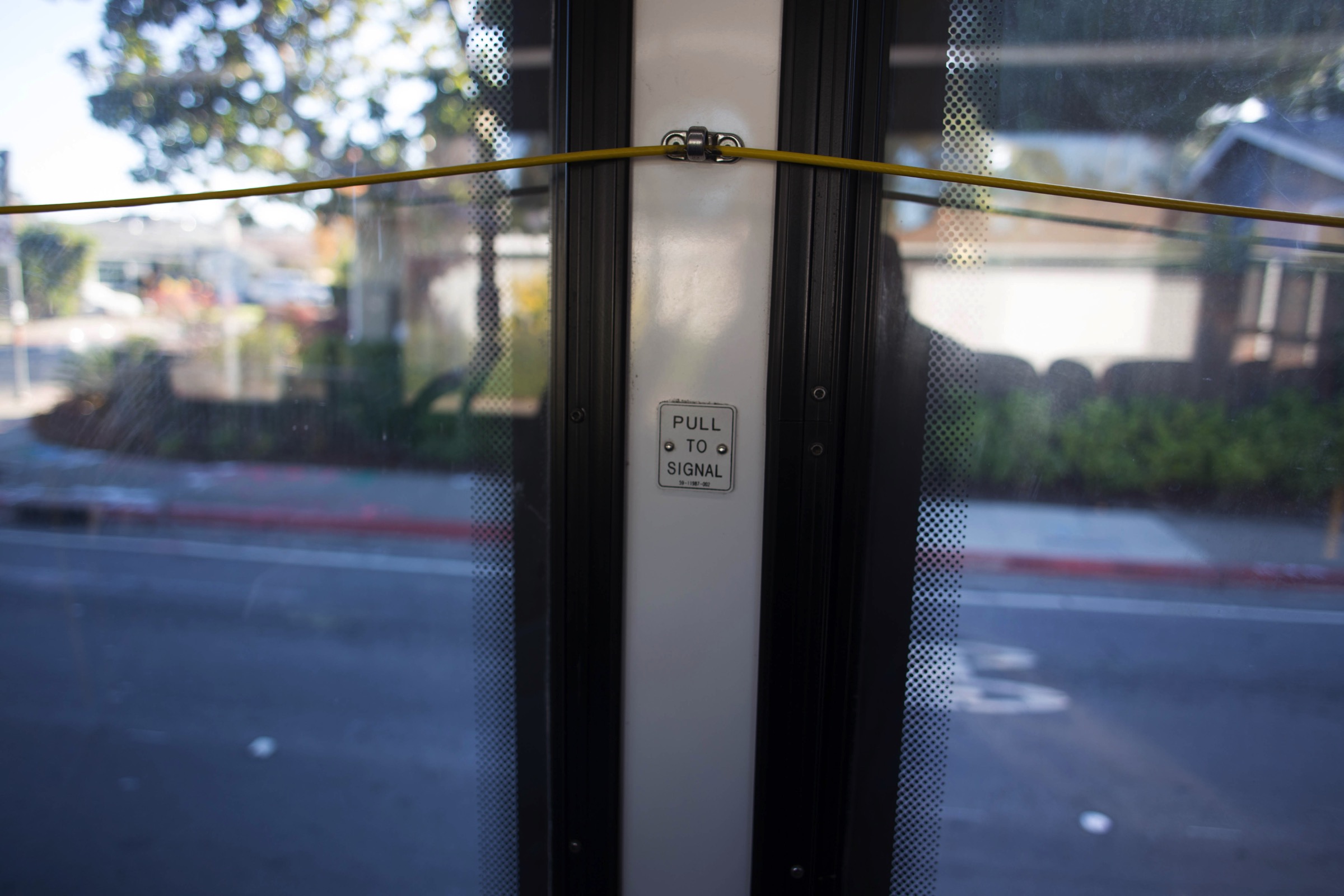
The bus stops aren’t equipped with electronic signs, but the buses themselves are: above the driver is one that indicates the next stop (there is also a voice announcement), and whether a stop has been requested. Request a stop by pulling the yellow cord or, if so equipped, pushing on the yellow tape running between the windows. Note that if someone has already requested a stop, pulling the cord has no effect.
Transfers are easy enough. I transferred at the Transit Center, and the only trick there is to look carefully at the signs—or pay attention to the 511.org instructions—to see which lane your next bus is going out of. Our Transit Center has three lanes, or “bays,” labeled “A,” “B,” and “C,” with “A” being the closest to the Caltrain tracks. Each route is permanently assigned to one of those lanes (and each lane services multiple routes). The 511.org trip planner indicates arriving and departing lanes, but you can just check the signs at each lane. Because each lane serves multiple routes, do be sure to pay attention to the electronic signs on the front, side, and rear of the bus you are boarding to make sure you aren’t getting on the wrong one.
Overall, I had a good experience on the bus—enough so that I anticipate that I’ll be using it more in the future. If I was still commuting to work on Caltrain I likely wouldn’t ride the bus to the train, but only because for me the walk is a comfortable one that saves me the bus fare. If I find myself needing to head out to Redwood Shores, however, or to Menlo Park, I’ll definitely consider taking the bus rather than driving myself. While the bus doesn’t work in every case, when it does SamTrans gets me to my destination without adding another car to the sea of vehicles on our overcrowded streets. And that makes me a small but active part of the solution to our traffic woes. Something that we should all consider doing.

Pingback: Comings and Goings | Walking Redwood City
SanTrans buses are just stupidly wasteful — huge and usually empty, even during school dropoff and pickup times. On the other hand, ever noticed how bad traffic is around 8-8:30 in the morning? That’s because Redwood City is a school of choice district, which means that rather than walking to their neighborhood schools, parents of public school children are driving all over town dropping off and picking up their kids. In a world without school buses (Greg, maybe you can write another blog addressing this issue some day), the transit system has not really stepped up to ease things. There are no convenient bus stops next to most schools. With a bit more thinking they could design bus routes that would actually provide a public service. What would it take to get sensible bus routes started so children can ride buses to school?
Interesting idea; I’ll add it to the list. I have fond memories of riding the big yellow school buses to school when I was a kid, but my own children never rode the bus (a combination of limited school bus service and the fact that my kids went to schools that were relatively close by). Thanks for the suggestion!
Where it becomes interesting is in “crossing the line.” I live in the County section of North Fair Oaks, and I work at Stanford. So, the 6-mike commute becomes a 2+ hour transit adventure, involving a couple of walks and busses. While it is not true to say “you can’t get there from here,” it is true in practice,
As a life-long pedestrian and user of public transportation, I certainly agree with you. It is my impression that public transportation planning in the Bay Area is done mostly by people who do not use public transportation and who see the issue as a local one instead of a regional one. After the Loma Prieta earthquake, I understand all the various transportation authorities got together to figure out how to deal with the collapse of a section of the Bay Bridge. To my knowledge, there has been no further comprehensive discussion of regional transportation issues. I am fortunate that in my 36 years on the Peninsula, I have been able to live in places where I have been able to make effective use of public transportation, but I have seen declines even in this area. A couple of examples: The VTA 22 bus used to end its route at the Menlo Park train station instead of the current termination at the Palo Alto station. This alone could have increased fares for Caltrain commuters, since Palo Alto and Menlo Park are in different Caltrain zones. Likewise, the Samtrans KX bus used to run from Page Mill and El Camino to the Transbay Terminal in San Francisco. There are other SF and SFO options, but very few of them take into account the possibility that a rider may have started in a county different from the destination county.
I, too, have noticed changes (mostly, it seems, contractions) in SamTrans’ bus service over the years. Changes certainly need to occur as demand shifts, but it doesn’t *appear* that changes over the last couple of years have been to reflect changing rider needs but instead seem (from an outside perspective, not based on a study of the system) to have been made for economic reasons. Making the system more economically viable is a laudable and indeed probably necessary goal, but I can’t help but wonder if there isn’t some way to survey people’s true needs and design a system that reflects those, rather than just making the system follow the largest and busiest streets the city, as SamTrans appears to be doing. Clearly I need to dig deeper and better understand how SamTrans chooses to route its buses. I’m willing to admit that they may know more about the subject than I do…!
Do you have any idea, as a Stanford employee, whether the new Marguerite shuttle service will connect the new Redwood City Stanford campus with the one in Palo Alto? I believe that they will be running shuttles between the new campus and the Redwood City Caltrain station, but if they also connected our campus with the main academic campus down in Palo Alto, that might provide some interesting new transit options for some. Especially since the Marguerite is, I believe, free and open to the public…
I’ve always judged the economy and how its doing by the traffic volume. Witness the difference between 2008 and now.
Just curious, what would your trip be like with 3 bags of groceries from Target ? or are you only thinking of “Work type Comute” and I don’t accept a cost savings if there is any, by using Safeway Delivery, Blue Apron, or So and So’s. Doesn’t seem that Bus travel has figured that out yet. Hope it has though.
Hauling three bags of groceries on and off a bus isn’t my idea of a good time, but I’ve seen people doing just that (often using those little collapsible carts) so some people make it work. I’m very fortunate that I don’t *have* to do that, but my experience on the bus has got me thinking about when it is practical for me to ride them, and when it is not. If I need to do a large grocery run I’ll still drive (I’m not big on the delivery services) but if I need to head out to Redwood Shores to investigate something for my blog, I will very likely give the bus a try, rather than drive or make the long journey on foot. Depending upon my needs I walk, drive, or ride the train…and now I’ll add SamTrans to the mix.
There are also free shuttle buses from the train station to various business locations and even a free shuttle that can take you Wunderlich and Edgewood Parks
https://www.commute.org/shuttles
http://parks.smcgov.org/ParkShuttle
Thanks for mentioning those. I was aware of them–I’ve seen the signs–but have yet to try them. Have you ridden either of these? Do they work well for you?
While I appreciate the tone and objective of your blog post I think SamTrans or a mini-bus as mentioned needs to make it a bit easier for people to get to and from around town. Things like taking only cash and routes that require a mile walk or a 30 minute pre-study of their routes will not inspire people over the long haul.
Keep in mind that mini-busses, shuttle busses, etc. aren’t really less expensive to operate because the majority of operational costs is labor.
@Sue: SamTrans does not only take cash. Like all Bay Area transit agencies, they also take (and prefer) the Clipper Card.
Commuters and heavy transit users can use a Clipper card, but for the casual user (me, these days) I, too, would love to see an option other than cash. The transit system up in Portland Oregon is the model I’d love to seem them adopt here: their system let you pay with your smartphone, simply by tapping a box on the streetcar much as you would when checking out in a grocery store. Alternatively you can buy a ticket using a smartphone app, or you can use cash to buy and old-fashioned paper ticket. And however you buy it your ticket is good on all of their buses, streetcars, and light rail trains, making transfers between them a no-brainer. Hopefully SamTrans is looking into this.
Pro-tip: monthly Caltrain passes valid for 2 more fare zones are also valid on SamTrans and VTA bus & light rail … so if you were like most Caltrain commuters, you’d use a monthly (both for the discount and convenience) … and so therefore would not be saving anything by not taking the bus since it’d be free. (Another benefit of Caltrain monthlies is that they’re valid on the entire Caltrain system on weekends and holidays … so even if they’re not valid for riding to SF or SJ on workdays, you’re good to go on weekends & holidays.)
That is a good tip–I hadn’t realized that (about the 2+ zone passes being good on SamTrans). I did know about the rest, since I was a holder of a multi-zone Caltrain monthly pass for many years, but perhaps there are some readers who have one who didn’t know about the extra perks. Thanks for pointing all of this out.
Note that on Samtrans buses this week, there is an announcement that sometime in January, there will be changes to 12 Samtrans routes. I haven’t had a chance to examine the changes yet.
The 12 SamTrans route mergers going into effect on Sunday, January 21, 2018, are summarized HEREL.
“SamTrans will merge 12 of its routes into six to simplify service. The mergers will mean fewer transfers for customers. Schedules for seven routes will also be adjusted to improve connections and meet [school] bell times.”
Thanks for pointing this out. Naturally I didn’t become aware of it until after I published the article…
“When I first did this, the choices I was given all involved me walking either to El Camino Real or to the Transit Center. Either way, I was being asked to walk nearly a mile before getting on a
bus…”
Bring back the mini-buses that covered RWC before Samtrans. Hope your article gets feedback..
It is indeed getting a lot of feedback. Thanks!