
This week I (not so) cleverly opted to take a long hike through the hills of San Carlos and beyond on what turned out to be the hottest day of the week. On Tuesday, when I was out hiking, my backyard weather station recorded a high of 95.2 degrees Fahrenheit — but I’m pretty sure that where I was it was even hotter. Thankfully, there was some shade throughout much of my journey, and I took frequent breaks. Plus, I’d had the rare foresight to bring along a container of water, which I very much needed on that day. Although the subsequent days turned out to be a few degrees cooler, the National Weather Service had predicted that Tuesday through Thursday would all be quite hot, so it wasn’t like I had a lot of choice (Monday, Labor Day, turned out to be fairly busy and so that wasn’t an option for me). In any case, I lived to tell the tale, so I’ll get to it, shall I?
Lately I’ve written a lot about ongoing development projects in various parts of the city, and thus I thought it was high time to do something completely different. I haven’t written about some of the local hiking opportunities for quite some time, so this week I opted to get back to nature and take a walk through three separate open space parks close to my home: Eaton Park, Big Canyon Park, and the Pulgas Ridge Open Space Preserve. Living where I do, close to the intersection of Whipple Avenue and Alameda de las Pulgas, I am extremely fortunate to have five such parks that I can hike through within walking distance of my home. Two (Eaton Park, and Big Canyon Park) are in San Carlos very close to the Redwood City border, one is fully in the county (Pulgas Ridge), one lies half in the county and half in Redwood City (Edgewood Park) and one lies entirely within Redwood City (Stulsaft Park). These parks are located such that it is fairly easy to mark out a path that goes to and through all five, and if the weather had been more conducive I probably would have done just that. But give the conditions this week, three was enough.
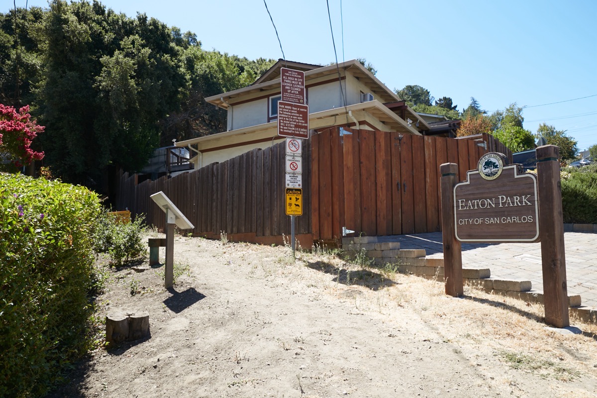
I began my walk by following Alameda de las Pulgas north to Eaton Avenue, which I then followed west to its very end. That is where one of Eaton Park’s four entrances is located:
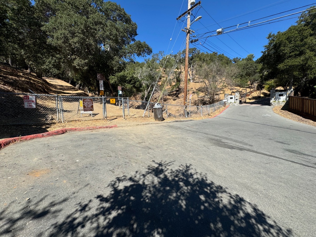
In the event you are inspired to follow in my footsteps, but want to drive to the park entrance, note that you can’t park directly in the cul-de-sac shown in the above photograph. You’ll need to park just prior to reaching the end of the street, where the curbs are not painted red. Also, pay attention to Eaton Avenue itself as you make your way up from Alameda de las Pulgas; the road comes to a “Y” at two points along the way, and you want to make sure you remain on the correct road. Bear left at the first “Y”, and then bear right here, at the second one:
Once you reach the park entrance, I highly recommend that you pick up one of the park brochure/trail maps that you’ll find there. These trail maps, which cover both Eaton Park and Big Canyon Park, can also be found online (here), but personally I find it far easier to study a paper map than to try and scroll around on a map on my phone. And note that you can drop your brochure back off at a kiosk when you exit the park, so unless you want to keep a copy, you aren’t even wasting paper when using one of these handy little brochures.
Unless you enter the park from the Loma Road entrance, which is already high in the hills, expect to gain some elevation as you hike through Eaton Canyon’s 66 acres of natural beauty. The park is honeycombed with trails, providing you with plenty of choices as to where to go. There are some good signs at most of the trail intersections, but they mostly just identify trails by name; unless you know the park’s trails intimately, you’ll really want to have a map of some sort to keep you from going in circles. Also, I should note that the trails in this park are well maintained, but they are relatively narrow, not paved, and in some places involve steps. So those with mobility issues may find this park’s trails to be something of a challenge.
I opted to begin by following the Vista Trail, which mostly hugs the eastern perimeter of the park while indeed providing some lovely vistas of the immediate Bay Area:
Expect to see some wildlife. I saw several hawks, and countless lizards. But you’ll likely see other birds and, perhaps, coyote, deer, bobcats, or rabbits. I didn’t see any of those on my hike, although I did see evidence of some, in the form of leavings on the trail.
From the Vista Trail I made my way to the top of “Hawk Hill” (elevation 528’), where I got some really lovely vistas:
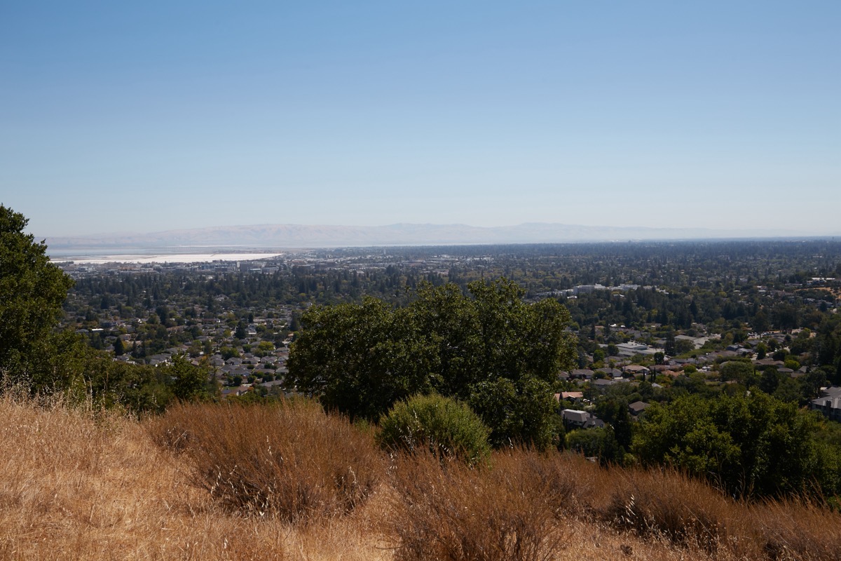
Looking to the northeast I even got a glimpse of downtown Oakland — although it was a bit hazy that day, so my view could have been better.
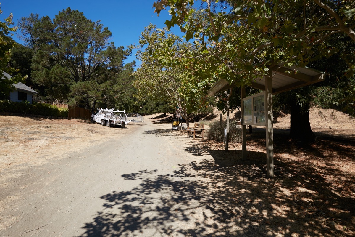
From the top of Hawk Hill I followed the Eaton Trail all the way to the west end of the park, which took me to Brittan Avenue directly across from the main entrance to Big Canyon Park. On the way I traveled through some lovely shaded areas:
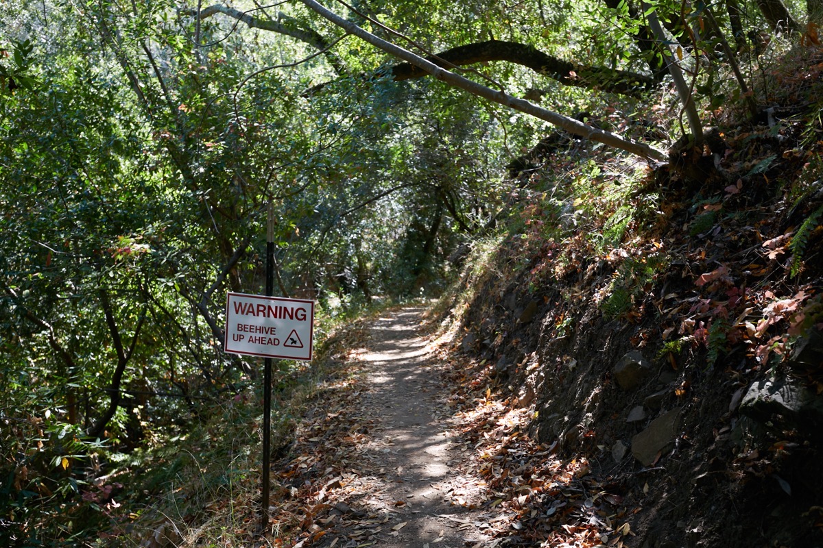
Note the sign warning of a “beehive up ahead.” Fortunately, this sign was on an adjacent trail, and not on the one I needed to follow to exit the park. But I’m really pleased that someone is keeping an eye out for hazards like these and warning park-goers about them.
I did encounter one section of the Eaton Trail that had apparently washed out at some point:
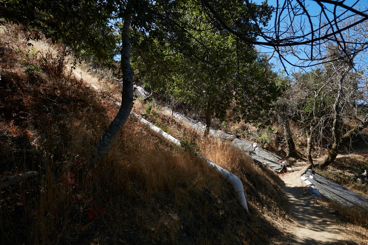
Again, I really appreciated the efforts that had been made to keep the damage from getting worse (both the plastic on the hillside and the large white pipe that had been installed to presumably divert rainwater around the damaged area). I also, of course, appreciated that the trail itself was still open for my use; I would have hated to have to backtrack at this point!
At the Brittan Avenue end of the Eaton Trail, you have to navigate a long (68 steps), steep stairway:
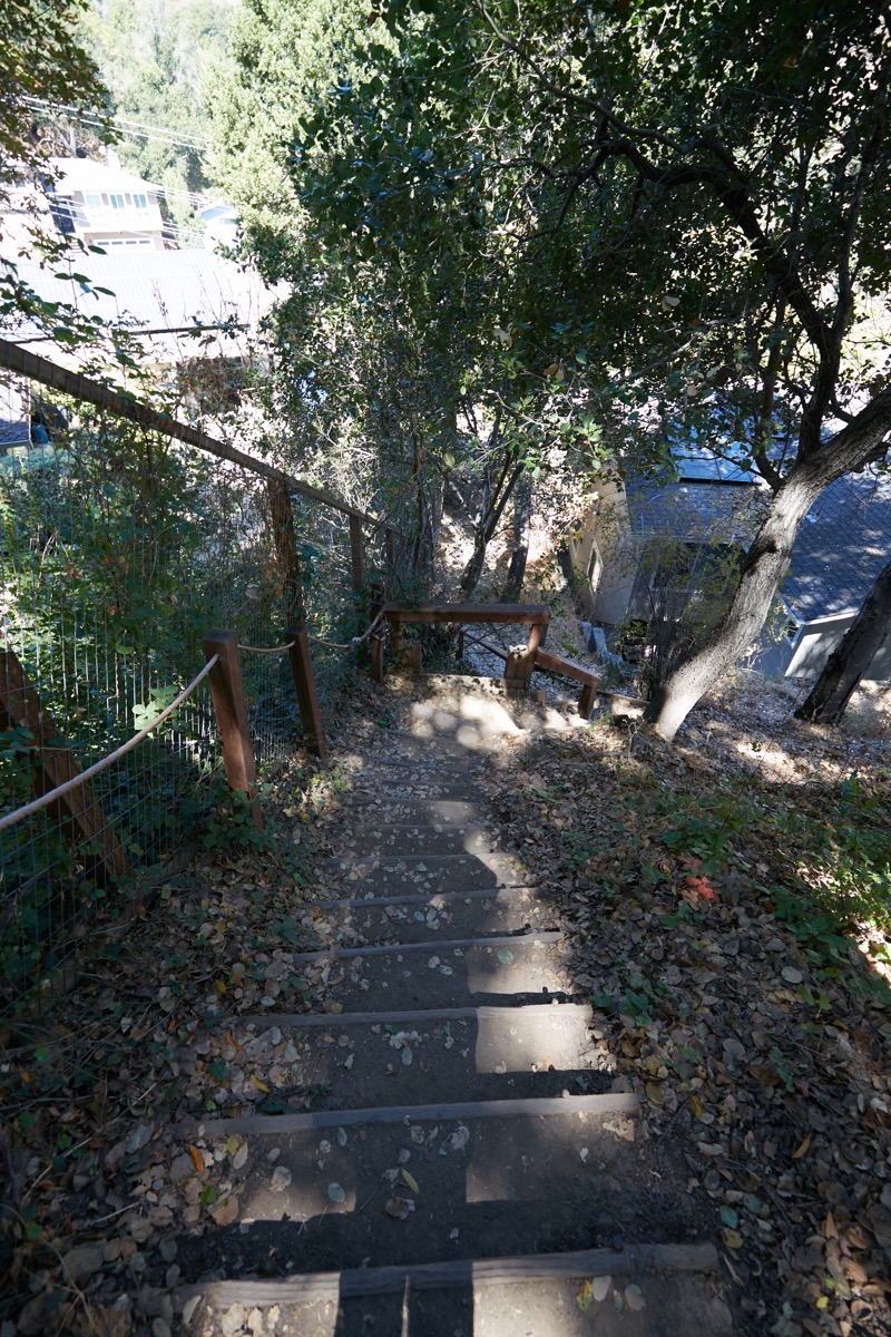
Thankfully there is a handrail, but it is made of rope and some of the posts are a bit wobbly. I did find it helpful in keeping my balance, but don’t plan on putting any serious weight on it.
At the bottom of the steps, you come out between two houses to find a nice park sign and a large mounted park map:
You can of course enter the park from this point, although you’ll immediately find yourself facing that long uphill staircase. I was exiting, though. I immediately crossed the street, where the main entrance to the 55-acre Big Canyon Park is located:
Here, too, you’ll find good signage, a kiosk with a large park map, and a box of paper maps. There is also a nice bench that I can personally attest to being a lovely place to rest up before heading up into the hills that make up San Carlos’ Big Canyon Park.
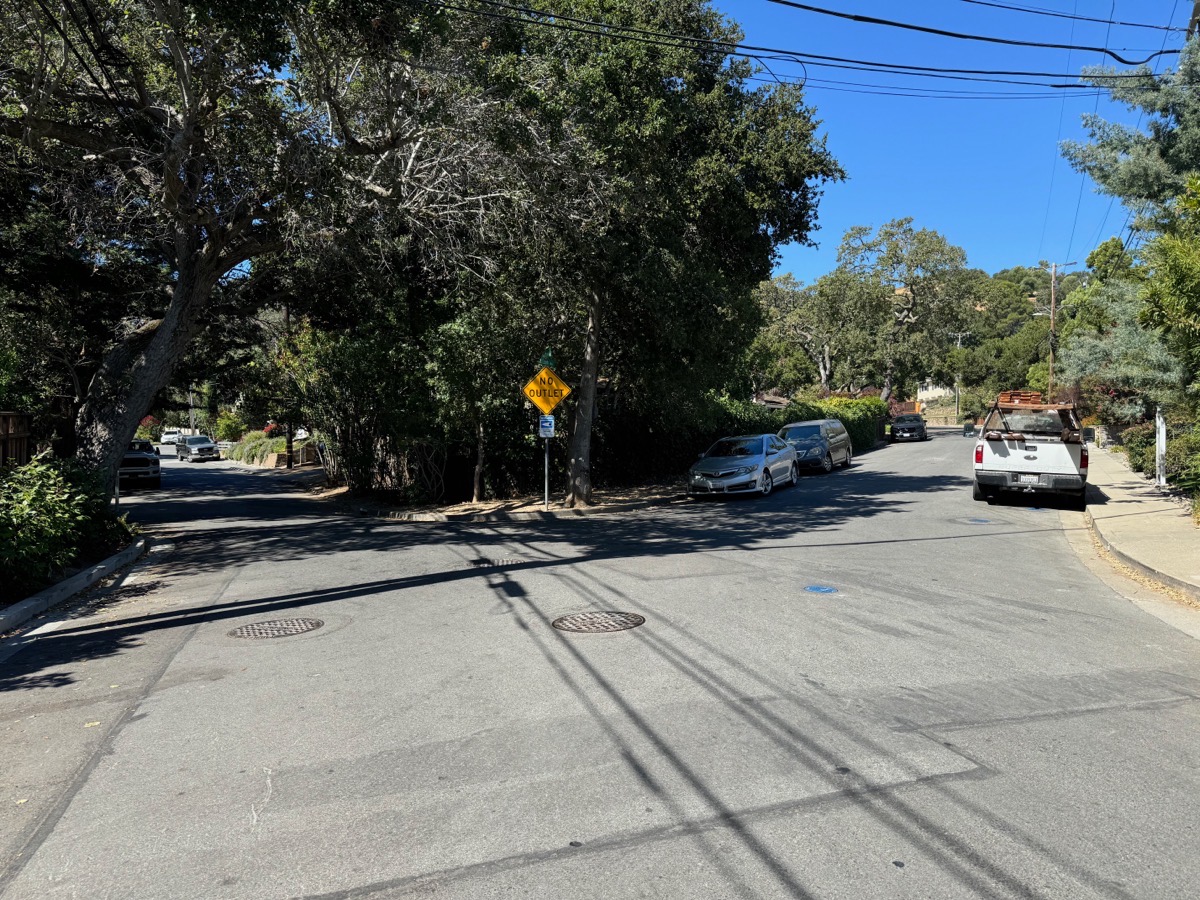
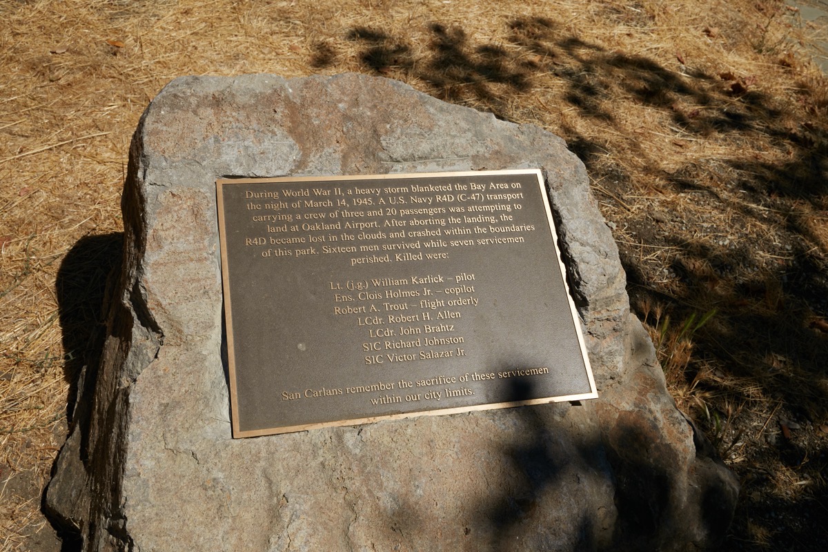
Almost immediately upon entering the park you have to choose whether you want to head towards the eastern side of the park — which eventually dead-ends (the trail just ends, and you have to retrace your steps) — or the western side, where you can come out onto Crestview Drive. I’ve walked the eastern side before, and wanted to connect to Pulgas Ridge via its entrance high up off of Crestview, so this week I headed west along the Harold Drake Trail. But not before pausing to read the plaque that commemorates the crash of a U.S. Navy transport plane in these hills during World War II. Seven servicemen were killed in that crash, while sixteen other men managed to survive. Although the remnants of the plane are long gone, I was later interested to learn that the crash occurred close to where I was headed: the plane apparently hit the hills within the (now) park boundaries, near to the park’s Tank Trail entrance.
The Tank Trail is a fairly short branch off the Harold Drake Trail (which itself is a loop); it is presumably named for the two large water tanks that the trail runs by:
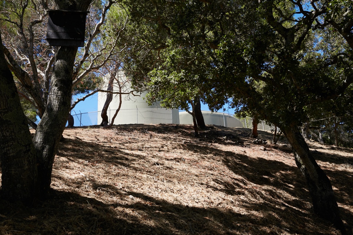
The trail ends at a short paved drive that provides vehicular access to those water tanks. That drive sits between two houses; look for a brown sign with the words “Big Canyon Park” on a post right at a crosswalk equipped with flashing beacons.
That crosswalk, incidentally, leads to the entrance to Crestview Park, which is a lovely neighborhood park that has both parking and restrooms. I found it a great place to take another break before making the long slog up Crestview Drive to its high point, which, naturally, is where you have to go in order to enter Pulgas Ridge from the top.
The entrance to Pulgas Ridge is not directly on Crestview Drive, but is only a short distance to the west down Los Vientos Way:

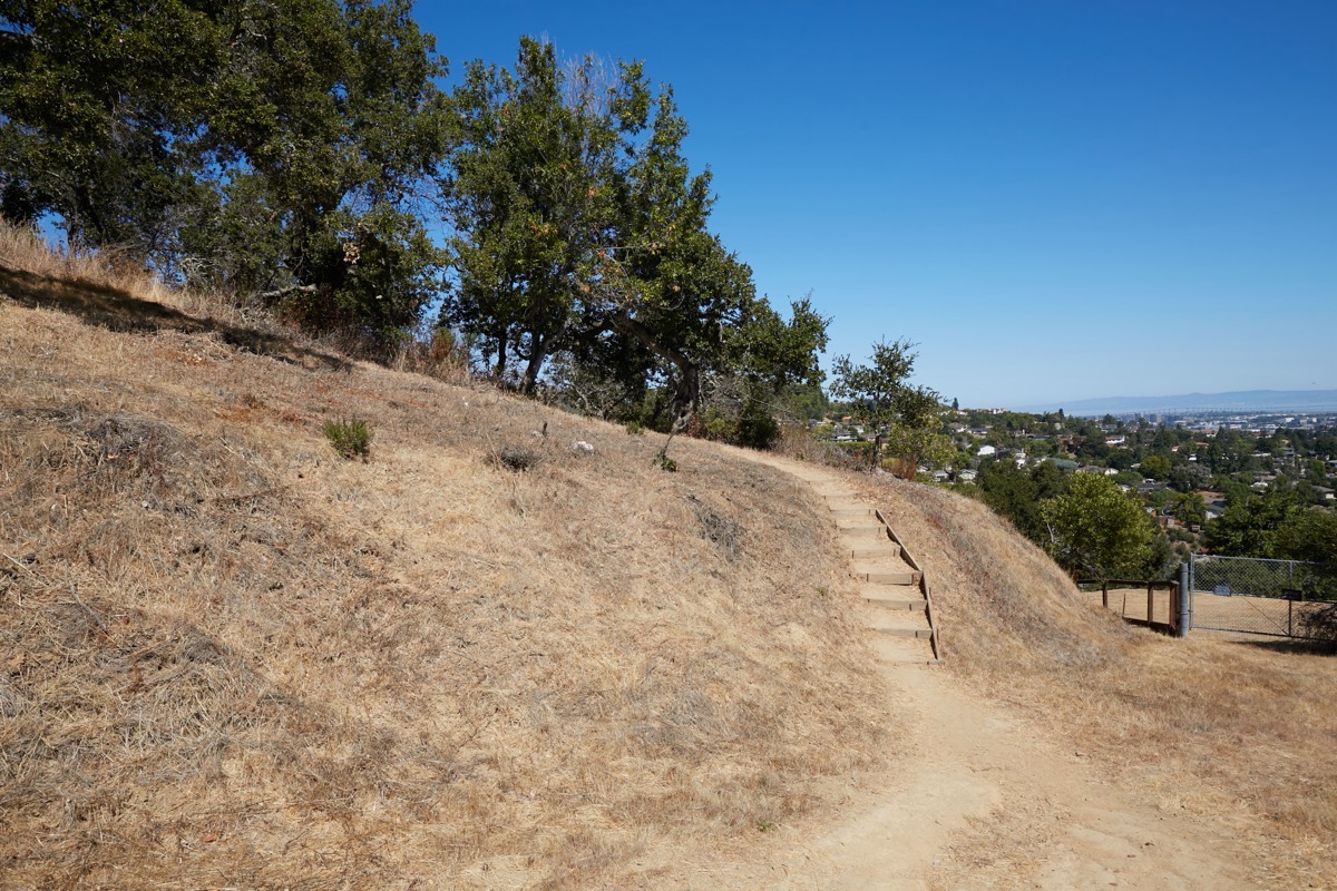
The Pulgas Ridge Open Space Preserve, in case you are not familiar, is a 366-acre park with nearly six miles of trails. Those trails are open to dogs (on-leash) and one of them leads to an off-leash area where you can allow your dog to roam free. The preserve has lovely views in various directions:
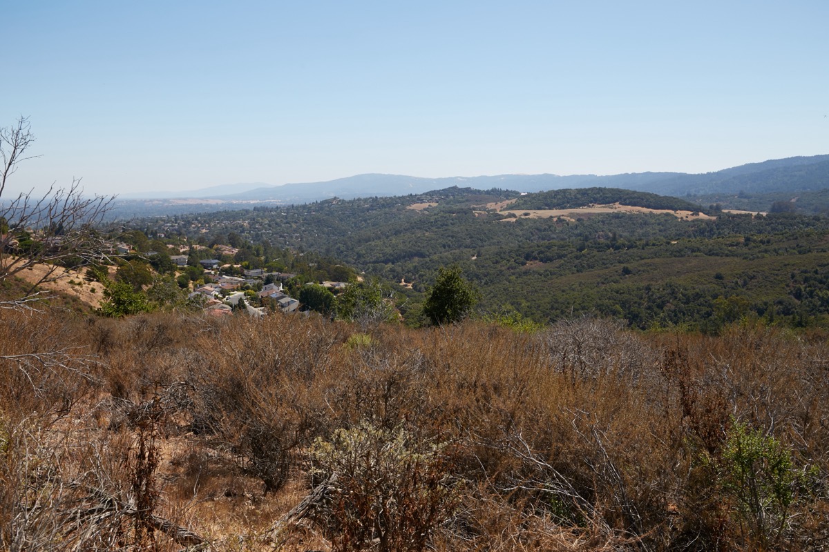
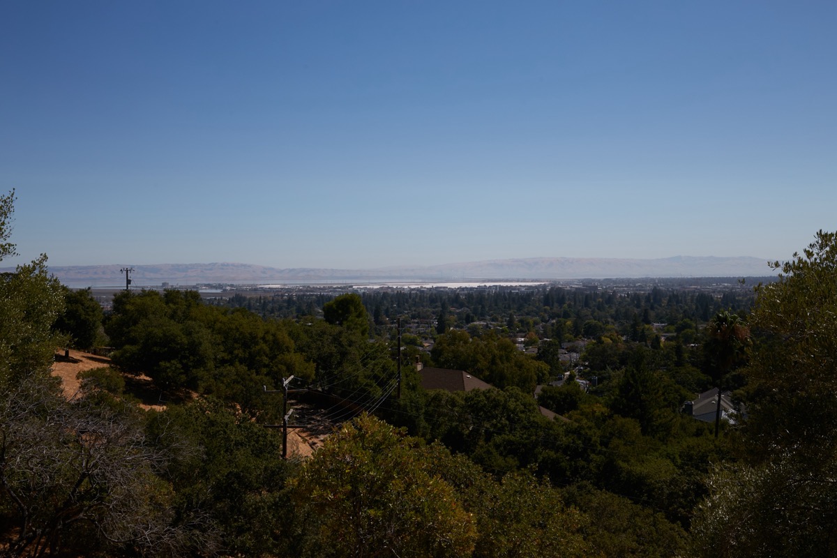
Here, the view is towards the south, over and beyond the adjacent Edgewood Park.
While hiking Pulgas Ridge, you can also expect to see plenty of wildlife. Possibly including, it is important to note, mountain lions and rattlesnakes:
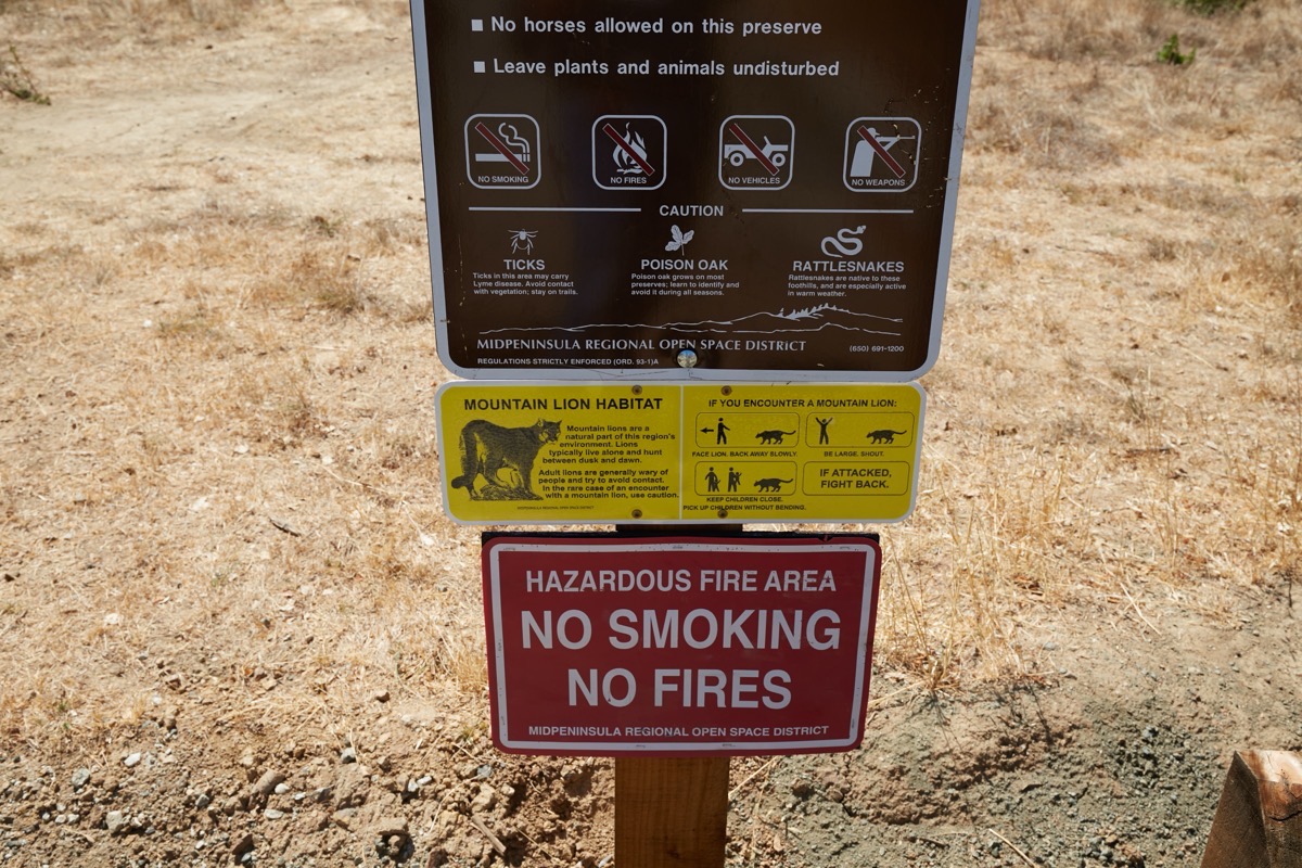
Not that I saw any mountain lions or snakes, of course. I did see plenty of hawks out hunting for prey, however, and countless more lizards. Oh, and beware of both poison oak and ticks. Fortunately, in all three parks the flora has been trimmed away from the trails, so if you stay on the trails and avoid touching any of the nearby trees or plants you should be OK. But just to be safe I always wear boots, thick socks, and long pants in these parks.
The upper entrance to the Pulgas Ridge Open Space Preserve is rather spartan, although there are at least some trash cans and a dispenser for dog waste bags. The lower, main entrance is more accommodating: there is a gravel parking lot, two porta-potties, and more signs and maps (including paper maps). No running water that I saw, though. To drive there, head out Edgewood Road and turn on Crestview Drive. Take the first left onto Edmonds Road, and follow that street until you see the parking area on the right.
Even with the heat, I had a lovely hike this week. It never ceases to amaze me how I can live in the middle of a typical American suburban neighborhood and yet find myself hiking in the woods after an easy walk of about 15 minutes or so. If you haven’t taken advantage of one or more of our area’s natural parks, I highly recommend doing so. It’s a great way to get away from the hustle and bustle of daily life and experience the world mostly as Mother Nature intends. Just be prepared for some serious exercise: all of our local parks featuring hiking trails are built on hillsides and in canyons, and thus mostly involve some serious up-and-down walking (Pulgas Ridge does have one nice trail along the canyon floor that is wheelchair accessible). I was reminded this week just how much I needed that exercise, and plan to get up in our hills a bit more often. But for those who are interested in the more urban parts of our area, I plan to return to the downtown beat next week, where I’ll have some updates about the 30-story affordable housing building proposed for downtown Redwood City…

I’m with you! You probably already do this, but I go up Whipple past the hospital, and then turn right on Upland Rd. I then follow it through to the cul-de-sac and down to Cordilleras. I then take Cordilleras west all the way to Edgewood Rd. Even though much of Cordilleras doesn’t have a sidewalk, the traffic is quieter than on Edgewood, and thus I find it to be somewhat safer. Once out on Edgewood, though, I’m mostly doing what you are doing, walking in the gutter or, where possible, just up off the curb. I would love for a proper sidewalk along at least one side of Edgewood, and a crosswalk with a flashing beacon at Crestview.