
Before getting into today’s topic, Redwood City is conducting an online “Community Satisfaction Survey”. I just completed it myself, and it takes about 10-15 minutes to do so. I would encourage everyone who lives and/or works in Redwood City to do likewise; the more responses the city gets, the more meaningful the results. Although you need to create an account to fill out the survey, you aren’t required to supply your name (you can, if you choose, though). You only need to supply an email address, a password (that you make up), and your zip code.
The survey, in English, can be found here. As for those who are more comfortable with Spanish, use this link.
Something I read recently stated that Redwood City was falling behind its goal of providing “3.0 acres of active parkland per 1,000 of population.” With a current population of around 87,000 residents, Redwood City would have to provide 261 acres of “active parkland” to meet that goal. To check, I added up the sizes of the 25 parks for which locations (and sizes) are listed on the city’s Parks webpage — including, I should note, Union Cemetery, since the city’s Parks and Recreation department does have some responsibility for it, even though many wouldn’t consider it a park in the typical sense. The result? 147 acres, which is indeed well shy of the city’s stated goal. To be fair, a portion of Edgewood Park (which is not one of the listed parks) lies within Redwood City’s borders, and its adjacency to the city makes it a park that one might reasonably add in to Redwood City’s total. That park alone is some 467 acres, so there’s that. But the aptly-named Edgewood Park is located on the very edge of a part of Redwood City that is hard for most to get to other than by car. When you take into account where each of the city’s parks are located relative to where people live, there are distinct pockets where the city falls well short of the standard, and areas where it exceed that standard. (For example, according to Wikipedia, Redwood Shores has a population of about 4,100 persons. That area’s parks add up to 39 acres, meaning that the Shores has about 9.5 acres of parkland for each 1,000 residents.)
Creating sufficient park space is relatively easy when one is constructing a planned community like Redwood Shores. It is much harder to do when you are dealing with an established community that is almost entirely built out, which is the case with Redwood City’s residential areas. Given enough money, of course, the city could simply buy up a couple of adjacent residential properties, bulldoze them, and construct a park on the resulting land. But as we all know, that is by no means realistic in this day and age: the cost to assemble an acre or two even in the city’s most inexpensive neighborhood would still be far more than the city would be able to afford. And, of course, we need all the housing we can get: tearing down housing for a park would simply exacerbate an already tough situation.
Thinking about a solution to this problem is what led me to this week’s walk. When I thought about where there is available land, I realized that there actually is some out there that could be turned into parks, if only the right people could be convinced. Indeed, that available land could make for a really interesting, and, I suspect, popular park. Some of you are probably already ahead of me, but for those that aren’t, the land I’m talking about is controlled by the San Francisco Public Utilities Commission (the SFPUC), and is known as the Hetch-Hetchy right-of-way.
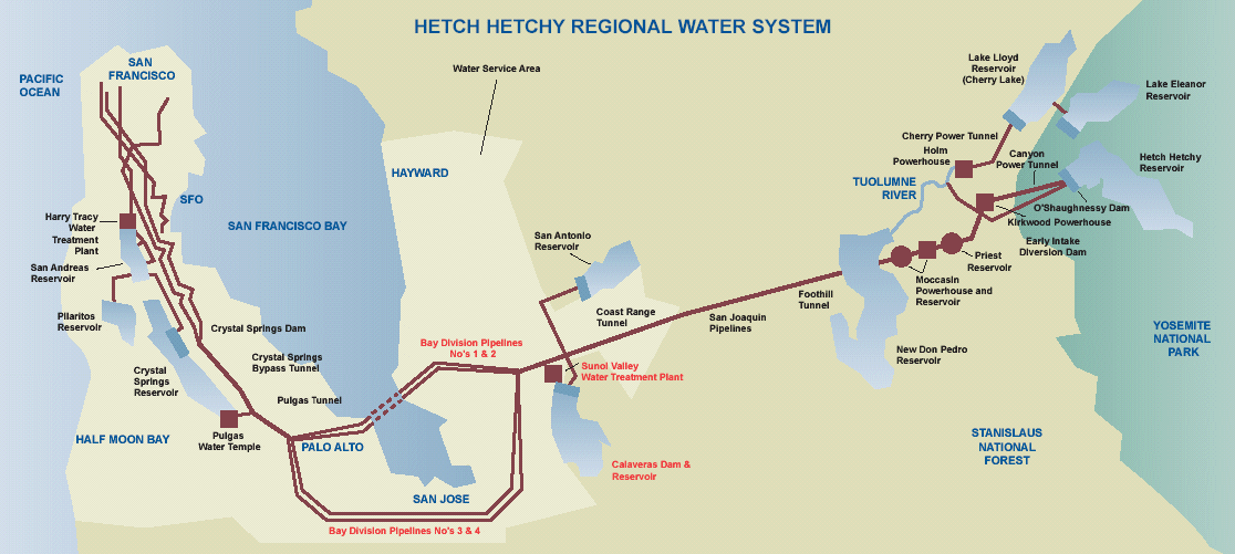
The water we drink, bath in, and wash with primarily originates from the Hetch Hetchy Valley, high in the Sierras. A complex system of pipelines, pumps and reservoirs brings that water to our area, where it is distributed to San Francisco and residents of San Mateo, Santa Clara, and Alameda counties. The main lines coming from the Hetch Hetchy Valley make their way to Fremont, where they split into two pairs of two. Two pipes make their way across the bay just south of the Dumbarton Bridge, surfacing in the Ravenswood Open Space Preserve. The other two skirt the bay, heading through San Jose and then coming up the Peninsula. For the curious, here is a map.
The four pipelines appear to reunite on the north side of Edgewood Road, not too far west of where Cordilleras Road meets Edgewood. At that point they are mostly aboveground: you can occasionally get a glimpse of the pipes on the hillside to your right as you proceed west on Edgewood Road. But except for in a rare few places, the pipes run beneath the earth, at least on our part of the Peninsula. For various reasons, including the periodic need for the SFPUC to dig down and do maintenance on the pipes, permanent structures are not allowed to be built where the pipelines run. Thus, their location is characterized by long, narrow strips of mostly undeveloped land. For many uses the fact that you cannot build permanent structures on the land is a drawback, but if you are looking for a place to use as a park, say, it can be an advantage.
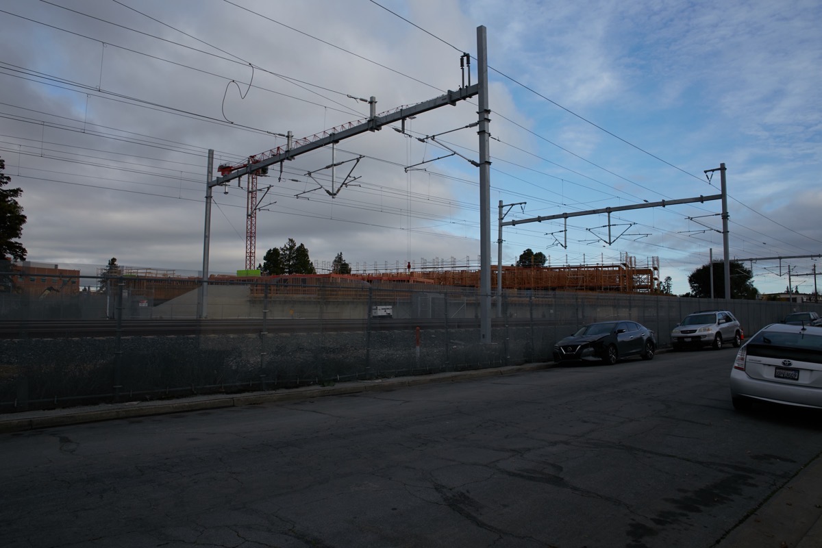
The pipeline runs through Redwood City are almost arrow-straight, with just a few mostly minor bends. Unfortunately, the SFPUC has fenced off nearly all of the land beneath which the pipelines run, so only in a very few places can one actually follow the pipeline route directly. Thus, when I decided to follow the pipelines as closely as I could — which I (mostly) did this week — I did a significant amount of zig-zagging. The pipelines cross beneath a great many Redwood City (and beyond) streets, so I made it my mission this week to, starting where the pipes cross beneath Edgewood Road, go to each point where they cross beneath a public street. And in those rare few places where one can actually walk along the right-of-way, I did that.
My goal was to walk the entire route from Edgewood Road out to the bay, in the Ravenswood Open Space Preserve. I knew that I couldn’t do it all in one go, though, especially not on foot. I ended up only making it (this week) as far as where the pipes pass beneath Highway 101, just east of Flood Park in Menlo Park. And even that took me two days to do. The first day I started from my home, walked out to where the pipelines passed beneath Edgewood Road, and then followed them all the way to where they pass beneath the Caltrain tracks. The second day I then drove to the other side of the tracks (in North Fair Oaks) and continued all the way to and through Flood Park, where I came up against Highway 101. Soon (depending upon the weather) I’ll drive over to the east side of Highway 101 and walk the final segment.
Although the direct pipeline route from Edgewood Road to the bay is just about 8 miles — a distance I could normally walk with little problem — the need to zig-zag lengthens the route tremendously. For example, the section I walked in the first day (from Edgewood Road out to Highway 101) is 5.3 miles in length, but my walk that day (which was a round-trip, and which originated not from Edgewood, but from my house near Sequoia Hospital) was 11.6 miles. That walk took me something like five-and-a-half hours.
The right-of-way is hard to find on a map, but somewhat easier if you go online and use satellite view: the long linear undeveloped spaces do tend to make themselves visible in some places. And on foot, once you find the right-of-way, it is fairly easy to follow given that it really does run in very straight lines for long stretches. Starting at my beginning on Edgewood Road:
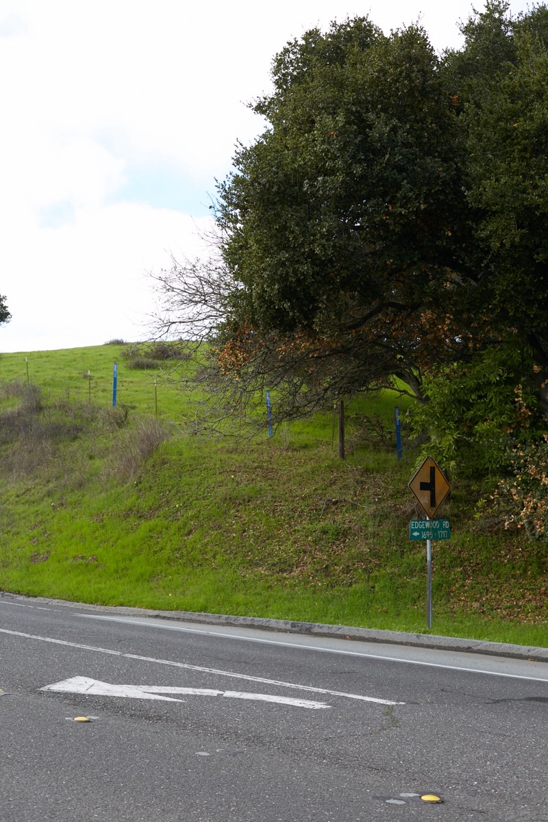
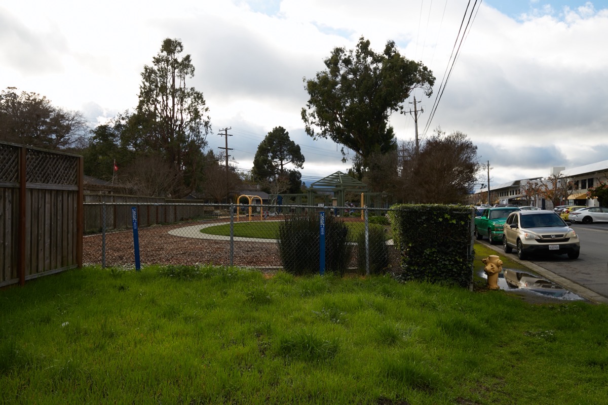
The above is the north side of Edgewood Road (I’m standing on the south side). Look closely just beyond the barbed-wire fence running along the top of the rise and you’ll see three widely spaced blue plastic posts. These posts mark the pipeline; I presume that the two outer posts mark the edges of the right-of-way, while the third marks the center. You’ll often see these posts on either side of the street where the pipeline crosses.
Turning around and looking south, you can start to see the path formed by the right-of-way:
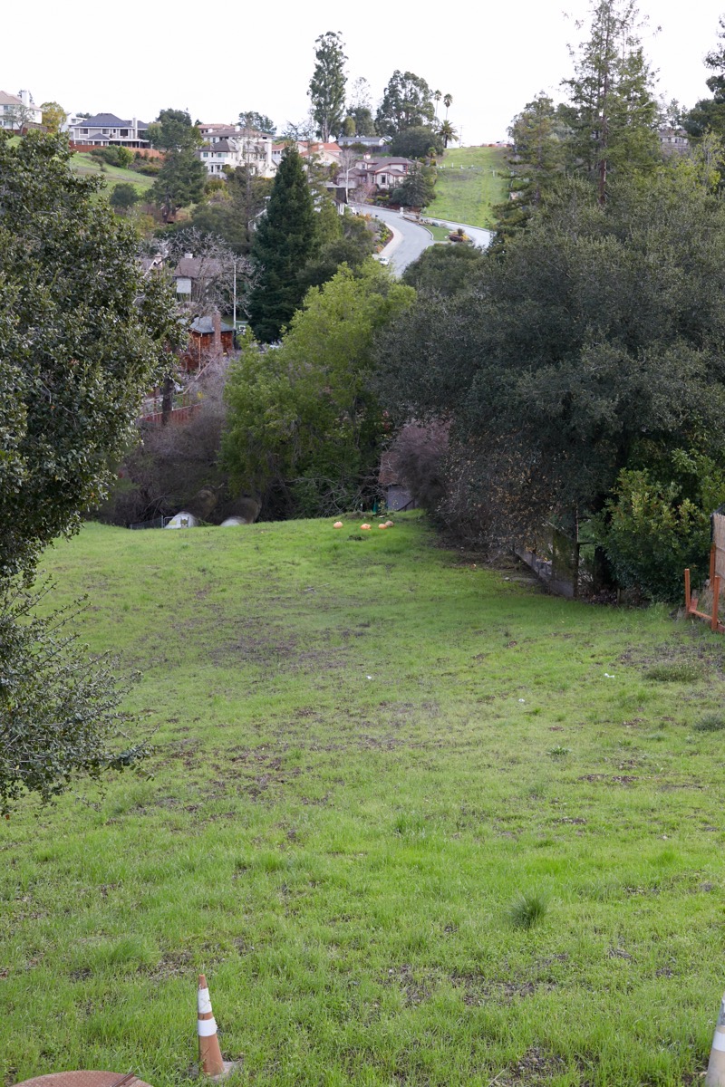
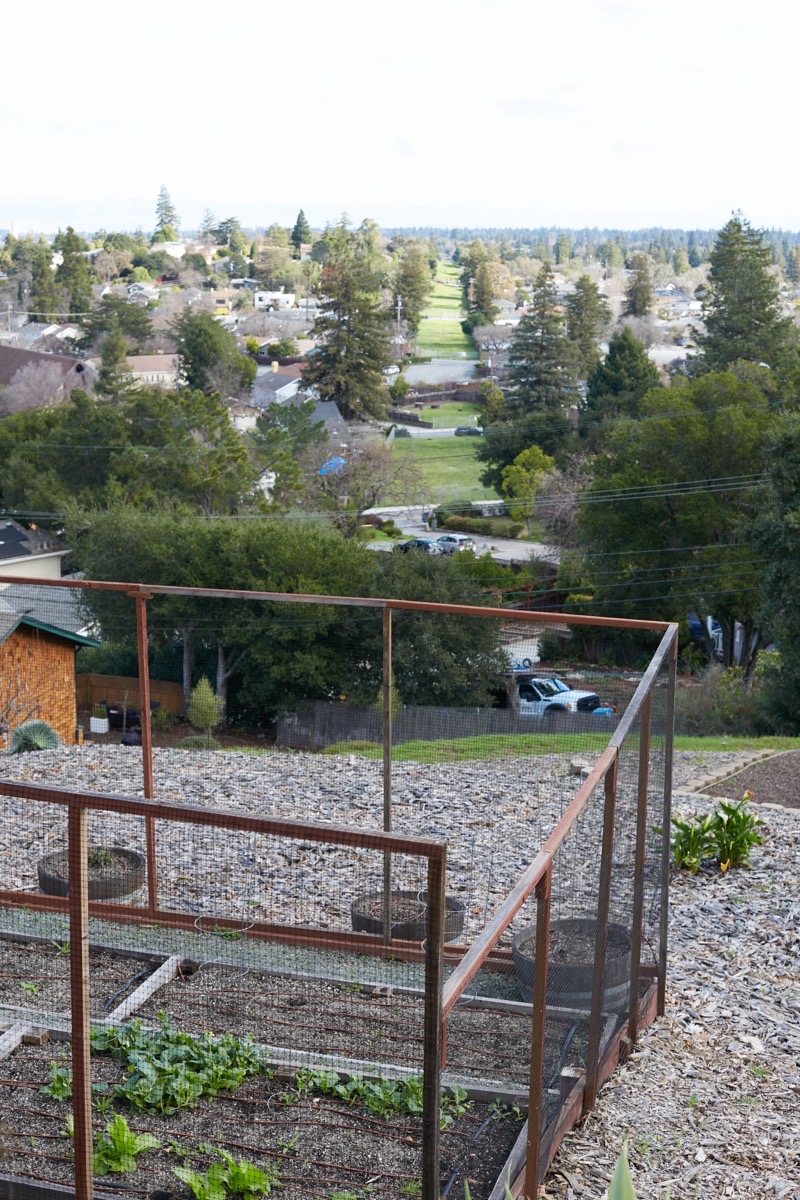
Follow the path down the hill — this is one of the very few segments not completely fenced off (but I warn you: it’s steeper than it looks here) — and you get to Cordilleras Creek. As you should just be able to make out, two pipelines become exposed and cross above the creek at this point. The pipelines then head back underground, but proceed beneath the roadway you can see near the top of the image (that roadway is Bennett Road, off Cordilleras Road). Where you can see the road curving left, the pipeline continues straight, up that cleared green stretch of land.
Walking this section involves a lot of up-and-down. I theoretically could have walked up Bennett Road and then climbed the hill, but instead I followed Cordilleras to Canyon Road to Oak Knoll Drive. Coming down Oak Knoll, I then bore left on Hillcrest Drive, which took me up the back side of the hill you see in the above image. Standing on the right-of-way at Hillcrest Drive, a view to the south looks like this:
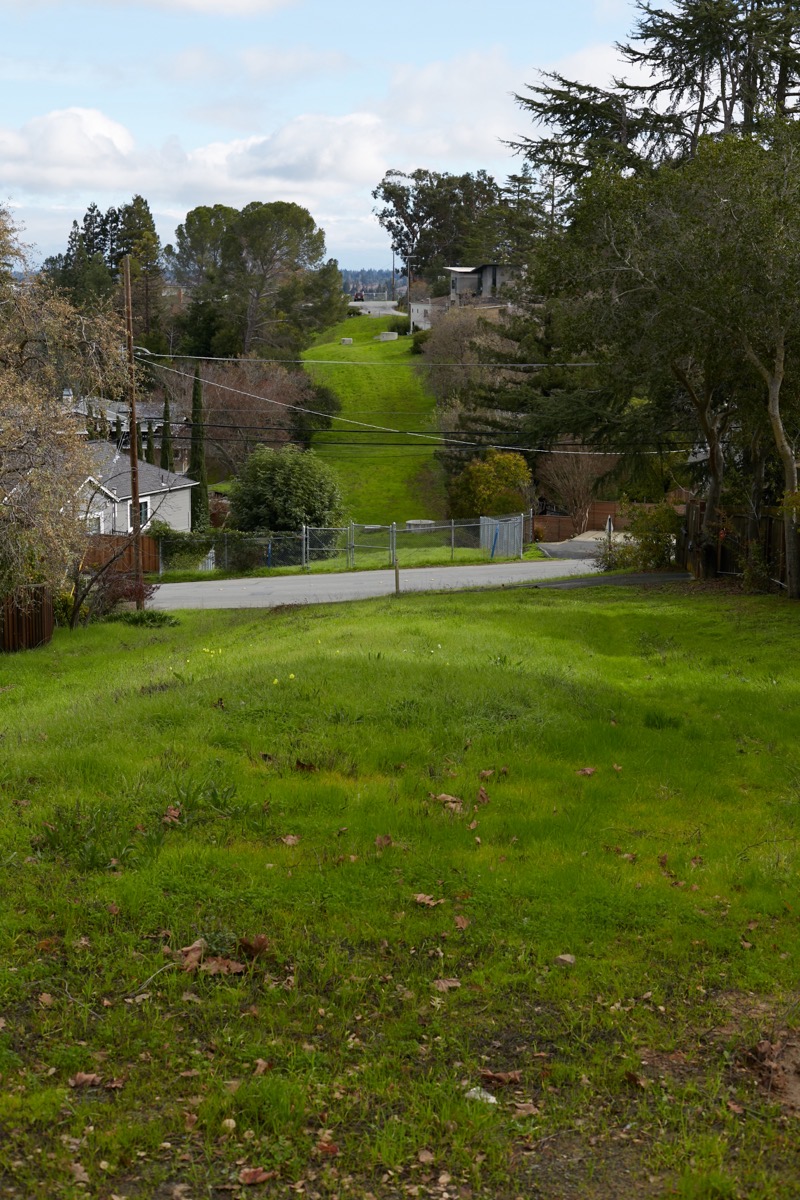
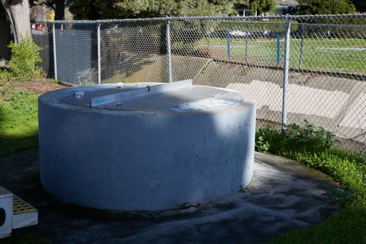
The street in the middle of the photo is Oak Knoll. At the top of the far hill you can just make out the end of little Esther Lane, where it dead-ends next to one of Redwood City’s underground water tanks.
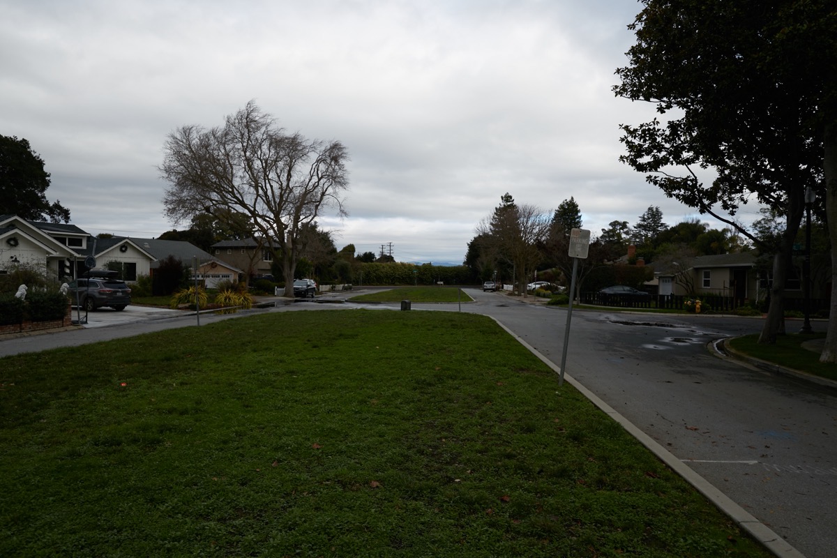
From the top of the rise you see above, you get a great view looking south of more of the right-of-way:
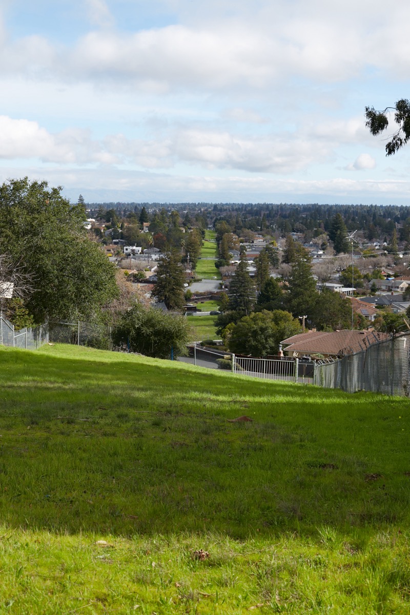
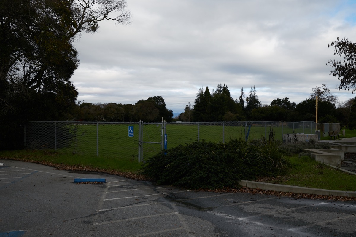
You get the idea. This thing is very long, straight, and, depending upon where you are on the route, between 40 and 100 feet wide. I think it would make for a lovely linear park, one that wouldn’t really need to be developed. As long as the land is reasonably flat and walkable, just leaving it as-is would be enough for most of us. And I would think that some minor additions — occasional benches along the sides (away from the pipelines), or some simple workout fixtures like you find along a parcourse, would go a long way towards making this a fun, very usable space.
From what I’ve showed so far, except for street crossings and fences the land is undeveloped. But in some places it has been developed somewhat. For instance, the right-of-way passes alongside some private properties where the residents are using the land for extra garden space and such:
In the foreground, a lovely bit of fenced garden sits right atop the right-of-way (this particular one is just off of Upland Road). Trace the right-of-way with your eyes and you’ll see parked cars: some people have run their driveways over it. At least one church in Redwood City has their parking lot partially on the right-of-way, as does a mortuary out on Woodside Road (Crippen & Flynn). The right-of-way cuts right through the Hawes Elementary School campus: a portion of that school’s playground is built atop the right-of-way. The right-of-way neatly divides Fleishman Park (just southeast of Woodside Road) in two, and then, interestingly, forms the entirety of Linden Park:

If you choose to follow it yourself, keep a sharp eye for the blue posts, which aren’t at every crossing, but do pop up from time-to-time:

Periodically you’ll also see either square or round access point that I presume provide access to key points along the pipeline’s path (this particular one is in Red Morton Park):
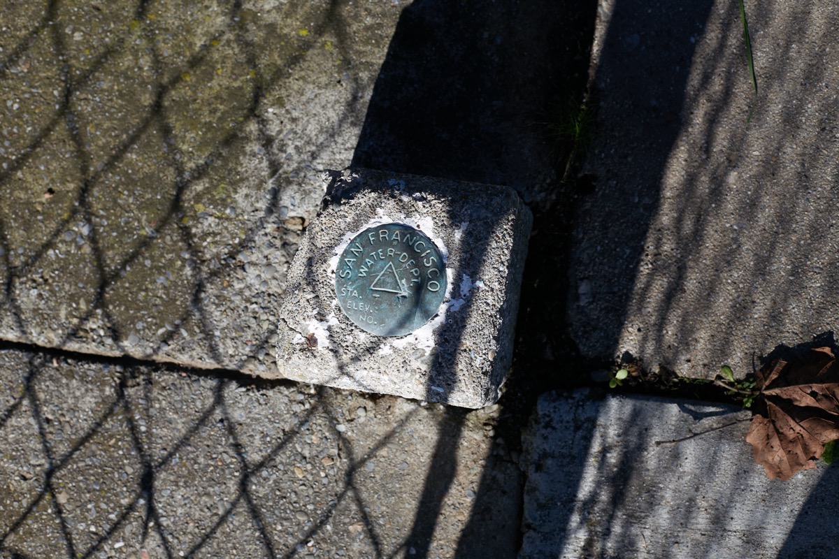
For the really sharp-eyed among us, every once in a while you’ll spot an elevation marker, placed along the route by the SFPUC (apparently, the San Francisco Water Dept., back then):
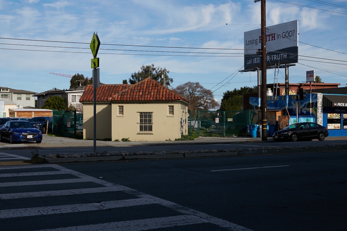
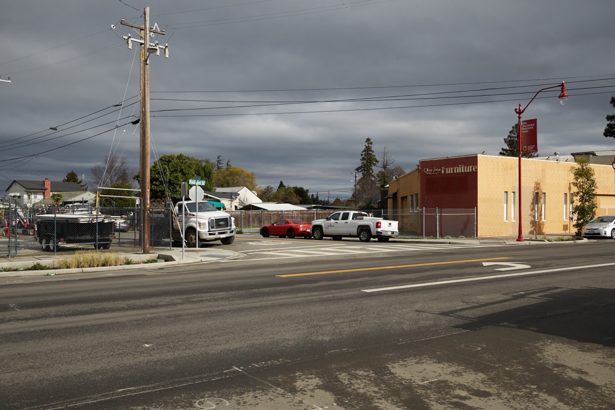
The two pipes I was following cross El Camino Real a couple of blocks south of Woodside Road, just south of Pronto Pizza (which itself is just south of University Art). Directly across El Camino is what I presume is one of the system’s pump stations:
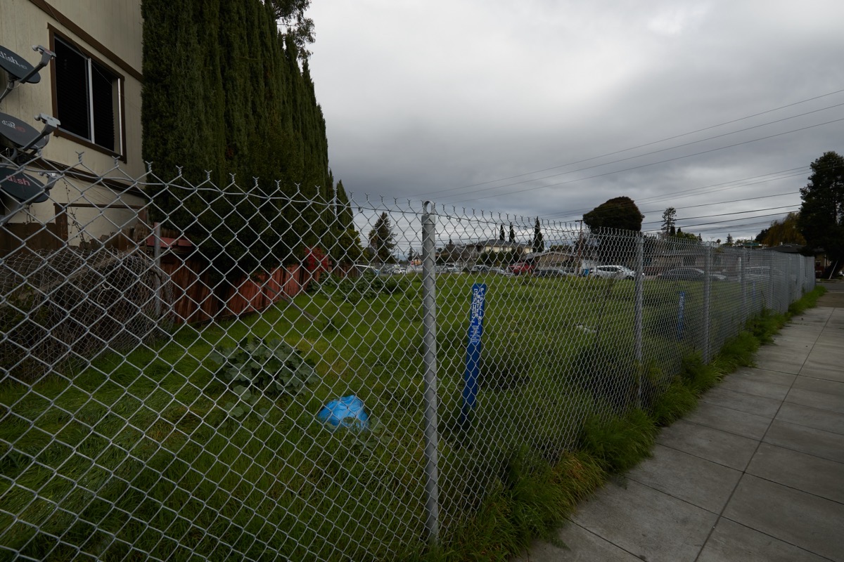
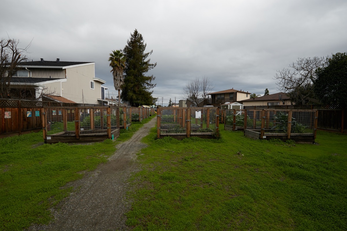
At this point we’re into North Fair Oaks. The path continues straight ahead, cutting through yards and alongside apartment buildings. Two block-long sections are not completely accessible to the public, but are being used to house some lovely community gardens:

The route then reaches the Caltrain tracks (on Westmoreland Avenue, midway between Buckingham and Dumbarton avenues, for the curious), which is where I ended my first day’s walk:
Day two picked up on the other side of the tracks, where I first spent a bit of time exploring the affordable housing project you can see in the above photo (but that’s a subject for another day). The right-of-way continues on its merry way here, slicing through block after block of mostly residential neighborhoods in North Fair Oaks:
Before it hits Middlefield Road, it provides the land for the lovely little Friendship Park, which has a small play structure but mostly consists of a sea of community garden beds:
One clue that you are on the right track is when you find a building that you’d expect to be rectangular, but is instead chopped off at a funny angle:
Beyond this point the right-of-way continues through residential areas until it reaches Marsh Road. Before it does, however, there are two more little parks constructed atop the pipeline route. First, there is North Fair Oaks Park, which you’ll find at 3500 Edison Way:
Then, along Bay Road just northwest of Marsh Road, there is this little unnamed park:

The pipelines run beneath the intersection of Bay and Marsh roads. From there, they continue underground right alongside Bay Road, on the freeway side of that street, until you get to Flood Park, where the right-of-way makes a slight turn to enter the park. It runs beneath the first part of that park’s main parking area, and then, when the parking area angles to the left, it continues straight across a baseball diamond, almost cutting from first to third base:
Note the blue post close to the center of the photo, and the large concrete access point closer to the photo’s right edge.
Beyond the ballfields, it runs beneath a Pétanque Court (Pétanque is a game similar to Bocce) and then exits the park (where, thankfully, there is an open gate). From there, the pipelines run two blocks beneath Iris Lane before reaching the ivy-covered sound walls of Highway 101, and the end of the line for me on the second day:
As I said, I’ll pick this up again across the freeway someday, and will follow the rest of the route out to the bay. And on another occasion I’ll undertake to follow the second pair of pipelines, which in skirting the bay make their way through Redwood City along a route that comes up from Woodside Road along Fernside Street, then beneath the Peninsula Community Center (PCC) property, through Garrett Park, then along Canyon Road and beyond to Edgewood Road.
As you can see, although much of the route I’ve followed thus far is inaccessible to the general public, the SFPUC has made concessions to allow parks, yards, driveways, and a handful of other private uses over some of the route. Thus, to my thinking, it should be possible to get nearly all of this entire route opened up to form a long, linear park broken up only by the Caltrain tracks, Highway 101, and perhaps one or two easily walked-around points.
Based on the experience that Redwood City had trying to get the tiny Linden Park built, I’m not expecting the SFPUC to welcome the idea with open arms. But if Redwood City truly wants to achieve its goal of three acres of parkland per 1,000 of its citizens, opening this land to the public may well be the only way to do so.

While making the map showing the conceptual Bay to Sea Trail https://www.openspace.org/what-we-do/projects/bay-sea-trail, I asked a planner at POST about the possibility of using this route. They also expressed that it sadly would probably never happen along the right of way because of adjacent landowners and SF Water Dept. Thanks for calling out that the city is park poor! We need more parks, of all kinds.
Hey, thanks for the pointer to the Bay to Sea Trail — what a neat project (that I had not heard about)! I’d love to hike such a thing, but it appears that it’ll be another decade plus before that could happen? In any case, I’ll keep an eye on the project, along with the SF Bay Trail. We need more things like these.
The parks that Redwood City has are pretty great — we just don’t have enough of them. The city is well aware of the issue, but of course the logistics are so difficult, especially given our current economic environment.
Thanks for link to survey, but only found out at the end the survey I needed to sign up on their website. And it seems I need to sign up to a website to leave you a reply also or I can email you. Too much work.
Sent from Yahoo Mail for iPad
I’m glad to see that you did figure out how to comment on my blog post! Indeed, as I noted in my blog, that survey does require you to create an account, but at least you need only supply an email address (which can be a throwaway one) and zip code. Personally I thought it was worth the trouble, but everyone can make up their own mind on that, of course.
Hi Greg, I am very sorry you did not see your note on that. I will try again. Your blog is great, sorry I did not read the fine print, anything after you said here is a survery was lost because I was excited about the survery. Chris
No worries. I was excited, too, and also a bit put off by the need to create yet another account. But I do this stuff both because I care about the city, and because it gives me more things to write about… 😎
Take care, and thanks for reading the blog!
In the late 50’s and early 60’s, I lived on Carson. The “hetch-hetchy” ran between the Alameda and Fernside, closer to Fernside.. For one block running north from Carson Street toward Roosevelt, the Hetch Hetchy field was mowed and maintained as a park. Neighborhood kids (including me) played football and baseball. (Climbed many a fence to retrieve a baseball from a backyard.) When I returned years later, I was surprised and disappointed to see that it was no longer maintained as a park/playfield. Reading this, I wonder how we ever got so lucky.
Exactly. That is how it should be used. When I was young we had a nearby dirt lot (remember those?) in which we played. Nowadays, with the cost of real-estate being what it is, and with people so concerned with liability issues, lots like that are pretty much a thing of the past, at least in our area.
I remember when I brought an out-of-town person who hadn’t visited Redwood City in some years and took her around downtown. She was an astonished at the building that was going on and she said to me “where are the parks and the green spaces?”?” I think a linear park, seems rather pathetic, although better than nothing and it just shows how the city Council members have done nothing but line their pockets with developers money. The other issue is that it’s a completely car centric town now with absolutely no way to get anywhere without driving and you can see it on the stress and anxiety on the drivers and the way they are driving very dangerously. too many people piled on top of each other all for the explanation that we need more people here
I’m still hoping that the city’s intent to build a downtown park becomes a reality. We badly need it, in my opinion, and such a thing does have a chance of being built since it would be constructed on land the city already owns. But assuming we do indeed get such a thing, it likely will take years.
For the 21 years that I was on the Redwood City council I brought up the point you are making numerous times. Staff flat out told me the S. F. water department would never let us do. In addition, many of the house owners that were adjacent to the park as it went through their neighborhood were not happy about the idea of having the public in what they consider to be their backyard. I still think it is a good idea. Thank you for bring it up.
You’re welcome. I know that there is little to no chance that this will ever come to pass, but I find it odd that in some places it is being used by the public, whereas in others it is not allowed.
Regarding “allowed” … it would be interesting to know if SFPUC actually did allow the uses you observed on their right of way, or whether these are just examples where neighbors have gone ahead and quietly done something without permission knowing that enforcement is lax to non-existent for such easily-removed, relatively harmless encroachments.